MyTopo
Wyoming Moose 30 Map
Couldn't load pickup availability
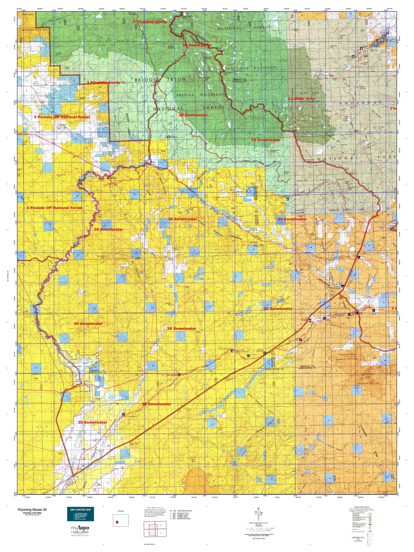
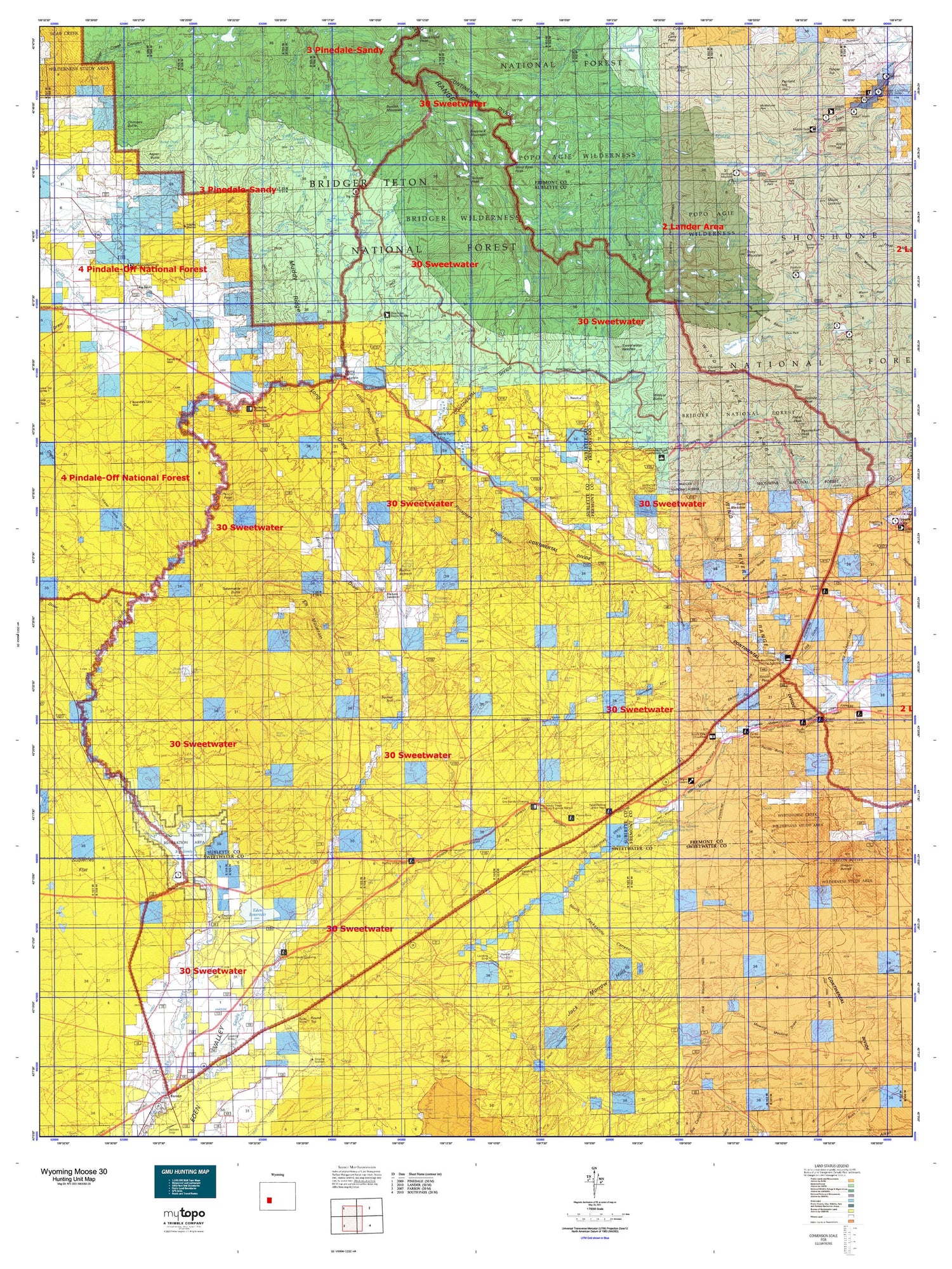
Hunting unit map of Wyoming Game Management Unit MOOSE-30 with topographic lines and unit boundaries. This topo map features UTM / MGRS and Latitude/Longitude grids, plus public land ownership. It comes folded on waterproof paper. Be fully prepared for your hunt with a MyTopo GMU map!.
This map contains the following named places: Alkali Creek,Anderson Homestead,Arambel Ranch,Arrowhead Lake,Aspen Butte,Aspen Creek,Atlantic Creek,Atlantic Lake,Atlantic Peak,Baer Lakes,Basco Creek,Beaver Creek,Beaver Lake,Big Sandy,Big Sandy Campground,Big Sandy Lake,Big Sandy Lodge,Big Sandy Mountain,Big Sandy Reservoir,Black Joe Creek,Black Joe Lake,Blair Creek,Block and Tackle Hill,Blue Lake,Blue Pit Reservoir,Boot Lake,Boulder Lake,Boulter Lake,Boulter Reservoir,Boundary Creek,Bruce Campground,Bruce Picnic Area,Bunion Mountain,Calvert Lakes,Chicken Creek,Chilcoot Lake,Chimney Butte,Christina Lake,Cirque Lake,Cirque of the Towers,Clear Creek,Clear Lake,Clear Lake Reservoir,Cony Mountain,Coon Lake,Corral Creek,Cottonwood Lake,Crows Nest,Dads Creek,Dads Lake,Deep Creek,Deep Creek Lakes,Deep Lake,Diamond Lake,Dog Tooth Peak,Donald Creek,Donald Lake,Driveway Creek,Dry Sandy Creek,Dry Sandy Stage,Duck Lake,Dutch Joe Creek,Dutch Joe Guard Station,East Echo Lake,East Fork Squaw Creek,East Sweetwater River,East Temple Peak,Echo Lakes,Eden Reservoir,Elizabeth Lake,Elizabeth Peak,Elk Mountain,Elkhorn Junction,Elkhorn Reservoir,Enterprise Reservoir,Erramouspe Ranch,Erramouspe Reservoir,Fairfield Creek,Fairfield Hill,Fiddlers Creek,Fiddlers Lake,Fiddlers Lake Campground,Fish Creek,Fish Lake,Flat Top,Fossil Hill,Francis Lake,Fremont County Youth Camp,Frozen Lakes,Frye Lake,Gold Creek,Granite Peak,Grass Creek,Gustave Lake,Hay Creek,Hay Meadow Reservoir,Hay Ranch,Haystack Butte,Haystack Mountain,High Meadow Creek,Ice Lakes,Independent Mountain,Irish Canyon Creek,Iron Creek,Island Lake,Jack Creek,Jack Morrow Creek,Jack Ranch,Jessie Lake,Jim Creek,Jim Lake,Johnson Lake,Juel Creek,Juel Ranch,Jug Lake,Kinch McKinney Hill,Larsen Creek,Laturio Mountain,Leckie,Leckie Reservoir,Leg Lake,Legion Lake,Little Dads Lake,Little Mitchell Slough,Little Pine Creek,Little Prospect Mountain,Little Sandy Creek,Little Sandy Lake,Little Sweetwater River,Lonesome Lake,Long Lake,Lookout Creek,Lost Creek,Louis Beach Campground,Louis Lake,Louis Lake Campground,Louis Lake Guard Station,Louis Lake Picnic Area,Louis Lake Resort,Lower Baer Lake,Lower Silas Lake,Marms Lake,McCann Ranch,Meeks Lake,Meyer Lookout,Middle Fork Guard Station,Middle Fork Squaw Creek,Middle Hay Ranch,Mill Creek,Miller Lake,Mirror Lake,Mitchell Peak,Mitchell Slough,Mount Arter,Mount Chevo,Mount Nystrom,Mountain Sheep Lake,Mud Lake,Muddy Lake,North Creek,North Fork Silver Creek,North Lake,North Pacific Creek,North Temple Creek,Old Halter and Flick Ranch,Old Juel Ranch,Ord Creek,Pabst Peak,Pacific Butte,Papoose Lake,Pencil Point,Petes Lake,Pingora Peak,Pinto Park Lake,Pocket Creek Lake,Poison Lake,Pool Creek,Popo Agie Campground,Popo Agie Primitive Area,Popo Agie Wilderness,Poston Lake,Poston Reservoir,Prospect Reservoir,Pylon Peak,Rapid Creek,Rapid Lake,Rennecker Peak,Roaring Fork Creek,Roaring Fork Lake,Roaring Fork Mountain,Round Top,Schiestler Peak,Sharps Meadows Creek,Sheep Creek,Sheet Lake,Shelter House,Silas Creek,South Muddy Creek,Squaw Teat,Squirrel Lake,Stage and Pony Express Station Site,Stough Creek Lakes,Sulphur Creek,Sweetwater Gap Ranch,Sweetwater Guard Station,Sweetwater Needles,Tabernacle Butte,Tally Pit Reservoir,Tayo Lake,Temple Creek Summer Home Area,Temple Lake,Temple Peak,Ten Trees,Thumb Lake,Timber Top,Tomahawk Lake,Tule Butte,Twin Lakes,University of Missouri Geology Camp,Upper Baer Lake,Upper Silas Lake,V Lake,War Bonnet Peak,Warrior Peaks,West Atlantic Peak,West Echo Lake,Wheeler Ranch,White Acorn Ranch,Whitehorse Creek,Wildcat Butte,Wind River Peak,Windy Lake,Wolf Lake,Worthen Meadow Reservoir,Zembo Reservoir


