
MyTopo
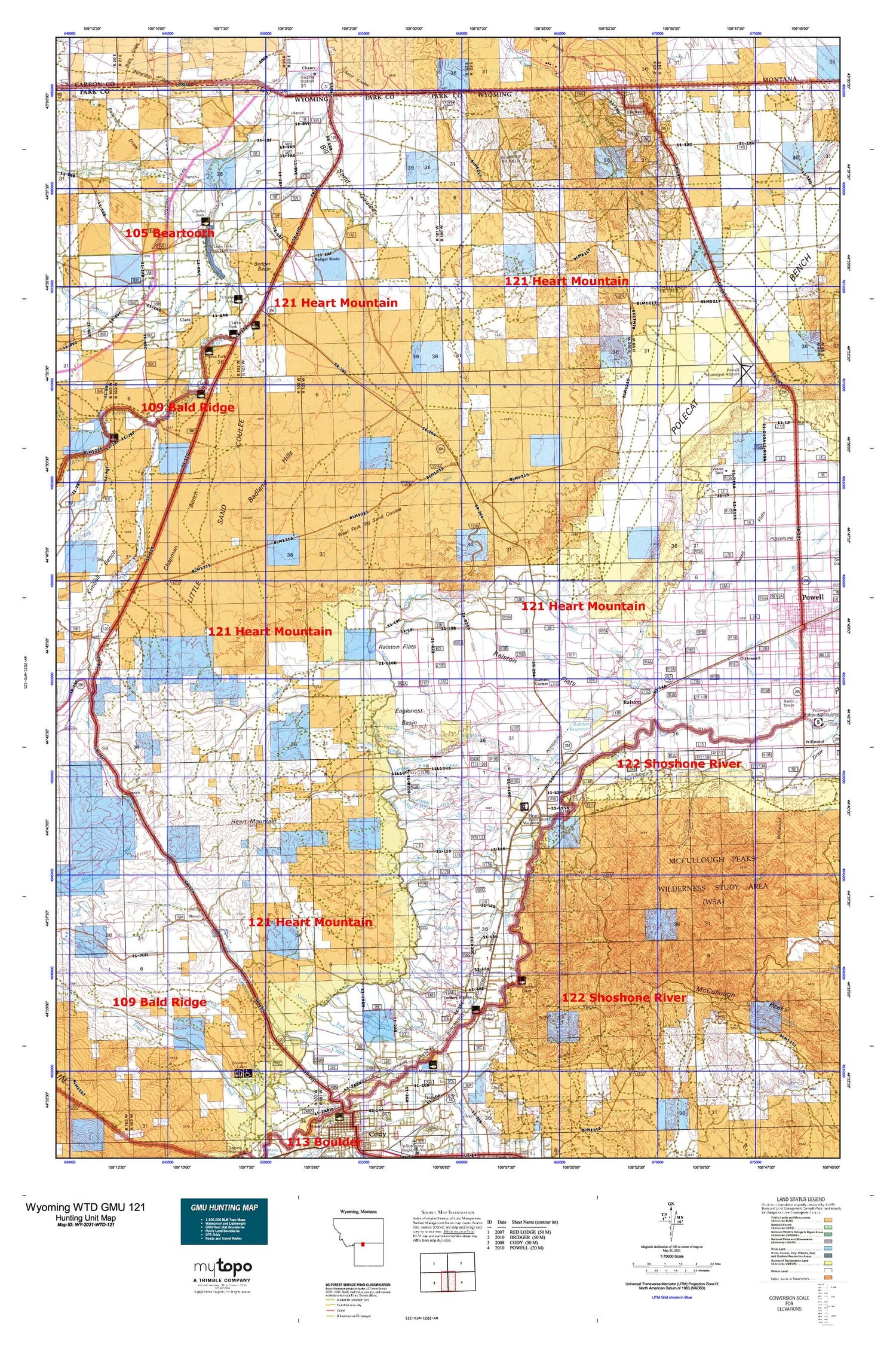
Wyoming Whitetail Deer GMU 121 Map
Couldn't load pickup availability
Hunting unit map of Wyoming Game Management Unit WTD-121 with topographic lines and unit boundaries. This topo map features UTM / MGRS and Latitude/Longitude grids, plus public land ownership. It comes folded on waterproof paper. Be fully prepared for your hunt with a MyTopo GMU map!.
This map contains the following named places: 82435,82440,Alkali Creek Dam,Alkali Creek Patch,Alkali Creek Reservoir,Angle Detention Dam,Badger Basin,Badland Hills,Badura Number 1 Dam,Badura Number 1 Reservoir,Bennett Buttes Cemetery,Bennett Creek,Bennett Creek Ditch,Big Sand Coulee,Bishop Cow Camp,Buck Creek,Buck Springs Creek,Buck Springs Detention Dam,Buck Springs Reservoir,Cat Track Reservoir,Cat Track Reservoir Dam,Chapman Bench,Chapman Creek Pit,Chesarek Ranch,Clark,Clark Ditch,Clark School,Corbett Dam,Corbett Tunnel,Deer Creek,Ditch H-33,Ditch H-41,Ditch H-57,Doctor Ditch,Dry Creek,Dry Gulch,Eaglenest,Eaglenest Basin,Eaglenest Creek,East Fork Alkali Creek,Elk Basin,Elk Basin Oil Field,Emma Lanchbury Dam,Emma Lanchbury Reservoir,Fubar Detention Dam,Garland Canal,Garrett Ranch,Heart Mountain,Heart Mountain Canal,Heart Mountain Relocation Center,Hopkins Dam,Hopkins Reservoir,Idaho Creek,Interstate Ditch,Iron Creek,Iron Creek Number 3 Detention Dam,Iron Creek Reservoir,Kamms Corner,Lanchbury Ranch,Lateral A,Lateral H-103,Lateral H-105,Lateral H-141,Lateral H-65,Lateral H-71,Lateral H-79,Lateral H-89,Lateral R,Lateral R-9 N,Lateral S,Lewellen Ranch,Line Creek,Linquist Ranch,Little Sand Coulee,Littlerock Creek,Lower Sand Coulee Reservoir,Lundvall Ranch,McCullough Peaks,McLean Gulch Reservoir,Middle Sand Coulee Reservoir,Miles Battlefield,Noble Ranch,North Alkali Creek,North Pit,O'Donnell,Oldham Mine,Paint Creek Dam,Park County Fire Protection District 4,Park County Fire Protection District 4 Clark,Pat O'Hara Creek,Pat O'Hara Sand and Gravel Pit,Penney Gulch,Pioneer School,Polecat Bench,Powell Division,Powell Flats,Powell Municipal Airport,Question Creek,Ralston,Ralston Census Designated Place,Ralston Lateral,Ralston Post Office,Ralston Reservoir,Robertson Draw,Rough Gulch,Ruff Detention Dam,Sand Coulee Detention Dam,Silver Tip Oil Field,Silvertip Mine,Simpson Ditch,Sirrine Ditch,Snafu Detention Dam,Snake Creek,South Eaglenest Creek,South Elk Basin Oil Field,Stafford Ranch,State Ditch,Three Falls Reservoir,Torezon Mine,Trask Ranch,Trotters Station,Two Dot Mine,Upper Sand Coulee Reservoir,Vocation,Walker Ranch,West Fork Alkali Creek,West Fork Big Sand Coulee,West Fork Sand Coulee Detention Dam,West Fork Sand Coulee Reservoir,Willwood Diversion Dam


