MyTopo
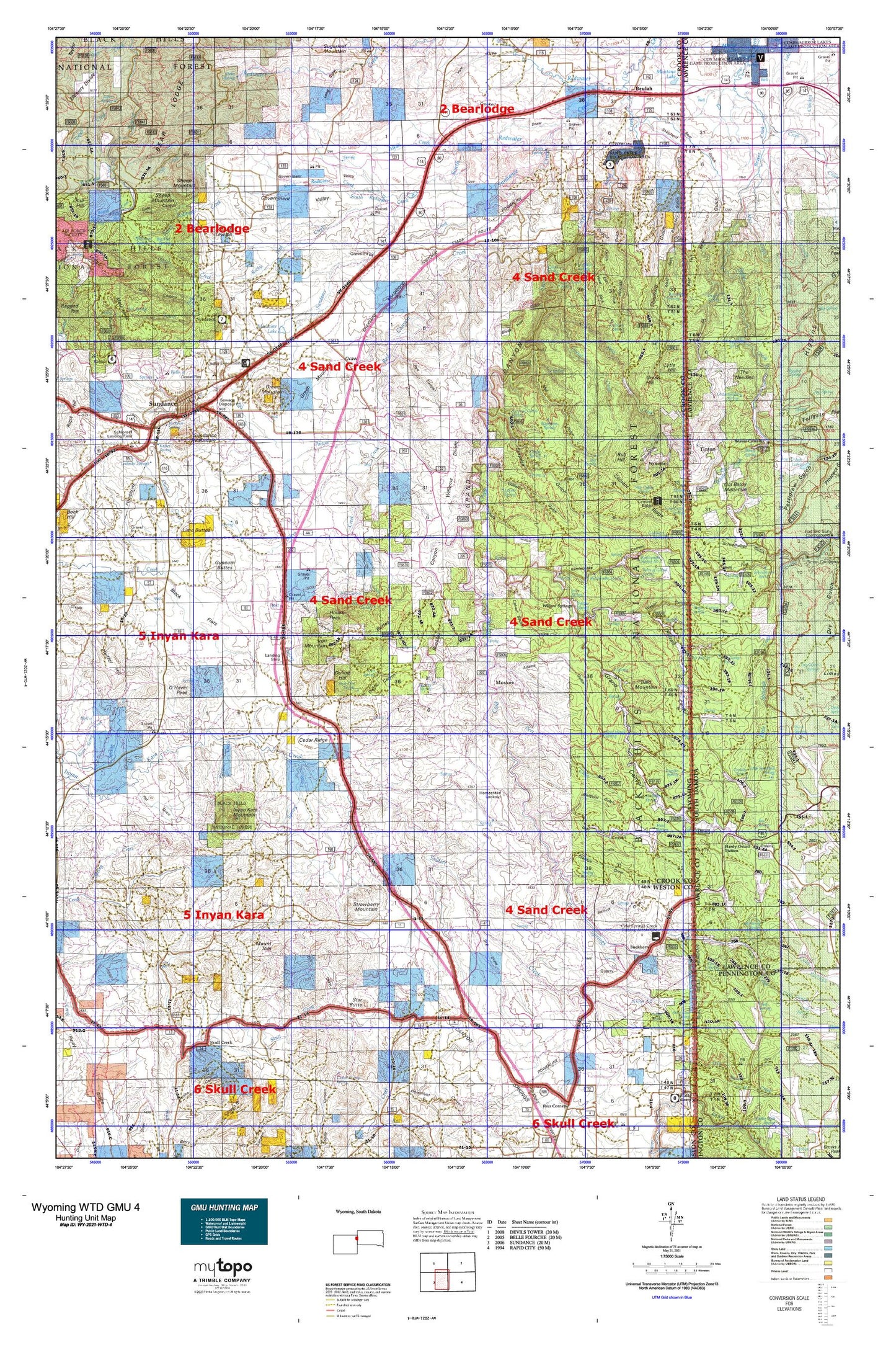
Wyoming Whitetail Deer GMU 4 Map
Couldn't load pickup availability
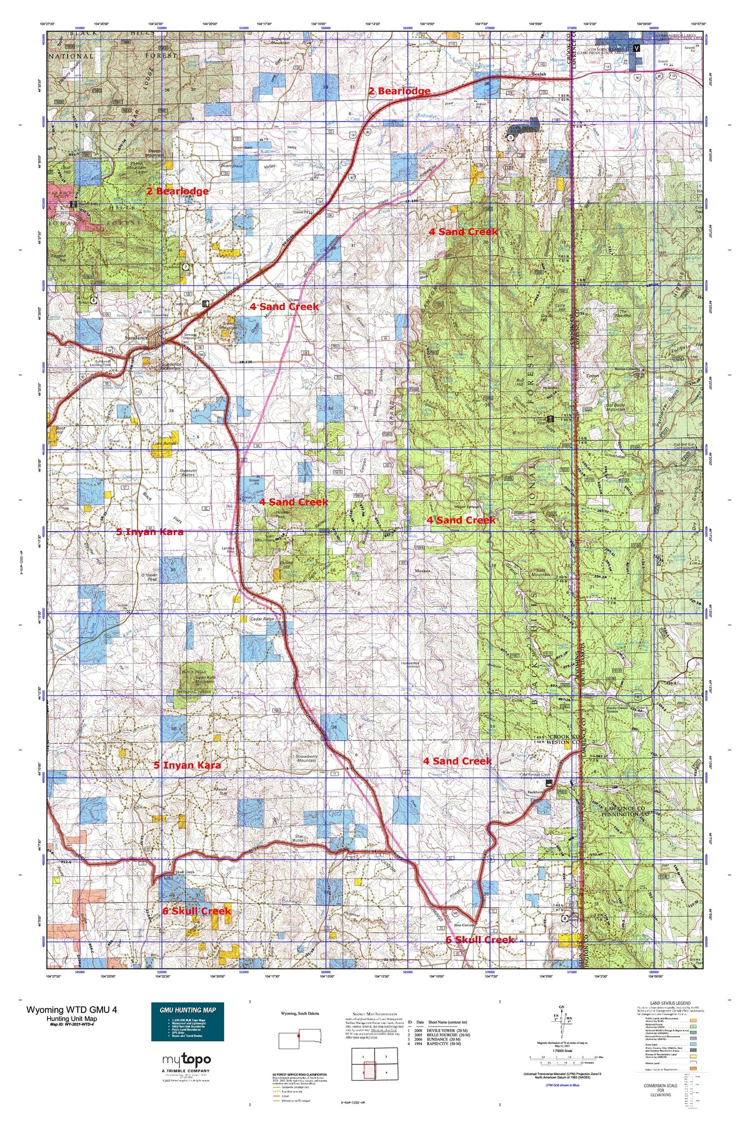
Hunting unit map of Wyoming Game Management Unit WTD-4 with topographic lines and unit boundaries. This topo map features UTM / MGRS and Latitude/Longitude grids, plus public land ownership. It comes folded on waterproof paper. Be fully prepared for your hunt with a MyTopo GMU map!.
This map contains the following named places: 82712,82715,82729,Adams Canyon,Adams Gulch,Alkali Creek,Apex Mine,Bald Mountain,Barnett Draw,Bear Creek Mountains Mine,Bear Den Spring,Bear Gulch,Bear Gulch Cemetery,Bear Gulch I,Bear Gulch Placer Mine,Bear Gulch Trail,Bear Lake,Bear Lodge District Mine,Bearing Tree,Beartown Hill,Beaver Ridge Trail,Beulah,Beulah Cemetery,Beulah Census Designated Place,Black Butte Deposit Mine,Black Buttes,Black Flats,Black Haw Gulch,Boardinghouse Creek,Boardinghouse Spring,Bonanza Gulch,Boundary Gulch,Buck Hollow,Buckhorn,Buckley Canyon,Buffalo Park,Bull Hill,Bull Hill Mine,Bush Ranch,C Nicholas Ranch,Calvary Sacket Draw,Cedar Ridge,Cedar Ridge Mine,Cement Ridge,Centennial Gulch,Chassell Creek,Chicago Gulch,Clark Dam,Clark Reservoir,Cold Creek,Cold Springs Creek,Cole Canyon,Conners Rock,Corral Creek,Cow Creek,Cranberry Springs Gulch,Crooked S Draw,Cummins Gulch,Cundy Creek,Deer Corral Spring,Deer Creek,Den Spring,Dry Draw,Dugout Gulch,Dugout Spring,Duling Canyon,Duling Hill,East Fork Boundary Gulch,East Fork Dugout Gulch,Elk Spring,Elkhorn Divide,Eureka Number Mine,Filmore Mine,Fish Canyon,Fish Mountain,G Reynolds Ranch,Geranium Park,Giant Mine,Giant-Volney Mine,Government Valley,Government Valley Mine,Grand Canyon,Grandview Hill,Green Hill,Green Mountain,Green Mountain Cemetery,Green Mountain Draw,Gypsum Buttes,H Reynolds Ranch,Hardy Guard Station,Harriet Peterson Number One Mine,Harriet Peterson Number Two Mine,Hegge Ranch,Hemler Reservoir,Homestake Lookout,Hooker Peak,Horton,Hospital Gulch,Hoyer Creek,Idol Gulch,Inum Group Mine,Inyan Kara Cemetery,Inyan Kara Mountain,Iron Mountain,J Miller Ranch,Jacobson Draw,Jones Bury and Murdock Property Number One Mine,Jones Ranch,Keenan Properties Mine,Kirley Gulch,Koksh Ranch,Kunath Ranch,Ladyfinger Gulch,Lap Circle Ranch,Lightning Creek,Lime Buttes,Lincoln Gulch,Lincoln Ranch,Lost Canyon,Lytle Hill,Mallory Gulch,Manhattan Gulch,Mathews Ranch,Medicine Flat,Medicine Flat Creek,Medicine Lake,Melquist Gulch,Middle Beaver Creek,Middle Fork Boundary Gulch,Miller Quarry Mine,Miller Ranch,Mineral Hill,Montana Lake,Moonshine Gulch,Moskee,Mount Lewisa,Mount Moriah Cemetery,Mount Tom,Negro Gulch,Negro Hill,North Beaver Creek,North Fork Sundance Creek,Ogden Creek,O'Haver Hill,O'Haver Peak,Old Baldy Mountain,Paxton Creek,Paxton Dam,Paxton Reservoir,Peterson Deposits Mine,Plato Gulch,Plato Ranch,Poison Creek,Pole Cabin Gulch,Potluck One Mine,Potluck Two Mine,Ranch A,Ranch A National Fish Genetics Laboratory,Rattlesnake Canyon,Rawhauser Quarry Mine,Rawhauser Sand Pit Mine,Red Canyon,Red Canyon Creek,Reuter Draw,Richardson Creek,Riflepit Canyon,Riflepit Divide,Rocky Ford Creek,Rocky Ford Dam,Rocky Ford Reservoir,Roena Gulch,Rough and Ready Mine,Rusty Number 9 Mine,S Nicholas Ranch,Saffron Gulch,Sager Ranch,Saint Albert's Catholic Cemetery,Sand Creek,Sand Creek Crossing,Sand Creek Mine,Schelldorf Draw,Schloredt Airport,Schoolhouse Gulch,Seeley Ranch,Seely Ranch,Seventy Flats,Sheep Mountain,Shepherd Gulch,Shirttail Gulch,Silver Creek,Skull Creek,Smith Draw,Soldier Creek,Soldiers Gravesite,South Beaver Creek,South Fork Ogden Creek,South Redwater Creek,Spearfish and Centaur Mine,Spottedtail Gulch,Spring Creek,Spring Draw,Stanton Draw,Star Butte,Stearns Park,Straight Lake,Strawberry Mountain,Sugarloaf,Sundance,Sundance Creek,Sundance District Ranger Station,Sundance Division,Sundance Mountain,Sunshine Hill,Surprise Gulch,Tent Canyon,The Needles,Thompson Gulch,Thompson Ranch,Tinton,Tinton Mine,Town of Sundance,Vista West Trailer Park,Wagon Canyon,Warner Springs Creek,Washington Park,Watson Pit Mine,Welcome,West Fork Boundary Gulch,West Fork Dugout Gulch,West Fork Skull Creek,Williams Divide,Williams Gulch,Williams-Surprise Divide,Willow Springs,Wyoming Gulch


