MyTopo
Beatrice Alabama US Topo Map
Couldn't load pickup availability
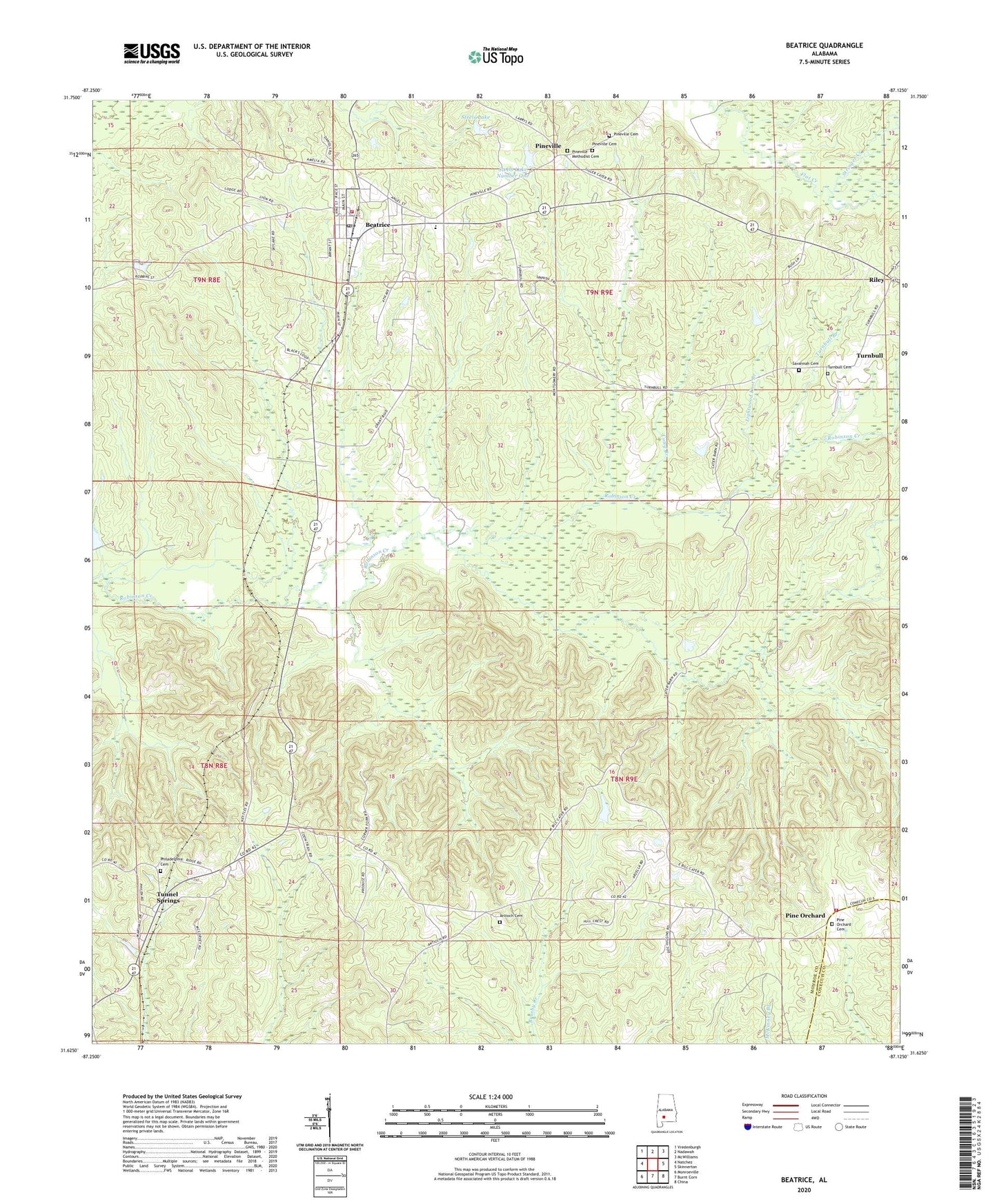
2024 topographic map quadrangle Beatrice in the state of Alabama. Scale: 1:24000. Based on the newly updated USGS 7.5' US Topo map series, this map is in the following counties: Monroe, Conecuh. The map contains contour data, water features, and other items you are used to seeing on USGS maps, but also has updated roads and other features. This is the next generation of topographic maps. Printed on high-quality waterproof paper with UV fade-resistant inks.
Quads adjacent to this one:
West: Natchez
Northwest: Vredenburgh
North: Nadawah
Northeast: McWilliams
East: Skinnerton
Southeast: China
South: Burnt Corn
Southwest: Monroeville
This map covers the same area as the classic USGS quad with code o31087f2.
Contains the following named places: Antioch Baptist Church, Antioch Cemetery, Beatrice, Beatrice Elementary School, Beatrice Post Office, Beatrice Volunteer Fire Department, Cotey Branch, Greer Junior High School, J F Shields High School, Kalem, Lightwood Knot Branch, Nettles Store, Philadelphia Baptist Church, Philadelphia Cemetery, Pine Orchard, Pine Orchard Cemetery, Pine Orchard Methodist Church, Pine Orchard Volunteer Fire Department, Pineville, Pineville Cemetery, Pineville Methodist Cemetery, Riley, Savannah Cemetery, Steel Family Pond Dam, Steels Lake, Steels Lake Number One, Steels Lake Number One Dam, Stringer Creek, Sylvester Church, Town of Beatrice, Tunnel Springs, Turnbull, Turnbull Branch, Turnbull Cemetery