
MyTopo
Cedar Bluff Alabama US Topo Map
Couldn't load pickup availability
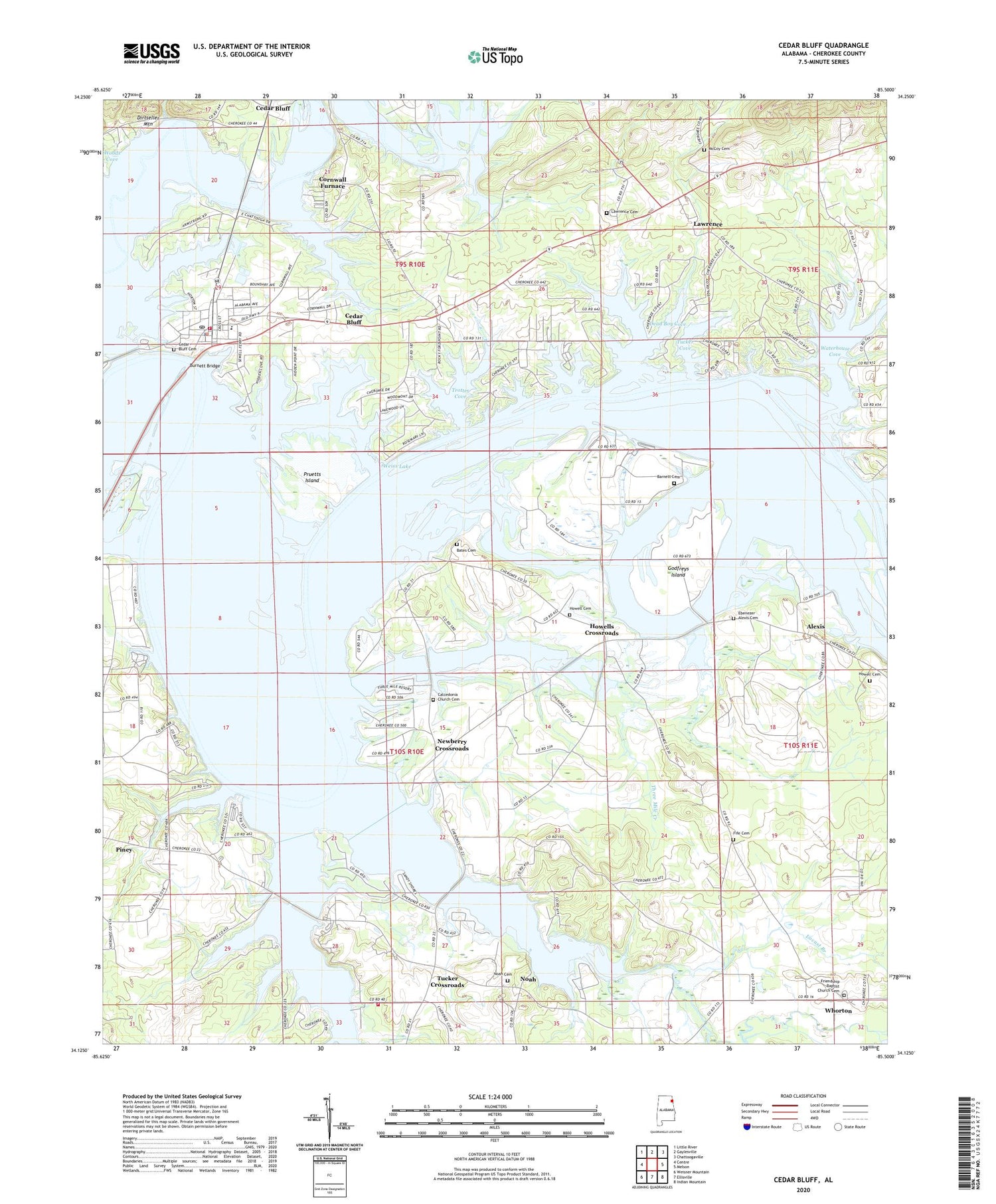
2024 topographic map quadrangle Cedar Bluff in the state of Alabama. Scale: 1:24000. Based on the newly updated USGS 7.5' US Topo map series, this map is in the following counties: Cherokee. The map contains contour data, water features, and other items you are used to seeing on USGS maps, but also has updated roads and other features. This is the next generation of topographic maps. Printed on high-quality waterproof paper with UV fade-resistant inks.
Quads adjacent to this one:
West: Centre
Northwest: Little River
North: Gaylesville
Northeast: Chattoogaville
East: Melson
Southeast: Indian Mountain
South: Ellisville
Southwest: Weisner Mountain
This map covers the same area as the classic USGS quad with code o34085b5.
Contains the following named places: Abernathy Mill, Alexis, Alexis Baptist Church, Alexis School, Alpine Shores, Barnett Cemetery, Bates Cemetery, Burnett Bridge, Calcedonia Baptist Church, Calcedonia Church Cemetery, Carthens Ferry, Cedar Bluff, Cedar Bluff Cemetery, Cedar Bluff Church, Cedar Bluff High School, Cedar Bluff Marina, Cedar Bluff Park, Cedar Bluff Police Department, Cedar Bluff Post Office, Cedar Bluff Volunteer Fire Department, Cherokee County, Cherokee County Training School, Cornwall, Cornwall Furnace, Cornwall Furnace Memorial Park, Cotton Patch, Dead Boy Cove, Demaris Baptist Church, Ebenezer Alexis Cemetery, Ebenezer Methodist Church, Enon Grove Baptist Church, Ferguson, Fife Cemetery, Fort Armstrong Ferry, Friendship Baptist Church, Friendship Baptist Church Cemetery, Godfreys Island, Hardwick Ferry, Howell Cemetery, Howells Crossroads, Lakeshore Marina, Lawrence, Lawrence Cemetery, Lawrence Ferry, Locust Branch, Macedonia Baptist Church, McCoy Cemetery, McCoy Ferry, Meadows Estates, Newberry Cove, Newberry Crossroads, Noah, Noah Baptist Church, Noah Cemetery, Pathkiller Cove, Pine Grove Church, Pruetts Island, Saint Marks Methodist Church, Sewell Ferry, Spring Creek, Spring Creek Volunteer Fire Department, Sterling, Summer Estates, Three Mile Creek, Town of Cedar Bluff, Trotter Cove, Tucker Cove, Tucker Crossroads, Waterhouse Cove, Whorton, Woods Cove, Yanceys Bend, ZIP Code: 35959


