MyTopo
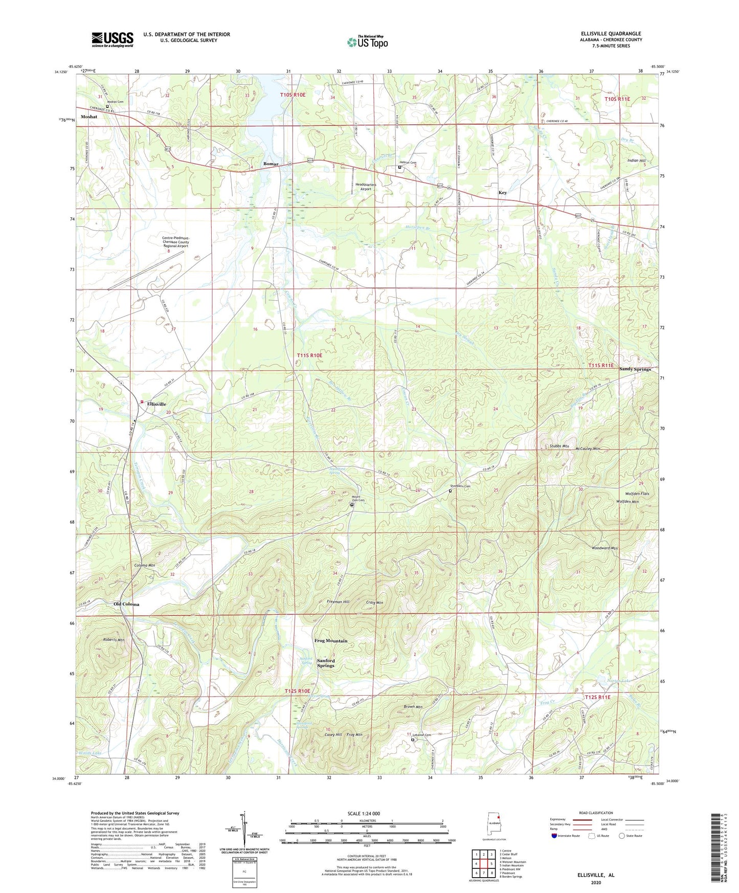
Ellisville Alabama US Topo Map
Couldn't load pickup availability
Also explore the Ellisville Forest Service Topo of this same quad for updated USFS data
2024 topographic map quadrangle Ellisville in the state of Alabama. Scale: 1:24000. Based on the newly updated USGS 7.5' US Topo map series, this map is in the following counties: Cherokee. The map contains contour data, water features, and other items you are used to seeing on USGS maps, but also has updated roads and other features. This is the next generation of topographic maps. Printed on high-quality waterproof paper with UV fade-resistant inks.
Quads adjacent to this one:
West: Weisner Mountain
Northwest: Centre
North: Cedar Bluff
Northeast: Melson
East: Indian Mountain
Southeast: Borden Springs
South: Piedmont
Southwest: Piedmont NW
This map covers the same area as the classic USGS quad with code o34085a5.
Contains the following named places: Big Elm Branch, Blue Pond, Bob Hollow Branch, Bomar, Brown Mountain, Bulse Branch, Cantrell Branch, Casey Hill, Centre-Piedmont-Cherokee County Regional Airport, Christian Mission Church, Coloma, Coloma Mountain, Coloma Post Office, Couches Mill, Cowan Creek, Craig Mountain, Craig Mountain Lookout Tower, Dockage Mine, Doctor McElraths Mill, Dry Branch, Dry Slough, Ellisville, Ellisville Church, Ellisville Volunteer Fire Department, Exie, Exie Church, Firestone Branch, Freeman Hill, Frog Mountain, Frog Mountain Church, Garvin Spring, Headquarters Airport, Hebron Methodist Church, Hebron Methodist Church Cemetery, Horsepen Branch, Hurricane Creek, Indian Hill, Jenning Chapel, Key, Lebanon Campground Church, Lebanon United Methodist Church Cemetery, McCauley Mountain, Mona, Moshat, Moshat Baptist Church, Moshat Baptist Church Cemetery, Mount Zion Church, Mount Zion Church Cemetery, Mount Zion School, New Bethel Church, New Prospect Church, Norton Dam, Norton Lake, Old Coloma, Pleasant Arbour Baptist Church, Roberts Mountain, Sandy Creek, Sanford Spring, Sanford Springs, Sheepskin Cemetery, Shield Mill, Spring Garden Division, Standford Spring, Standford Springs, Strickland Branch, Stubbs Mountain, Terrapin Creek Watershed Dam Number 6, Union Church, Unity Hill Baptist Church, Wolfden Flats, Wolfden Mountain, Woodward Mountain, ZIP Code: 35960