MyTopo
Coffeeville Lock And Dam Alabama US Topo Map
Couldn't load pickup availability
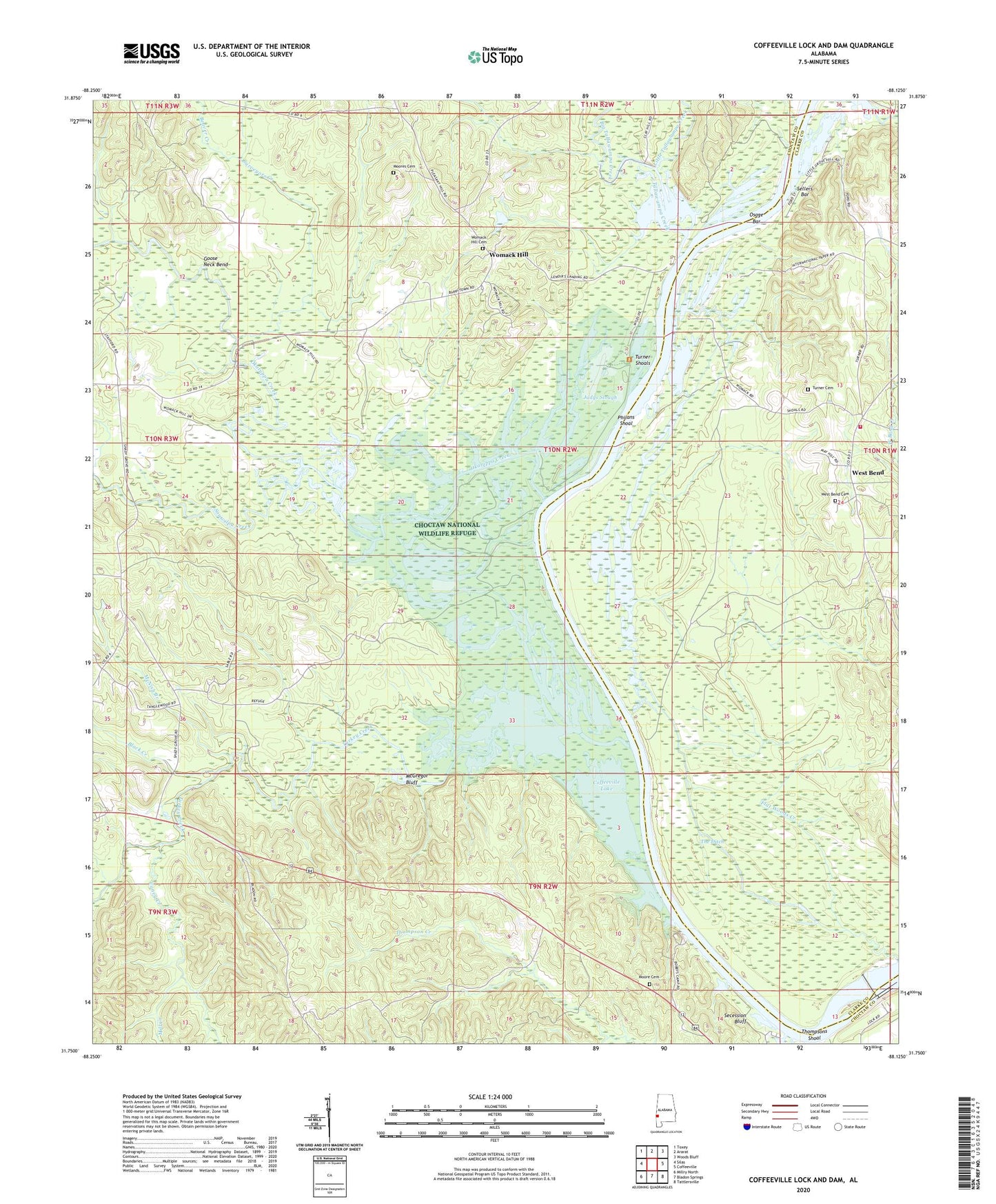
2024 topographic map quadrangle Coffeeville Lock And Dam in the state of Alabama. Scale: 1:24000. Based on the newly updated USGS 7.5' US Topo map series, this map is in the following counties: Choctaw, Clarke. The map contains contour data, water features, and other items you are used to seeing on USGS maps, but also has updated roads and other features. This is the next generation of topographic maps. Printed on high-quality waterproof paper with UV fade-resistant inks.
Quads adjacent to this one:
West: Silas
Northwest: Toxey
North: Ararat
Northeast: Woods Bluff
East: Coffeeville
Southeast: Tattlersville
South: Bladon Springs
Southwest: Millry North
This map covers the same area as the classic USGS quad with code o31088g2.
Contains the following named places: Barrytown Oil Field, Beaver Creek, Big Tallawampa Creek, Black Creek, Bladon Springs Landing, Bobbys Landing, Caney Creek, Cedar Point Church, Choctaw National Wildlife Refuge, Coffeeville Lake Public Use Area, Coffeeville Lock and Dam, Coker Bend Lake, Coxs Landing, Fakit Chipunta, Flat Woods Creek, Flatwood, Gilbertown Dock, Goose Neck Bend, Hills Landing, House of Prayer Church, J W Thornton Landing, Judys Slough, Lenoir Landing, Lenora, Little Tallawampa Creek, Lower Plug, Mays Woodyard Landing, McGregor Bluff, McNish Branch, Mill Creek, Moore Cemetery, Moores Cemetery, Mount Pleasant Baptist Church, Okatuppa Creek, Okatuppa Creek Public Use Area, Osage Bar, Osage Woodyard Landing, Philans Shoal, Pleasant Chapel Baptist Church, Powes Landing, Secession Bluff, Sellers Bar, Sellers Landing, Shorts Landing, Singley Landing, Smith Landing, South Womack Hill Oil Field, Souwilpa Creek, Surveyors Creek, Tallawampa Creek, The Ditch, Thompsons Shoal, Thorntons Landing, Turkey Creek, Turkey Creek Landing, Turkey Creek Oil Field, Turner Cemetery, Turner Shoals, Turners Landing, Upper Plug, West Bend, West Bend Bethel Volunteer Fire Department, West Bend Cemetery, West Bend Church, West Bend Oil Field, Womack Hill, Womack Hill Baptist Church, Womack Hill Cemetery, Womack Hill Church, Womack Hill Oil Field, Wrights Landing