
MyTopo
Millry North Alabama US Topo Map
Couldn't load pickup availability
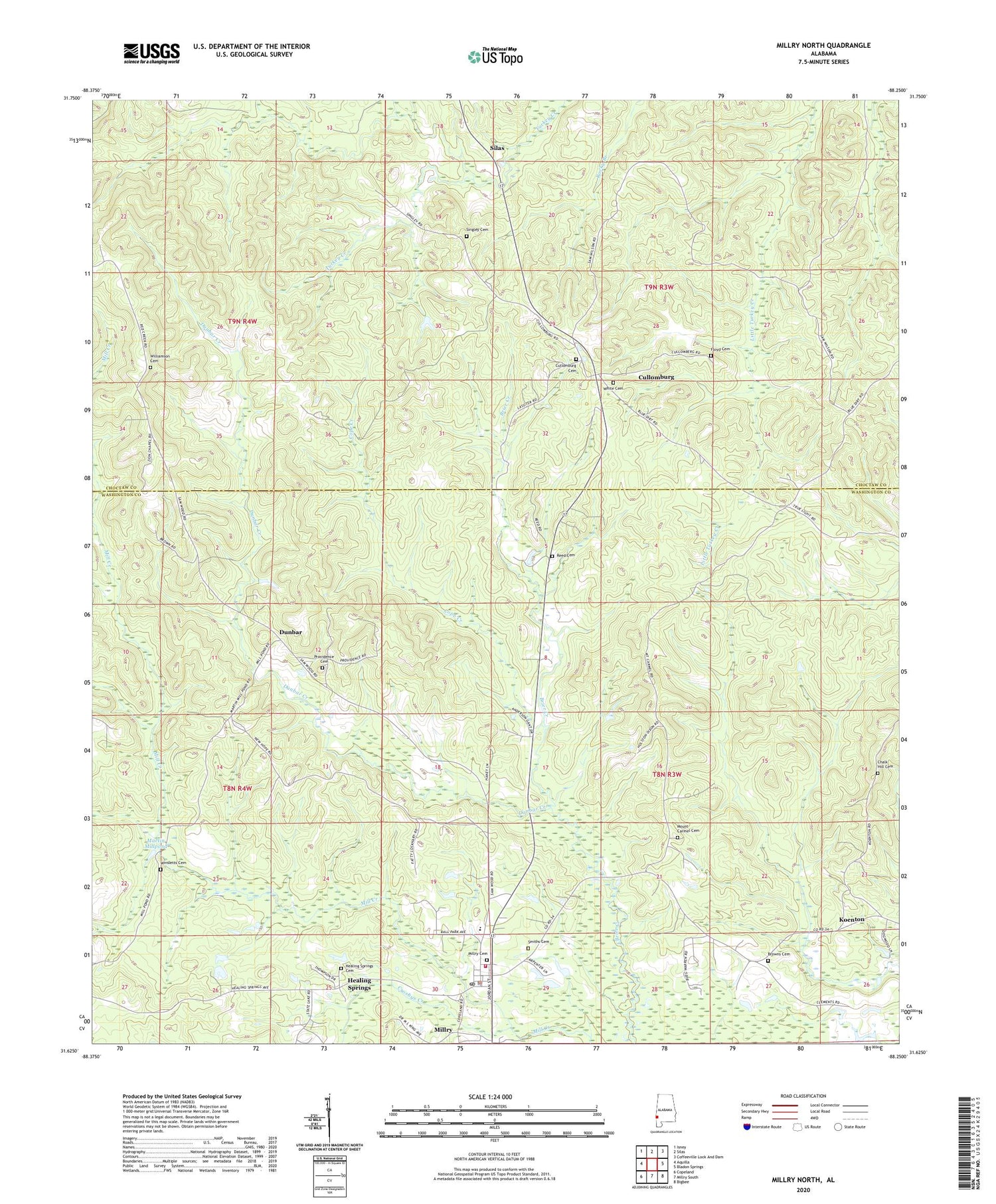
2024 topographic map quadrangle Millry North in the state of Alabama. Scale: 1:24000. Based on the newly updated USGS 7.5' US Topo map series, this map is in the following counties: Washington, Choctaw. The map contains contour data, water features, and other items you are used to seeing on USGS maps, but also has updated roads and other features. This is the next generation of topographic maps. Printed on high-quality waterproof paper with UV fade-resistant inks.
Quads adjacent to this one:
West: Aquilla
Northwest: Isney
North: Silas
Northeast: Coffeeville Lock And Dam
East: Bladon Springs
Southeast: Bigbee
South: Millry South
Southwest: Copeland
This map covers the same area as the classic USGS quad with code o31088f3.
Contains the following named places: A D Britton Stadium, Browns Cemetery, C and J Church of God, Chalk Hill Baptist Church, Chalk Hill Cemetery, Church of the Apostle Faith, Cope Creek, Crosbys Creek, Cullomburg, Cullomburg Baptist Church, Cullomburg Cemetery, Cullomburg Census Designated Place, Cullomburg United Methodist Church, Dunbar, Dunbar Creek, Floyd Cemetery, Healing Springs, Healing Springs Cemetery, Knights School, Koenton, Martin Millpond, Martins Mill, Millry, Millry Assembly of God Church, Millry Baptist Church, Millry Cemetery, Millry Division, Millry High School, Millry Police Department, Millry Post Office, Millry Sewage Lagoon, Millry Volunteer Fire Department, Mount Carmel Cemetery, Mount Carmel Methodist Church, New Hope Church, Providence Cemetery, Providence Church, Reed Cemetery, Rescueville, Sanctified Tabernacle, Silas Gospel Mission, Singley Cemetery, Smiths Cemetery, Town of Millry, White Cemetery, White Chapel Baptist Church, Williamson Cemetery, Winsletts Cemetery, Zion Chapel African Methodist Episcopal Zion Church


