MyTopo
Eufaula South Alabama US Topo Map
Couldn't load pickup availability
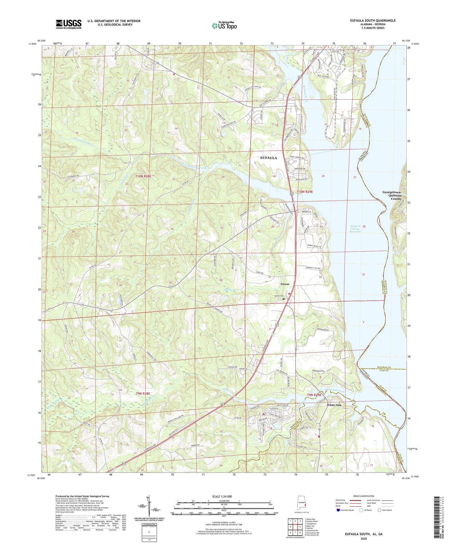
2024 topographic map quadrangle Eufaula South in the state of Alabama. Scale: 1:24000. Based on the newly updated USGS 7.5' US Topo map series, this map is in the following counties: Barbour, Quitman, Henry, Clay. The map contains contour data, water features, and other items you are used to seeing on USGS maps, but also has updated roads and other features. This is the next generation of topographic maps. Printed on high-quality waterproof paper with UV fade-resistant inks.
Quads adjacent to this one:
West: Baker Hill
Northwest: White Oak
North: Eufaula North
Northeast: Georgetown
East: Hatcher
Southeast: Fort Gaines NE
South: Fort Gaines NW
Southwest: Lawrenceville
Contains the following named places: Alexanders Landing, Alexanders Mill, Barbour Creek, Barbour Creek Landing Recreational Facility, Blacks Branch, Bluff City Elementary School, Chauncy Sparks Termina, Chauncy Sparks Trade School, Cheneyhatchee Creek, Cheneyhatchee Creek Recreation Area, Chipola Creek, Christian Grove Church, Epworth United Methodist Church, Espy School, Eufaula Church, Eufaula Fire and Rescue Southside Station, Eufaula Fire and Rescue Westside Station, Freemont Junior High School, Freemount African Methodist Episcopal Church, Friendship Church, Grantham Creek, Jernigans Mill, Jones Chapel, McCarrols Mill, Millers Woodyard Landing, Sandville Church, Sandy Creek, Sardis Cemetery, Sardis Church, Screamer Volunteer Fire Department Station 3, Terese, White Oak, White Oak Church, White Oak Creek, White Oak Creek Recreation Area, White Oak Volunteer Fire Department, Woods School