
MyTopo
Fort Gaines NW Alabama US Topo Map
Couldn't load pickup availability
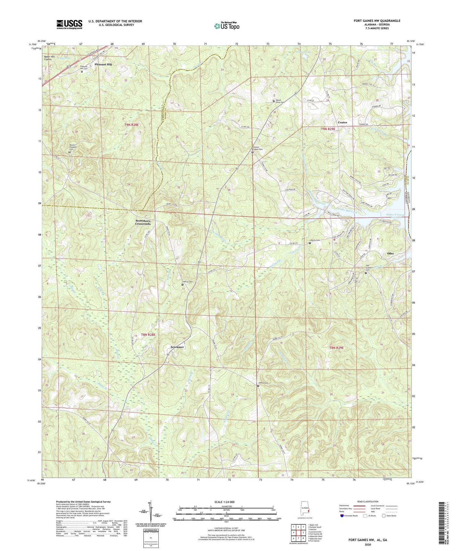
2024 topographic map quadrangle Fort Gaines NW in the state of Alabama. Scale: 1:24000. Based on the newly updated USGS 7.5' US Topo map series, this map is in the following counties: Henry, Barbour, Clay. The map contains contour data, water features, and other items you are used to seeing on USGS maps, but also has updated roads and other features. This is the next generation of topographic maps. Printed on high-quality waterproof paper with UV fade-resistant inks.
Quads adjacent to this one:
West: Lawrenceville
Northwest: Baker Hill
North: Eufaula South
Northeast: Hatcher
East: Fort Gaines NE
Southeast: Fort Gaines
South: Abbeville East
Southwest: Abbeville West
Contains the following named places: Barnes Mill Creek, Billy Branch, Boggy Branch, Chester Chapel Cemetery, Chester Chapel Freewill Baptist Church, Coates, Double Bridges, Espy Number 51 Mine, Espy Pond, Free Gift Church, Gin Branch, Griffin Mine, Hillardsville, Judson Cemetery, Judson Missionary Baptist Church, Liberty Cemetery, Liberty Creek, Liberty Methodist Church, Lucas Number 1 Mine, Lucas Number 2 Mine, Mathison Mine, McCloud Branch, Mount Olive Cemetery, Mount Olive Church, Mount Pleasant Cemetery, Mount Pleasant Church, New Hope Missionary Baptist Church, Old Judson Cemetery, Otho, Pleasant Grove Church, Pleasant Hill, Pleasant Hill Baptist Church, Pleasant Hill Cemetery, Polk Spring Branch, Scottsboro Crossroads, Scottsboro School, Screamer, Screamer Volunteer Fire Department Station 1, Spring Branch, Thomas Mill Creek, Thomas Mill Creek Park, Wells Branch, Wilson Pond, Woods Mill


