MyTopo
Kirk Alabama US Topo Map
Couldn't load pickup availability
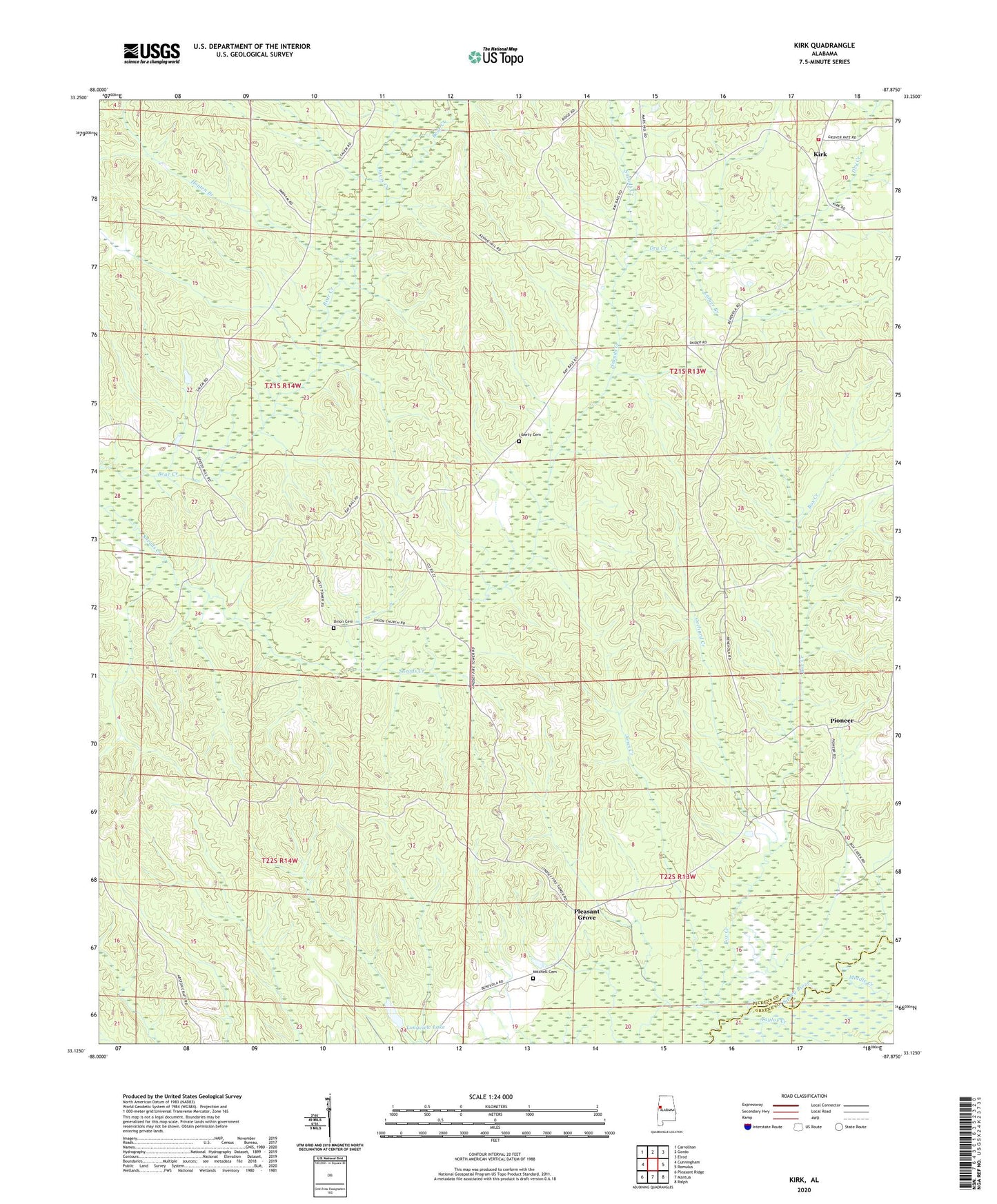
2024 topographic map quadrangle Kirk in the state of Alabama. Scale: 1:24000. Based on the newly updated USGS 7.5' US Topo map series, this map is in the following counties: Pickens, Greene. The map contains contour data, water features, and other items you are used to seeing on USGS maps, but also has updated roads and other features. This is the next generation of topographic maps. Printed on high-quality waterproof paper with UV fade-resistant inks.
Quads adjacent to this one:
West: Cunningham
Northwest: Carrollton
North: Gordo
Northeast: Elrod
East: Romulus
Southeast: Ralph
South: Mantua
Southwest: Pleasant Ridge
This map covers the same area as the classic USGS quad with code o33087b8.
Contains the following named places: Brannan School, Davis Creek, Dry Creek, Houten Branch, Jones Creek, Kenney Hill Church, Kenny Hill School, Kings School, Kirk, Kirk School, Kirk Volunteer Fire Department, Latner Branch, Lebanon Church, Liberty Cemetery, Liberty Church, Longview Dam, Longview Lake, Mars Hill Church, Middle Creek, Mitchell Cemetery, Orchard Creek, Pine Grove Church, Pioneer, Pleasant Grove, Pleasant Grove Lookout Tower, Raleigh Division, Souls Chapel, Speeds Water Mill, Taylor Creek, Union Cemetery, Union Church, Union School, ZIP Code: 35466