MyTopo
Ralph Alabama US Topo Map
Couldn't load pickup availability
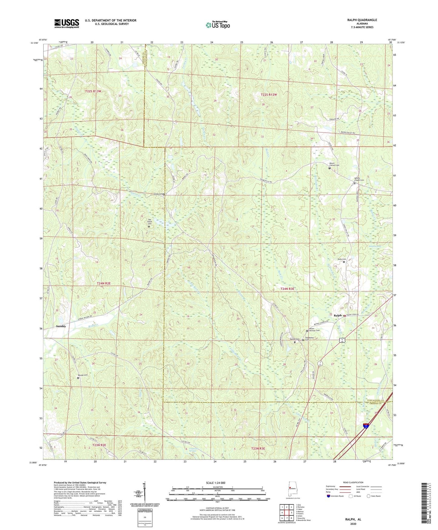
2024 topographic map quadrangle Ralph in the state of Alabama. Scale: 1:24000. Based on the newly updated USGS 7.5' US Topo map series, this map is in the following counties: Greene, Tuscaloosa. The map contains contour data, water features, and other items you are used to seeing on USGS maps, but also has updated roads and other features. This is the next generation of topographic maps. Printed on high-quality waterproof paper with UV fade-resistant inks.
Quads adjacent to this one:
West: Mantua
Northwest: Kirk
North: Romulus
Northeast: Coker
East: Fosters
Southeast: Moundville West
South: Knoxville
Southwest: Union
This map covers the same area as the classic USGS quad with code o33087a7.
Contains the following named places: Beaver Creek, Bethel Baptist Church, Bethel Cemetery, Beulah Baptist Church, Beulah Cemetery, Beulah School, Boom, Copperas Springs, Dowling School, Enterprise School, Fosters - Ralph Fire Protection District Ralph Station, McCracken Creek, Moseley, Mount Carmel Cemetery, Mount Carmel Methodist Church, Mount Herman Cemetery, Mount Herman Church, New Zion Baptist Church, Old Bethel Cemetery, Old Shiloh Cemetery, Phillips Creek, Pinson Branch, Ralph, Ralph Post Office, Reed Swamp, Sealy Cemetery, Shadowood, Shechi Lake Dam Number Two, Shechi Lake Number Two, Shiloh Baptist Church, Shiloh Cemetery, Shiloh School, Washington Temple Church of God in Christ, Wesley Chapel Cemetery, Wesley Chapel School, Wesley Chapel United Methodist Church, ZIP Code: 35480