MyTopo
Repton Alabama US Topo Map
Couldn't load pickup availability
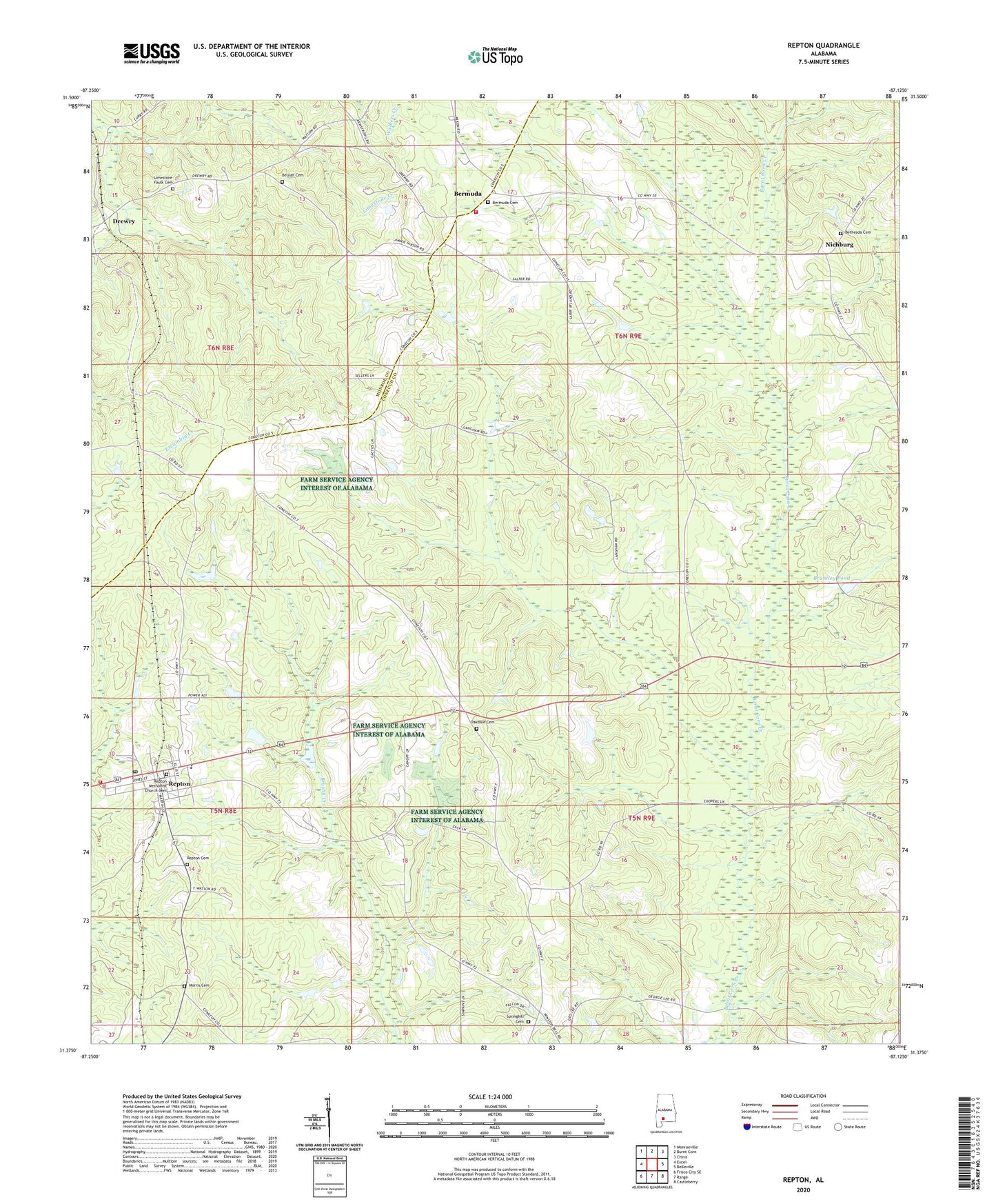
2024 topographic map quadrangle Repton in the state of Alabama. Scale: 1:24000. Based on the newly updated USGS 7.5' US Topo map series, this map is in the following counties: Conecuh, Monroe. The map contains contour data, water features, and other items you are used to seeing on USGS maps, but also has updated roads and other features. This is the next generation of topographic maps. Printed on high-quality waterproof paper with UV fade-resistant inks.
Quads adjacent to this one:
West: Excel
Northwest: Monroeville
North: Burnt Corn
Northeast: China
East: Belleville
Southeast: Castleberry
South: Range
Southwest: Frisco City SE
This map covers the same area as the classic USGS quad with code o31087d2.
Contains the following named places: Bermuda, Bermuda Cemetery, Bermuda Church, Bermuda School, Bermuda United Methodist Church, Bermuda Volunteer Fire Department, Bethesda Baptist Church, Bethesda Cemetery, Beulah Baptist Church, Beulah Cemetery, Brantley Dam, Brantley Pond, Langham, Limestone Faulk African Methodist Episcopal Church, Limestone Faulk Cemetery, Monroe Church, Morris Cemetery, Mount Rose High School, Mous, New Centennial Baptist Church, Nichburg, Nichburg Junior High School, Oak Grove Church, Oakdale Assembly of God Church, Oakdale Cemetery, Osierfield, Osierfield School, Owens Chapel, Repton, Repton Cemetery, Repton High School, Repton Post Office, Repton Volunteer Fire Department, Springhill Cemetery, Springhill Methodist Church, Town of Repton, W R Carter Dam, ZIP Code: 36475