MyTopo
Range Alabama US Topo Map
Couldn't load pickup availability
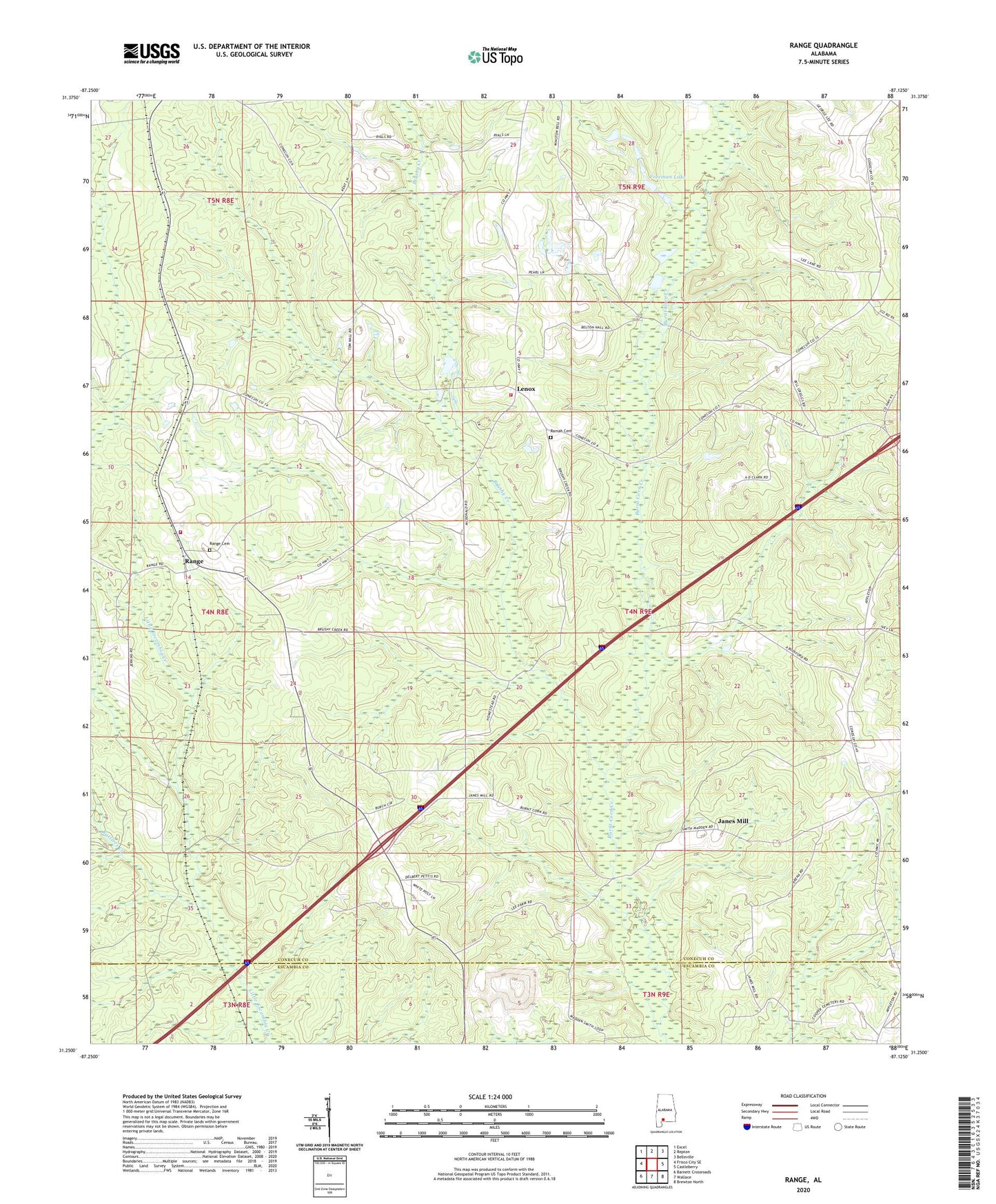
2024 topographic map quadrangle Range in the state of Alabama. Scale: 1:24000. Based on the newly updated USGS 7.5' US Topo map series, this map is in the following counties: Conecuh, Escambia. The map contains contour data, water features, and other items you are used to seeing on USGS maps, but also has updated roads and other features. This is the next generation of topographic maps. Printed on high-quality waterproof paper with UV fade-resistant inks.
Quads adjacent to this one:
West: Frisco City SE
Northwest: Excel
North: Repton
Northeast: Belleville
East: Castleberry
Southeast: Brewton North
South: Wallace
Southwest: Barnett Crossroads
This map covers the same area as the classic USGS quad with code o31087c2.
Contains the following named places: Baggetts Chapel, Bethel Church, Brushy Creek, Burnt Corn Creek Oil Field, Freeman Lake, Freeman Lake Dam, Grace Fellowship Church, Hartwood Church, House of Prayer Holiness Church, James School, Janes Mill, Lenox, Lenox Baptist Church, Lenox Post Office, Lenox Springhill Volunteer Fire Department, New Haven Church, New Hopewell Church, Oak Grove Church, Ramah Cemetery, Ramah Church, Range, Range Cemetery, Range Church, Range Post Office, Range Volunteer Fire Department, Rattlers Creek, Repton Division, Timberlands Landfill, ZIP Codes: 36454, 36473