MyTopo
Stevenson Alabama US Topo Map
Couldn't load pickup availability
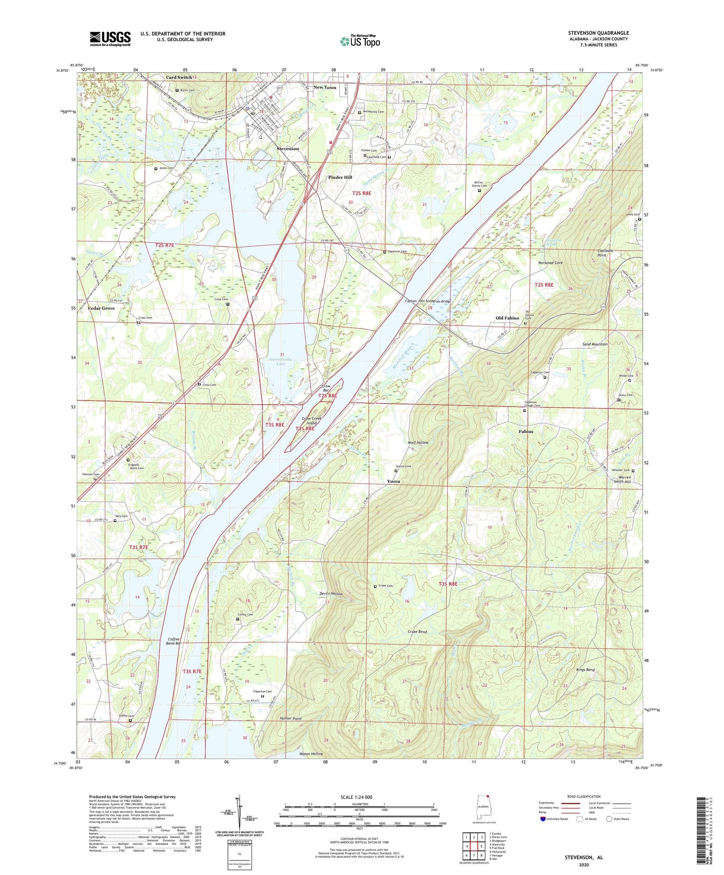
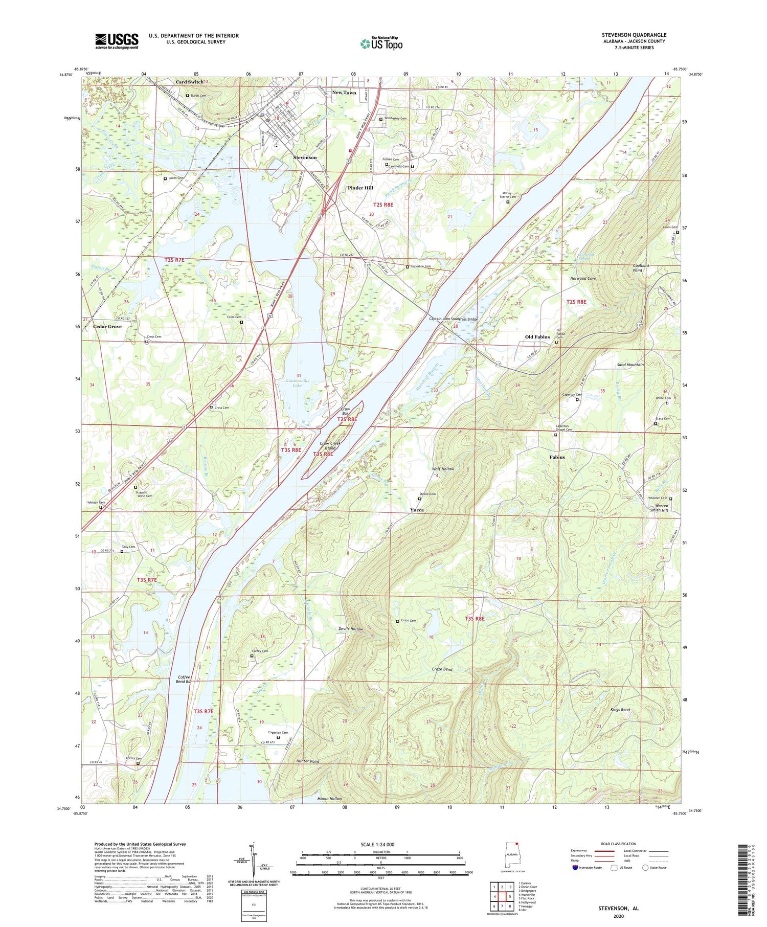
2024 topographic map quadrangle Stevenson in the state of Alabama. Scale: 1:24000. Based on the newly updated USGS 7.5' US Topo map series, this map is in the following counties: Jackson. The map contains contour data, water features, and other items you are used to seeing on USGS maps, but also has updated roads and other features. This is the next generation of topographic maps. Printed on high-quality waterproof paper with UV fade-resistant inks.
Quads adjacent to this one:
West: Wannville
Northwest: Eureka
North: Doran Cove
Northeast: Bridgeport
East: Flat Rock
Southeast: Ider
South: Henagar
Southwest: Hollywood
This map covers the same area as the classic USGS quad with code o34085g7.
Contains the following named places: Baldridge Reservation, Bengis Creek, Brogue Branch, Burch Cemetery, Cameronsville School, Campbell Chapel, Caperton Cemetery, Caperton Chapel, Caperton Ferry, Captain John Snodgrass Bridge, Card Switch, Cawlfield Cemetery, Cedar Grove, Center Star Missionary Baptist Church, Church of Christ, Coalbank Point, Coffee Bend Bar, Coffey Cemetery, Coffeys Ferry, Coon Creek, Craze Bend, Cross Cemetery, Crow Bar, Crow Creek, Crow Creek Island, Crow Creek Wildlife Management Area, Cumberland Church, Deal Creek, Devils Hollow, Fabius, First United Methodist Church of Stevenson, Foshee Cemetery, Hunter Point, Hymer, Johnson Cemetery, Kings Bend, Marshall Branch, Mason Hollow, McCoy Grove Church, McCoy School, Monday Branch, Mud Creek Public Shooting Area, New Town, Nichols Branch, Norwood Cove, Norwood Spring, Oak Grove Church, Old Fabius, Old Fabius Church, Pinder Hill, Pump Spring Branch, Raccoon Creek Public Hunting Area, Rocky Branch, Ross Branch, Rudders Chapel, Rudders Ferry, Slaton Branch, Sterne Branch, Sterne Cemetery, Stevenson, Stevenson High School, Stevenson Historic District, Stevenson Municipal Park, Stevenson Police Department, Stevenson Post Office, Stevenson Volunteer Fire Department Station 2, Stevenson Volunteer Fire Department Station 3, Sulphur Springs Church, Sulphur Springs School, Tally Cemetery, Warren Smith Creek, Warren Smith Hill, Wheeler Cemetery, Wimberley Cemetery, Wolf Hollow, WVSV-FM (Stevenson), Yucca, Zion Church