
MyTopo
Ider Alabama US Topo Map
Couldn't load pickup availability
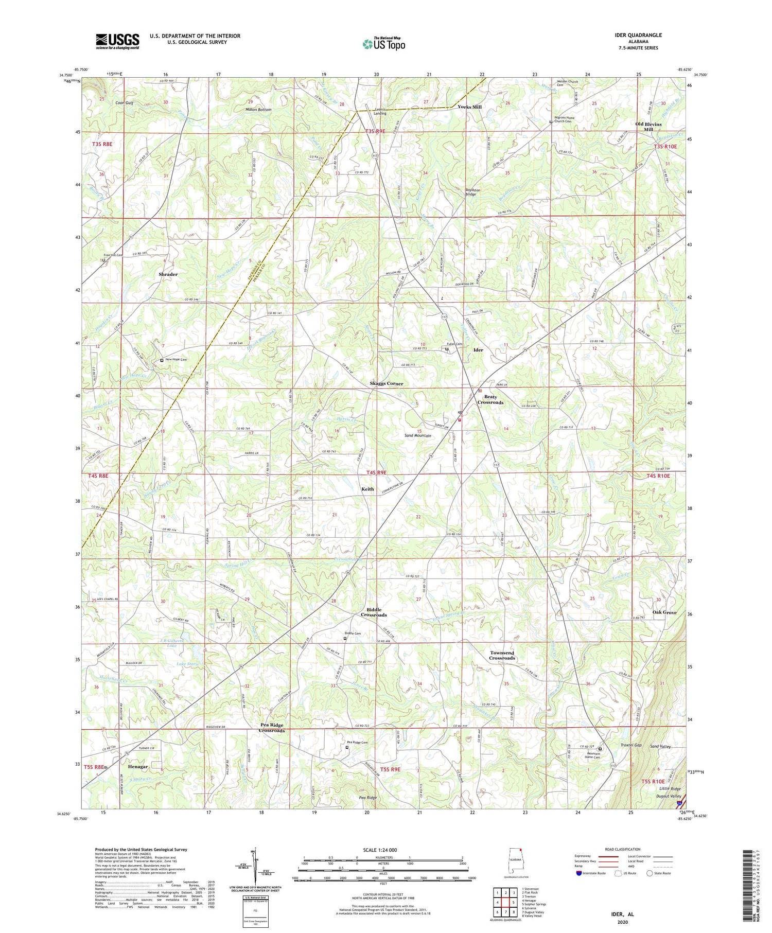
2024 topographic map quadrangle Ider in the state of Alabama. Scale: 1:24000. Based on the newly updated USGS 7.5' US Topo map series, this map is in the following counties: DeKalb, Jackson. The map contains contour data, water features, and other items you are used to seeing on USGS maps, but also has updated roads and other features. This is the next generation of topographic maps. Printed on high-quality waterproof paper with UV fade-resistant inks.
Quads adjacent to this one:
West: Henagar
Northwest: Stevenson
North: Flat Rock
Northeast: Trenton
East: Sulphur Springs
Southeast: Valley Head
South: Dugout Valley
Southwest: Sylvania
This map covers the same area as the classic USGS quad with code o34085f6.
Contains the following named places: Bailey Branch, Beaty Crossroads, Biddle Cemetery, Biddle Crossroads, Big Glade Branch, Boydston Bridge, Boydston Creek, Charlie Creek, Chestnut Grove Baptist Church, City of Henagar, Crow Creek, Double Bridges, East Fork Bryant Creek, Emmanuel Church, Evans Spring Branch, Fellowship Church, Five Points Church, Freehill Baptist Church, Friendship Church, Fuller Cemetery, Fuller Creek, Harris Creek, Henagar Post Office, Highfield Branch, Ider, Ider Church, Ider Division, Ider Fire Department, Ider Missionary Baptist Church, Ider Police Department, Ider Post Office, Ider School, J R Gilbert Dam, J R Gilberts Lake, Jones Branch, Keith, Keith School, Koger Creek, Lake Storie, Lees Chapel, Leon's Landing, Macedonia Primitive Baptist Church, Mason Bottom, Moore Branch, Mount Zion Missionary Baptist Church, Mountain Home Cemetery, Mountain Home Church, Mountain View Church, New Bethel Church Number 2, New Hope Cemetery, New Hope Church, New Hope Creek, Oak Grove, Oak Grove School, Old Blevins Mill, Pea Ridge Cemetery, Pea Ridge Church, Pea Ridge Crossroads, Pilgrims Home Church, Pole Creek, Presswood Branch, Schrader School, Shrader, Shrader School, Shumaker Branch, Skaggs Corner, Spring Hill Church, Spring Hill School, Storie Dam, Thunder Canyon Camp, Town of Ider, Townsend Crossroads, Troxtel Gap, Yorks Mill, ZIP Codes: 35978, 35981


