
MyTopo
Surginer Alabama US Topo Map
Couldn't load pickup availability
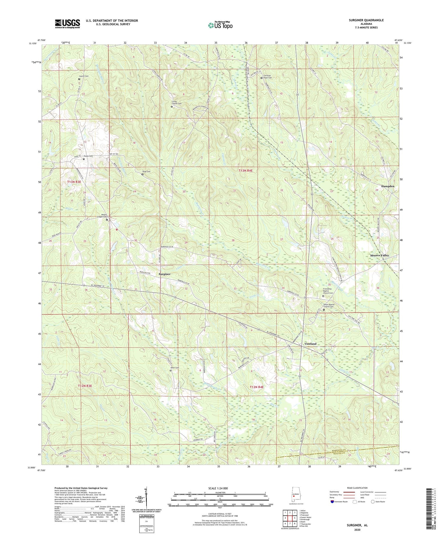
2024 topographic map quadrangle Surginer in the state of Alabama. Scale: 1:24000. Based on the newly updated USGS 7.5' US Topo map series, this map is in the following counties: Marengo, Wilcox. The map contains contour data, water features, and other items you are used to seeing on USGS maps, but also has updated roads and other features. This is the next generation of topographic maps. Printed on high-quality waterproof paper with UV fade-resistant inks.
Quads adjacent to this one:
West: Sweet Water
Northwest: Miller
North: Magnolia
Northeast: Flatwood
East: Kimbrough
Southeast: Pine Hill
South: Thomasville
Southwest: Bashi
This map covers the same area as the classic USGS quad with code o32087a6.
Contains the following named places: Arbor Cemetery, Arbor Church, Baptizing Creek, Christian Hope Cemetery, Christian Hope Church, Christian Union Church, Church of God, Cypress Creek, Dixons Mill Division, Dry Creek, Ellison, Friendship Baptist Church, Friendship Baptist Church Cemetery, Hampden, Holy Church, Hosea Cemetery, Jackson School, Laurel Cemetery, Little Creek, Living Church Cemetery, Magnolia Terminal, Moores Valley, Piney Woods Creek, Pope School, Pritchett Mill Creek, Pritchett School, Shields School, Shiloh Lookout Tower, Shop Cemetery, Surginer, Surginer Volunteer Fire Department Station 1, Threadgill Mill Creek, Turkey Creek, Union Baptist Church, Union Baptist Church Cemetery, Union Grove Church, Vineland, Vineland Church, Vineland Macedonia Church, Wesley Chapel Cemetery, Wesley Chapel Elementary School, Wesley Chapel United Methodist Church, Wilma School


