MyTopo
Bashi Alabama US Topo Map
Couldn't load pickup availability
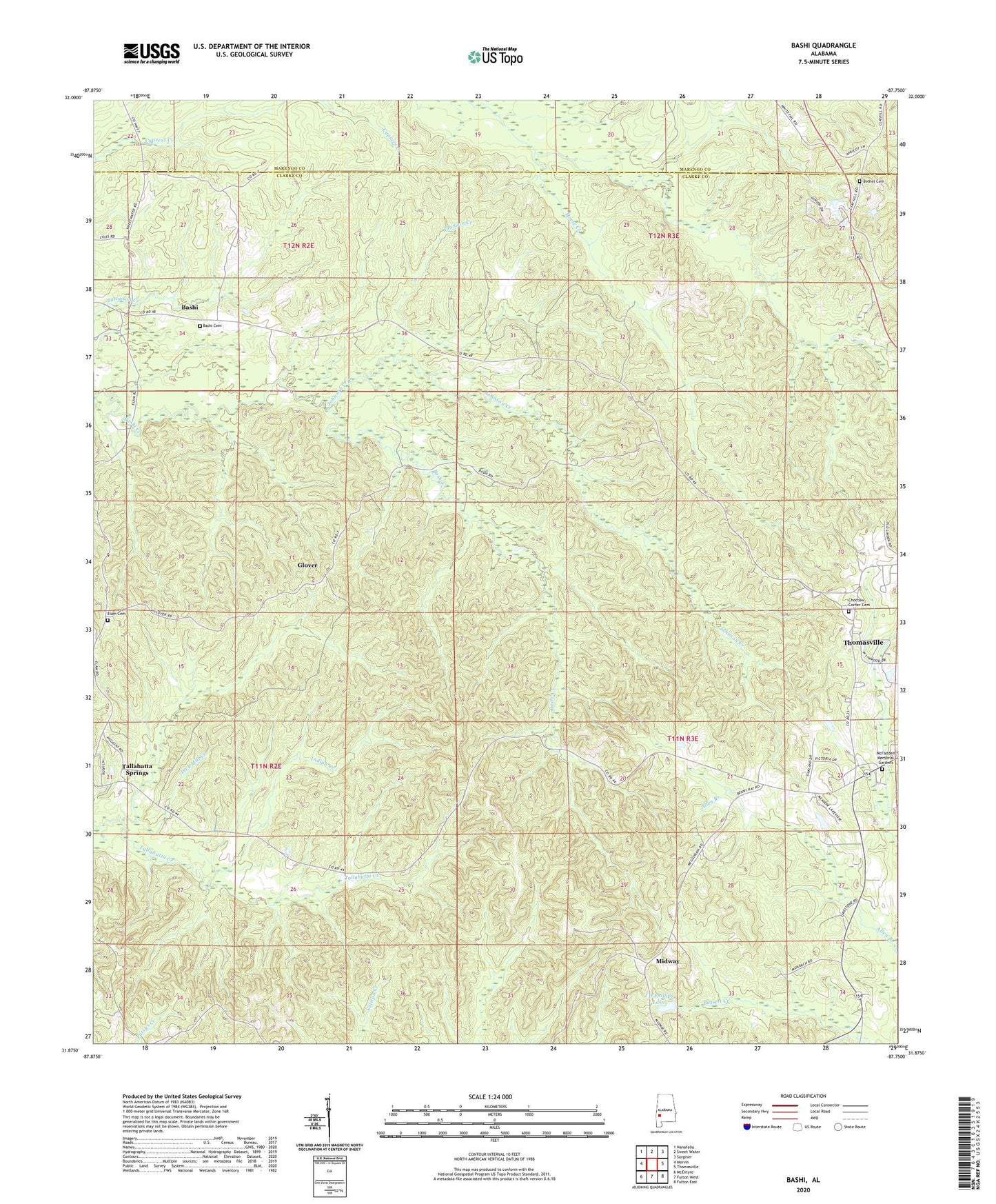
2024 topographic map quadrangle Bashi in the state of Alabama. Scale: 1:24000. Based on the newly updated USGS 7.5' US Topo map series, this map is in the following counties: Clarke, Marengo. The map contains contour data, water features, and other items you are used to seeing on USGS maps, but also has updated roads and other features. This is the next generation of topographic maps. Printed on high-quality waterproof paper with UV fade-resistant inks.
Quads adjacent to this one:
West: Morvin
Northwest: Nanafalia
North: Sweet Water
Northeast: Surginer
East: Thomasville
Southeast: Fulton East
South: Fulton West
Southwest: McEntyre
This map covers the same area as the classic USGS quad with code o31087h7.
Contains the following named places: Bashi, Bashi Academy, Bashi Cemetery, Bashi United Methodist Church, Bethel Cemetery, Bethel Methodist Church, Carlstons Mill, Choctaw Corner, Choctaw Corner Cemetery, Dick Mill Creek, Elam Cemetery, Elam Church, Elam Methodist Church, Glover, Indian Creek, J D Phillips Lake, J D Phillips Lake Dam, Johnson Creek, McFadden Memorial Gardens, Messiah Church, Midway, Midway Church, Miles Chapel, New Hope Number 1 Baptist Church, Thomasville Academy, Thomasville Air Force Station, Thomasville Division, ZIP Code: 36784