MyTopo
West Blocton West Alabama US Topo Map
Couldn't load pickup availability
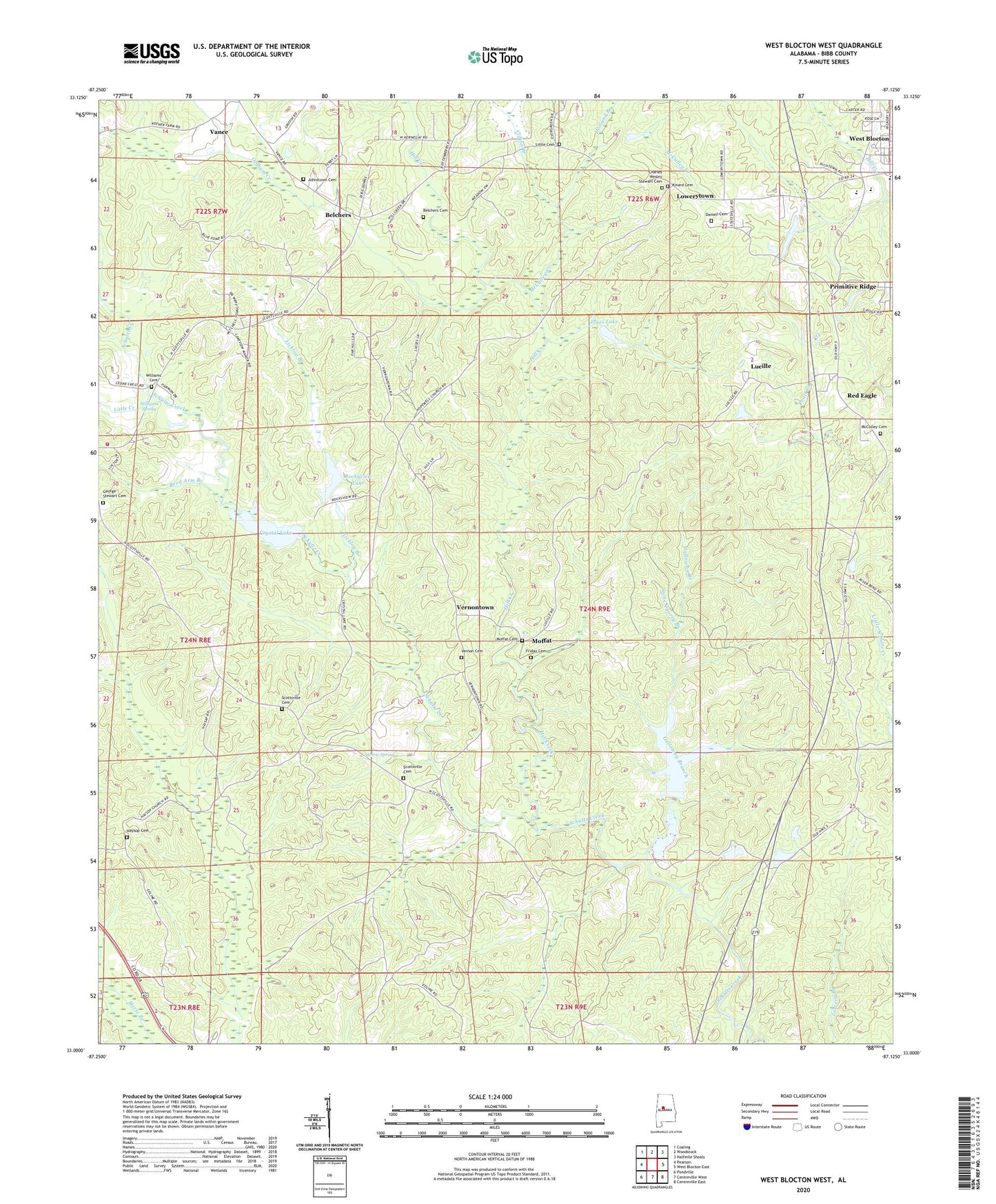
2024 topographic map quadrangle West Blocton West in the state of Alabama. Scale: 1:24000. Based on the newly updated USGS 7.5' US Topo map series, this map is in the following counties: Bibb. The map contains contour data, water features, and other items you are used to seeing on USGS maps, but also has updated roads and other features. This is the next generation of topographic maps. Printed on high-quality waterproof paper with UV fade-resistant inks.
Quads adjacent to this one:
West: Pearson
Northwest: Coaling
North: Woodstock
Northeast: Halfmile Shoals
East: West Blocton East
Southeast: Centreville East
South: Centreville West
Southwest: Pondville
This map covers the same area as the classic USGS quad with code o33087a2.
Contains the following named places: Ada Chapel, Belchers, Belchers Cemetery, Bibb County Lake, Bibb County Vocational School, Bibb Lookout Tower, Blocton Third Baptist Church, Braehead, Braehead Slope Mine, Camps Forge, Cedar Grove Fire Department, Charles Wesley Stewart Cemetery, Chase Lake Dam, Clifton Branch, Crystal Lake, Daniell Cemetery, Fikestown, Friday Cemetery, Galloway Branch, George Stewart Cemetery, Haysop Cemetery, Haysop Missionary Baptist Church, Hill Creek, Hill Creek Mine, Holland Branch, Hopewell Primitive Baptist Church, Johnstown, Johnstown Baptist Church, Johnstown Cemetery, Johnstown School, Jones Lake, Kinard Cemetery, Licklog Branch, Little Cemetery, Little Creek, Lone Star School, Lowerytown, Lowerytown Baptist Church, Lucille, Lucille Baptist Church, McCulley Cemetery, McCulley Creek, McGrawtown, Moffat, Moffat Cemetery, Morris Spring, Mount Grove Baptist Church, Oldham Creek, Pearson Lake Dam, Pine Grove School, Primitive Ridge, Red Eagle, Reed Arm Branch, Reedy Branch, Richtown, Rockyview Lake, Scottsville, Scottsville Baptist Church, Scottsville Cemetery, Scottsville Cotton Mill, Scottsville Union Church, Shady Grove Dam Number One, Shady Grove Dam Number Two, Shady Grove Lake Number One, Shady Grove Lake Number Two, Shady Grove Lakes, Shallow Ford, Siloam Baptist Church, Smiths Ford, Stone Quarry Branch, Tiger Stadium, Town of West Blocton, Tryon School, Vernon Cemetery, Vernontown, Vernontown School, West Blocton Division, West Blocton Elementary School, West Blocton High School, West Blocton Water Works, West Scottsville United Methodist Church, Williams Cemetery, Williams Spring, ZIP Code: 35184