MyTopo
West Point Alabama US Topo Map
Couldn't load pickup availability
Also explore the West Point Forest Service Topo of this same quad for updated USFS data
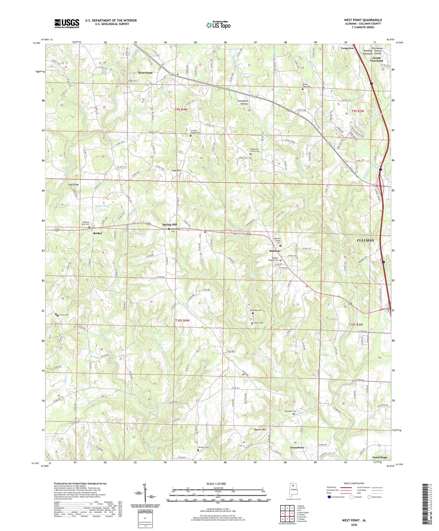
2024 topographic map quadrangle West Point in the state of Alabama. Scale: 1:24000. Based on the newly updated USGS 7.5' US Topo map series, this map is in the following counties: Cullman. The map contains contour data, water features, and other items you are used to seeing on USGS maps, but also has updated roads and other features. This is the next generation of topographic maps. Printed on high-quality waterproof paper with UV fade-resistant inks.
Quads adjacent to this one:
West: Jones Chapel
Northwest: Massey
North: Falkville
Northeast: Eva
East: Cullman
Southeast: Hanceville
South: Trimble
Southwest: Crane Hill
This map covers the same area as the classic USGS quad with code o34086b8.
Contains the following named places: Alvis Branch, Ames School, Baldwin, Baldwin Chapel Cemetery, Baldwin Chapel Cumberland Presbyterian Church, Baldwin Church of Christ, Baldwin Heights Baptist Church, Baldwin Heights Cemetery, Baldwin School, Bethel, Bethel Church of Christ, Bethel Community Center, Bethsadia Baptist Church, Bethsadia Cemetery, Bethsadia Volunteer Fire Department Station 1, Bethsadia Volunteer Fire Department Station 2, Bethsadia Volunteer Fire Department Station 3, Brown Pond Dam, Browns Pond, Bullard Branch, Burrow Lake, Chaney Branch, Crosses Chapel Cemetery, Crosses Chapel United Methodist Church, Ege Farm Dam, Ege Farm Pond, Emeus Baptist Church, Emeus Cemetery, Emeus Methodist Church, Faith Cumberland Presbyterian Church, Fellowship Baptist Church, Fellowship Cemetery, Fellowship Primitive Baptist Church, Grandview, Grandview Lookout Tower, Hartwic Cemetery, Haynes Mountain, Hog Mountain, Honig School, Jaybird Creek, Killpatrick Creek, Legg Bridge, Liberty Congregational Methodist Church, Little Rock Creek, Logan Division, Logan Fire Department Station 2, Missionary Grove Baptist Church, Missionary Grove Baptist Church Cemetery, Moore Branch, Mount Nebo Baptist Church, Mount Nebo Cemetery, Ottis Burrow Dam, Patterson Branch, Pilgrim Rest Church Cemetery, Pilgrim Rest Independent Baptist Church, Pine Hill, Pine Hill Methodist Church, Pleasant View Congregational Methodist Church, Price Creek, Pullen Cemetery, Salem Missionary Baptist Church, Southern Pines, Spitznagl Cemetery, Spring Hill, Spring Hill Baptist Church, Steele Orchard, Sweetgum Hollow, Terri Pines Country Club, Town of West Point, Vest Creek, Walker United Methodist Church, West Point, West Point High School, West Point Volunteer Fire Department, Whites Dam, Whites Pond, York Branch, ZIP Code: 35057