MyTopo
Crane Hill Alabama US Topo Map
Couldn't load pickup availability
Also explore the Crane Hill Forest Service Topo of this same quad for updated USFS data
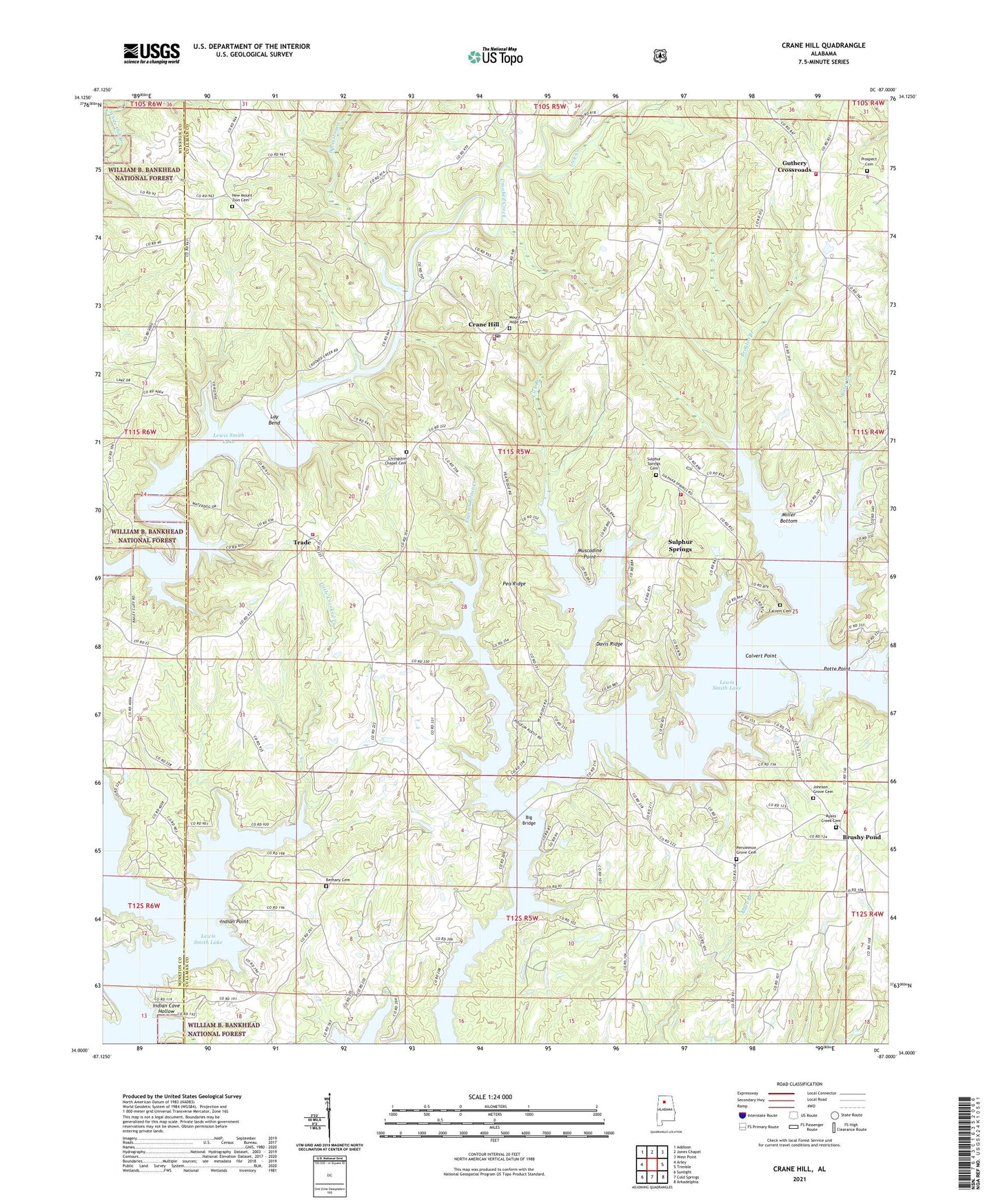
2024 topographic map quadrangle Crane Hill in the state of Alabama. Scale: 1:24000. Based on the newly updated USGS 7.5' US Topo map series, this map is in the following counties: Cullman, Winston. The map contains contour data, water features, and other items you are used to seeing on USGS maps, but also has updated roads and other features. This is the next generation of topographic maps. Printed on high-quality waterproof paper with UV fade-resistant inks.
Quads adjacent to this one:
West: Arley
Northwest: Addison
North: Jones Chapel
Northeast: West Point
East: Trimble
Southeast: Arkadelphia
South: Cold Springs
Southwest: Sunlight
This map covers the same area as the classic USGS quad with code o34087a1.
Contains the following named places: Alder Branch, Antioch Church, Bates Branch, Bethany Baptist Church, Bethany Cemetery, Beulah Church of the Nazarene, Big Bridge, Bremen Volunteer Fire Department Station 2, Broglen Branch, Brushy Pond, Brushy Pond Number 1 Mine, Calvert Cemetery, Calvert Point, Crane Hill, Crane Hill Church of Christ, Crane Hill Communities Fire Department Station 1, Crane Hill Communities Fire Department Station 2, Crane Hill Division, Crane Hill Post Office, Crane Hill Volunteer Fire Department Station 4, Davis Ridge, Dowling Junior High School, Dowling Memorial Park, Flat Rock School, Flat Rock United Methodist Church, Guthery Crossroads, Harmony Missionary Baptist Church, Holy Ground Baptist Church Cemetery, Indian Cave Hollow, Indian Point, Johnson Grove Cemetery, Johnson Grove United Methodist Church, Lay Bend, Lick Branch, Lick Creek, Little Crooked Creek, Livingston Chapel Cemetery, Livingston Chapel School, Livingston Chapel United Methodist Church, Logan Church of God, Logan Fire Department Station 3, Miller Bottom, Mount Hope Cemetery, Mount Hope Missionary Baptist Church, Mount Zion, Mount Zion School, Muscadine Point, New Mount Zion Baptist Church, Pea Ridge, Persimmon Grove Cemetery, Persimmon Grove Church of Christ, Pigeon Roost Creek, Potte Point, Prospect Cemetery, Prospect Church, Rushings Chapel, Ryan's Creek Baptist Church, Ryans Creek Cemetery, Sulphur Springs, Sulphur Springs Baptist Church, Sulphur Springs Cemetery, Trade, Wheat, Wheat School, Wheeler Grove Church of Christ, Whetstone Creek, ZIP Codes: 35053, 35098