MyTopo
Bad Bug Butte Arizona US Topo Map
Couldn't load pickup availability
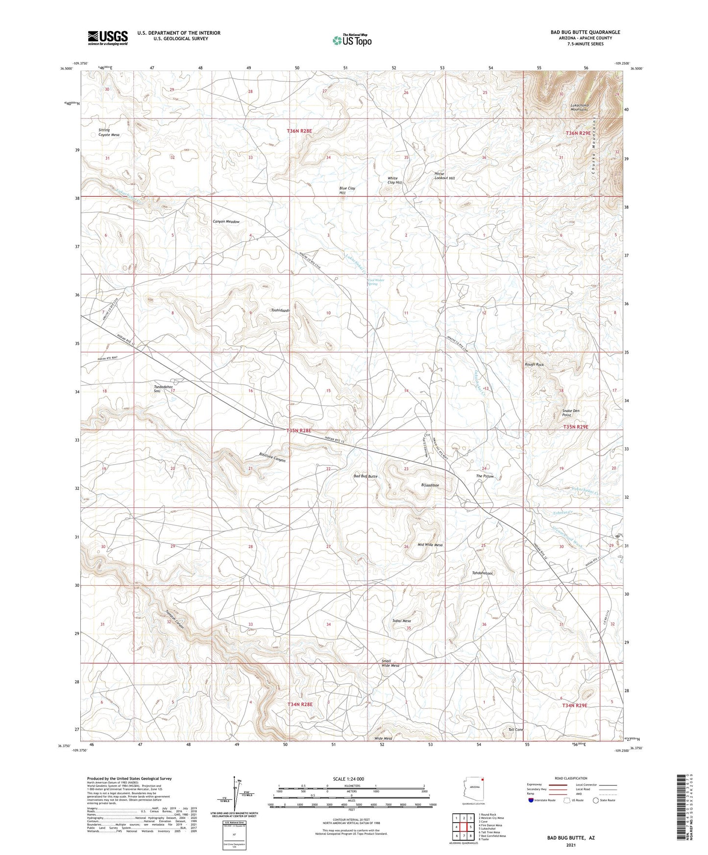
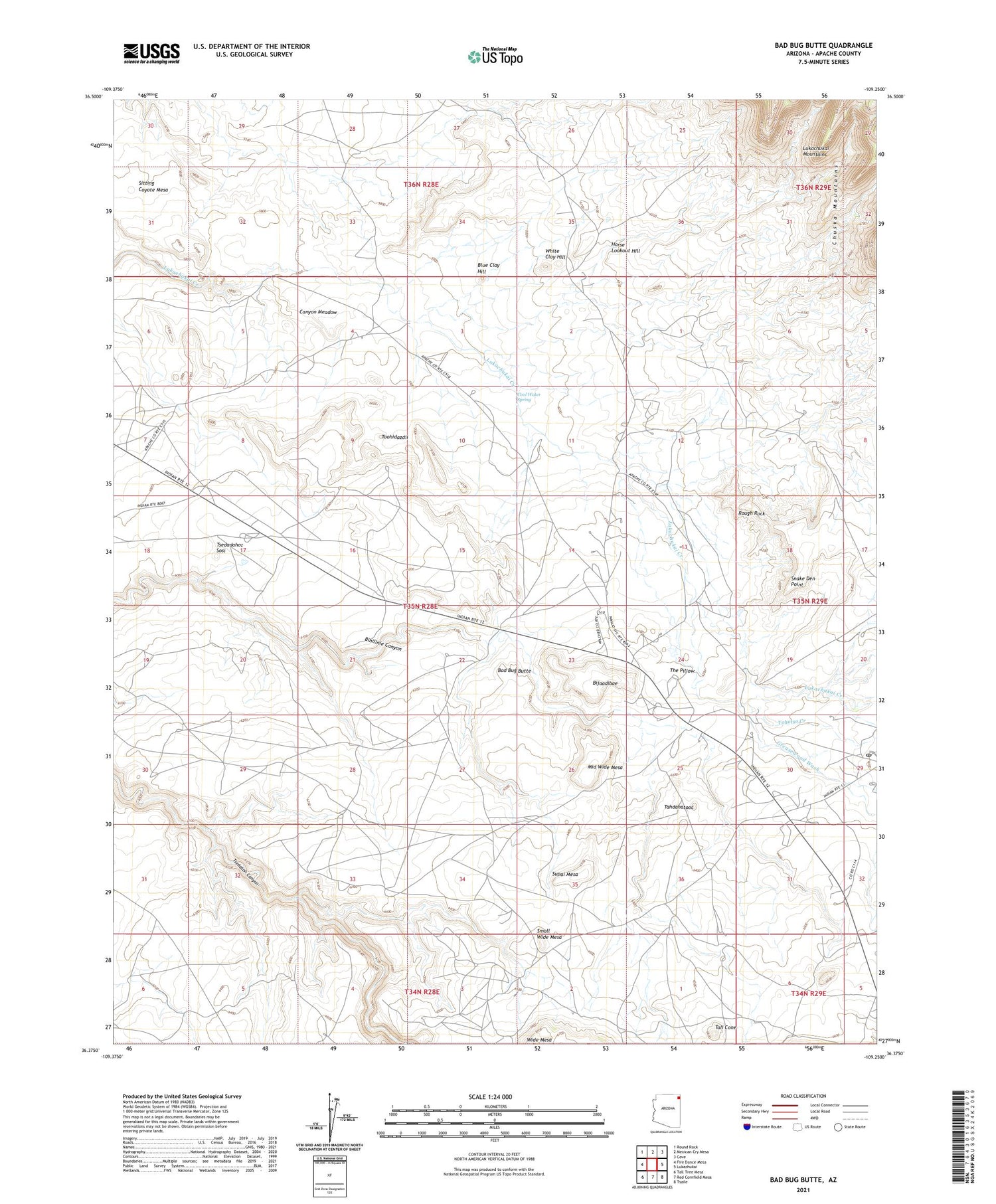
2021 topographic map quadrangle Bad Bug Butte in the state of Arizona. Scale: 1:24000. Based on the newly updated USGS 7.5' US Topo map series, this map is in the following counties: Apache. The map contains contour data, water features, and other items you are used to seeing on USGS maps, but also has updated roads and other features. This is the next generation of topographic maps. Printed on high-quality waterproof paper with UV fade-resistant inks.
Quads adjacent to this one:
West: Fire Dance Mesa
Northwest: Round Rock
North: Mexican Cry Mesa
Northeast: Cove
East: Lukachukai
Southeast: Tsaile
South: Red Cornfield Mesa
Southwest: Tall Tree Mesa
This map covers the same area as the classic USGS quad with code o36109d3.
Contains the following named places: Bad Bug Butte, Bijaadibae, Blue Clay Hill, Canyon Meadow, Cool Water Spring, Greasewood Wash, Horse Lookout Hill, Lukachukai Airport, Lukachukai Post Office, Middle Wide Mesa, Rough Rock, Sitting Coyote Mesa, Small Wide Mesa, Snake Den Point, Supai Mesa, Tahdahatooc, Tall Cone, The Pillow, Tohotso Creek, Toohidazdii, Tsedadahot Sosi, White Clay Hill, Wide Mesa, ZIP Code: 86507