MyTopo
Tsaile Arizona US Topo Map
Couldn't load pickup availability
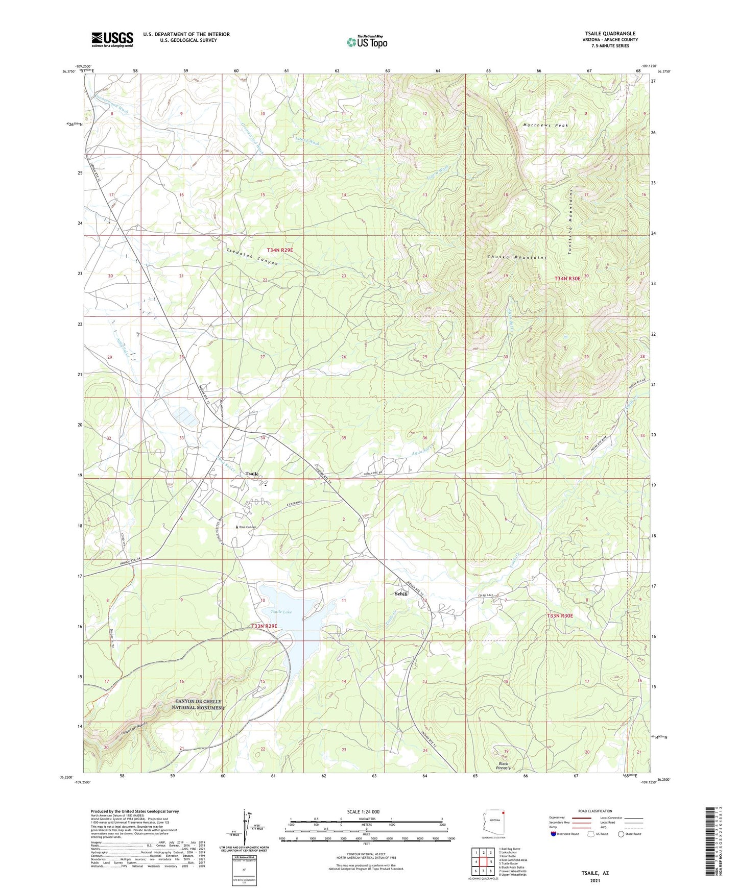
2021 topographic map quadrangle Tsaile in the state of Arizona. Scale: 1:24000. Based on the newly updated USGS 7.5' US Topo map series, this map is in the following counties: Apache. The map contains contour data, water features, and other items you are used to seeing on USGS maps, but also has updated roads and other features. This is the next generation of topographic maps. Printed on high-quality waterproof paper with UV fade-resistant inks.
Quads adjacent to this one:
West: Red Cornfield Mesa
Northwest: Bad Bug Butte
North: Lukachukai
Northeast: Roof Butte
East: Tsaile Butte
Southeast: Upper Wheatfields
South: Lower Wheatfields
Southwest: Black Rock Butte
This map covers the same area as the classic USGS quad with code o36109c2.
Contains the following named places: Black Pinnacle, Black Pinnacle Campground, Dine College, Dine College Tsaile Campus Guy Gorman Sr Classroom Building, Dine College Tsaile Campus Gymnasium, Dine College Tsaile Campus Library, Dine College Tsaile Campus Ned Hatathli Center, Dine College Tsaile Campus Student Services, Dine College Tsaile Campus Student Union, KNCC-FM (Tsaile), Matthews Peak, Saint Ann Church, Sehili, Sehili Census Designated Place, South Shore Campground, Tsaile Census Designated Place, Tsaile Creek, Tsaile Dam, Tsaile Elementary School, Tsaile Lake, Tsaile Lake Campground, Upper Greasewood Trading Post