MyTopo
Bates Well Arizona US Topo Map
Couldn't load pickup availability
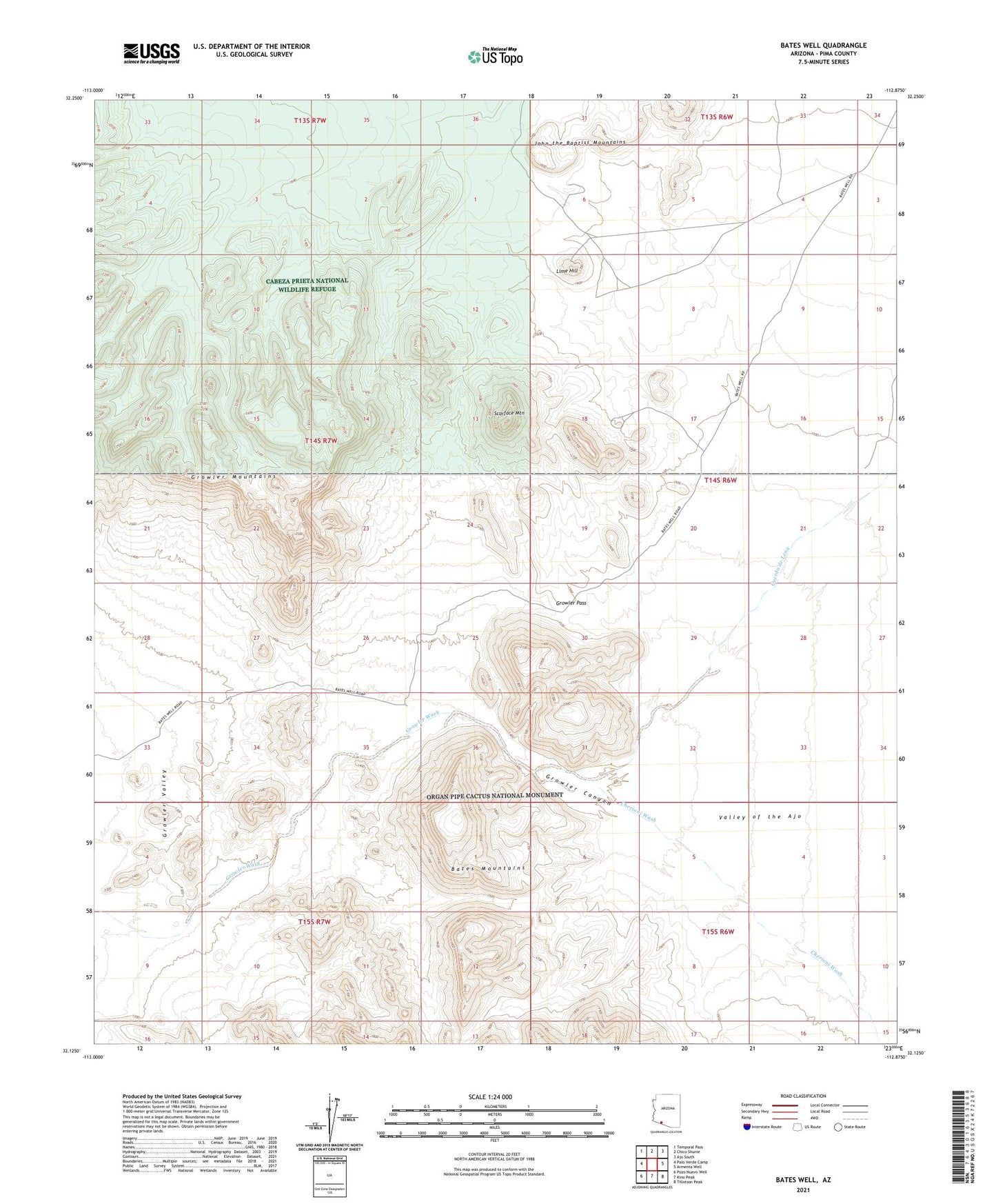
2021 topographic map quadrangle Bates Well in the state of Arizona. Scale: 1:24000. Based on the newly updated USGS 7.5' US Topo map series, this map is in the following counties: Pima. The map contains contour data, water features, and other items you are used to seeing on USGS maps, but also has updated roads and other features. This is the next generation of topographic maps. Printed on high-quality waterproof paper with UV fade-resistant inks.
Quads adjacent to this one:
West: Palo Verde Camp
Northwest: Temporal Pass
North: Chico Shunie
Northeast: Ajo South
East: Armenta Well
Southeast: Tillotson Peak
South: Kino Peak
Southwest: Pozo Nuevo Well
This map covers the same area as the classic USGS quad with code o32112b8.
Contains the following named places: Ajo Division, Bandeja Well, Bates Well, Bluebird Mine, Cherioni Wash, Cuerda de Lena, Daniells Well, Growler Canyon, Growler Pass, Lime Hill, Scarface Mountain