
MyTopo
Blue Gap Arizona US Topo Map
Couldn't load pickup availability
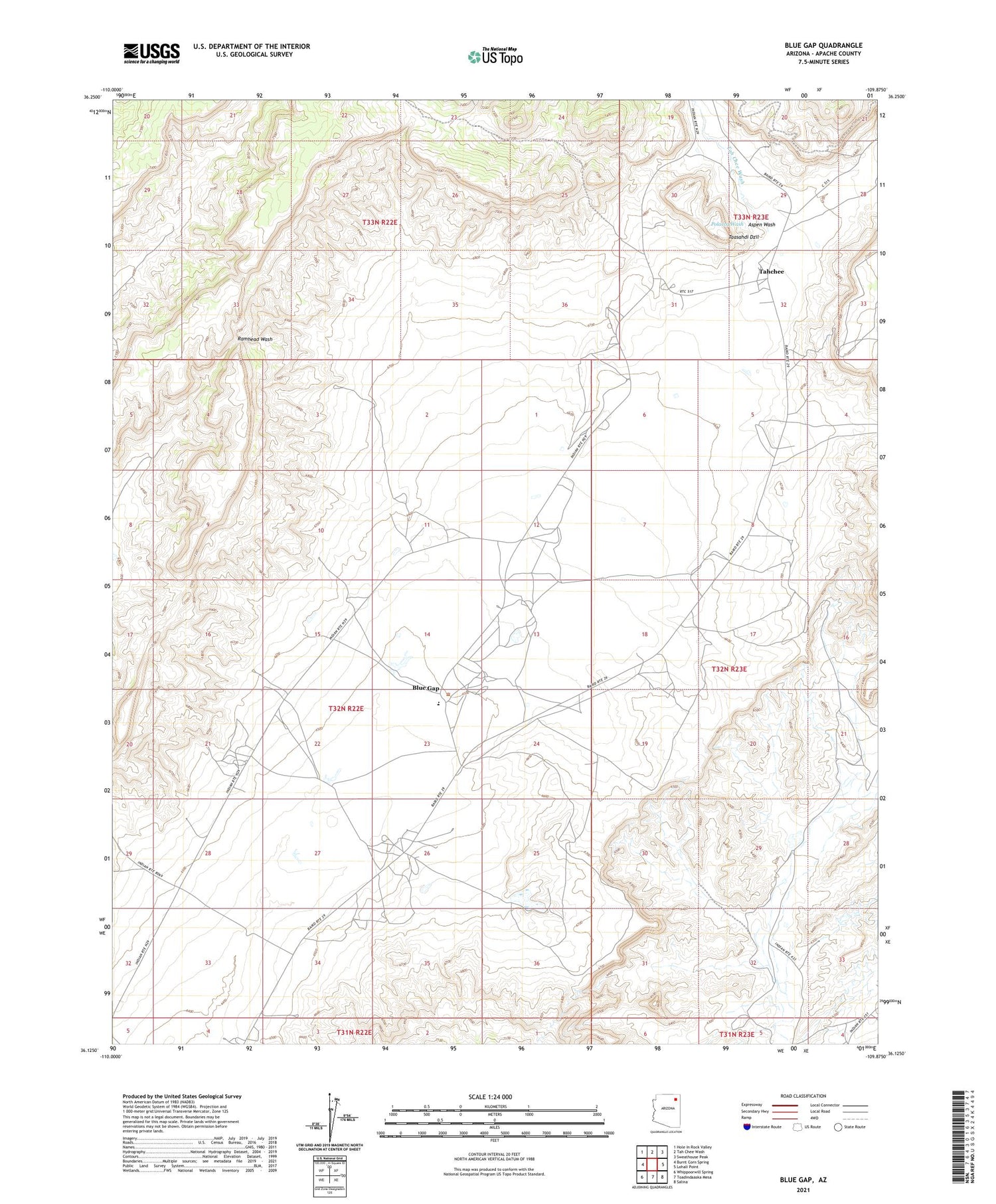
2021 topographic map quadrangle Blue Gap in the state of Arizona. Scale: 1:24000. Based on the newly updated USGS 7.5' US Topo map series, this map is in the following counties: Apache. The map contains contour data, water features, and other items you are used to seeing on USGS maps, but also has updated roads and other features. This is the next generation of topographic maps. Printed on high-quality waterproof paper with UV fade-resistant inks.
Quads adjacent to this one:
West: Burnt Corn Spring
Northwest: Hole In Rock Valley
North: Tah Chee Wash
Northeast: Sweathouse Peak
East: Lohali Point
Southeast: Salina
South: Toadindaaska Mesa
Southwest: Whippoorwill Spring
This map covers the same area as the classic USGS quad with code o36109b8.
Contains the following named places: Aspen Wash, Black Mountain Mission, Black Mountain Trading Post, Blue Gap, Blue Gap Chapter House, Blue Gap School, Taasahdi Dzil, Tachee Chapter, Tah Chee Wash, Tahchee


