MyTopo
Boiling Over Well Arizona US Topo Map
Couldn't load pickup availability
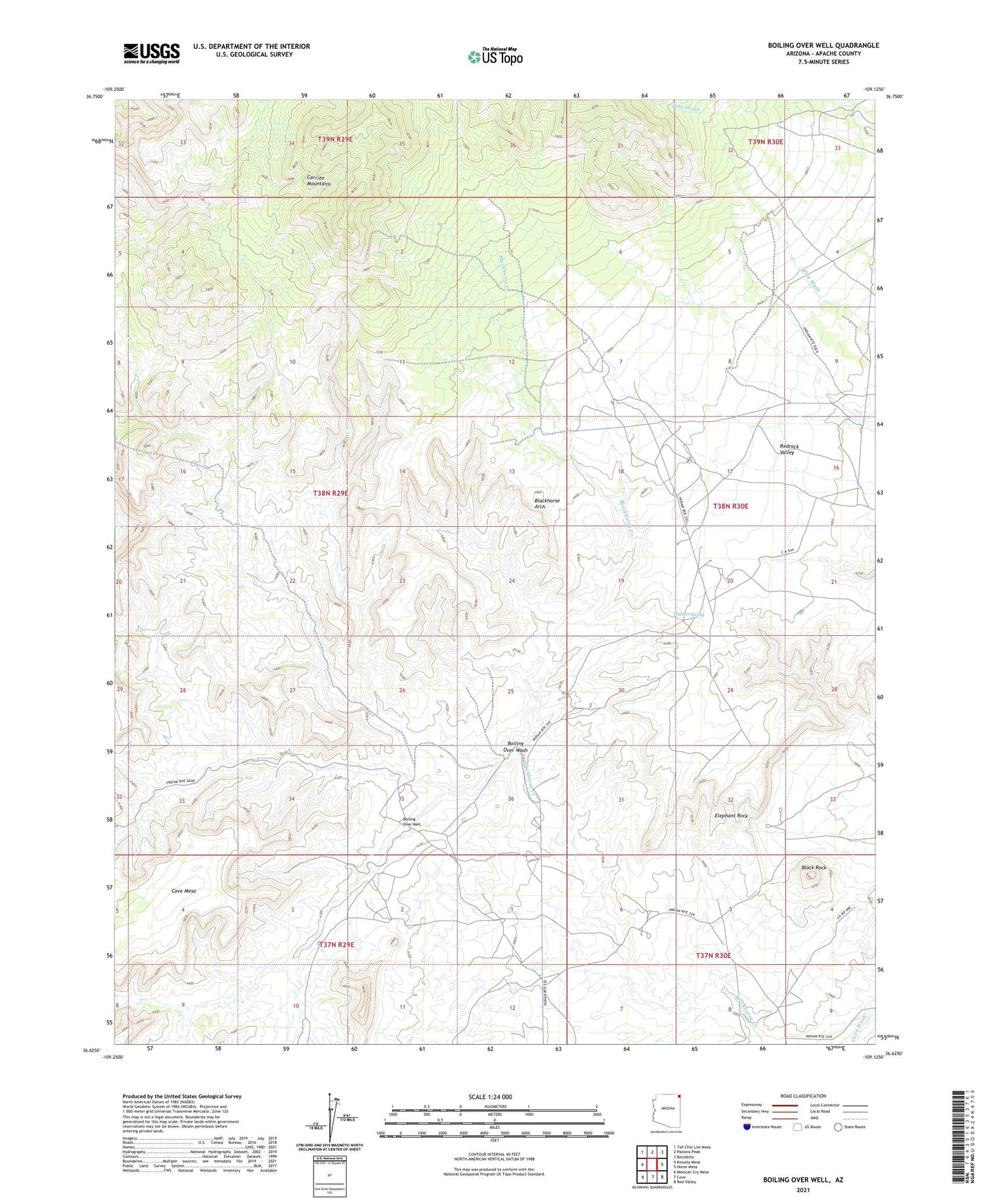
2021 topographic map quadrangle Boiling Over Well in the state of Arizona. Scale: 1:24000. Based on the newly updated USGS 7.5' US Topo map series, this map is in the following counties: Apache. The map contains contour data, water features, and other items you are used to seeing on USGS maps, but also has updated roads and other features. This is the next generation of topographic maps. Printed on high-quality waterproof paper with UV fade-resistant inks.
Quads adjacent to this one:
West: Kinusta Mesa
Northwest: Toh Chin Lini Mesa
North: Pastora Peak
Northeast: Beclabito
East: Horse Mesa
Southeast: Red Valley
South: Cove
Southwest: Mexican Cry Mesa
This map covers the same area as the classic USGS quad with code o36109f2.
Contains the following named places: Black Rock, Blackhorse Arch, Blackhorse Creek, Boiling Over Wash, Boiling Over Well, Elephant Rock, Hidden Spring, Tohe Thlany Begay Mine