MyTopo
Beclabito New Mexico US Topo Map
Couldn't load pickup availability
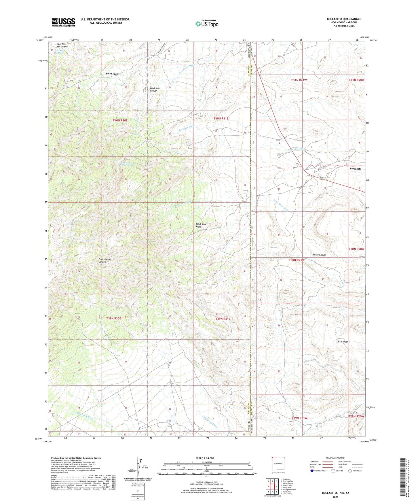
2023 topographic map quadrangle Beclabito in the states of Arizona, New Mexico. Scale: 1:24000. Based on the newly updated USGS 7.5' US Topo map series, this map is in the following counties: San Juan, Apache. The map contains contour data, water features, and other items you are used to seeing on USGS maps, but also has updated roads and other features. This is the next generation of topographic maps. Printed on high-quality waterproof paper with UV fade-resistant inks.
Quads adjacent to this one:
West: Pastora Peak
Northwest: Cow Butte
North: Teec Nos Pos
Northeast: Sallies Spring
East: Rocky Point
Southeast: Sand Spring
South: Horse Mesa
Southwest: Boiling Over Well
This map covers the same area as the classic USGS quad with code o36109g1.
Contains the following named places: 12-599 Water Well, Beclabito, Beclabito Census Designated Place, Beclabito Dome Historical Marker, Beclabito Spring, Black Rock Canyon, Black Rock Canyon Spring, Black Rock Ridge, Carrizo Number One, Copper Mine, Cottonwood Wash, Syracuse Mine, Teec Nos Pos Canyon, Twin Falls