MyTopo
Bonita Spring Arizona US Topo Map
Couldn't load pickup availability
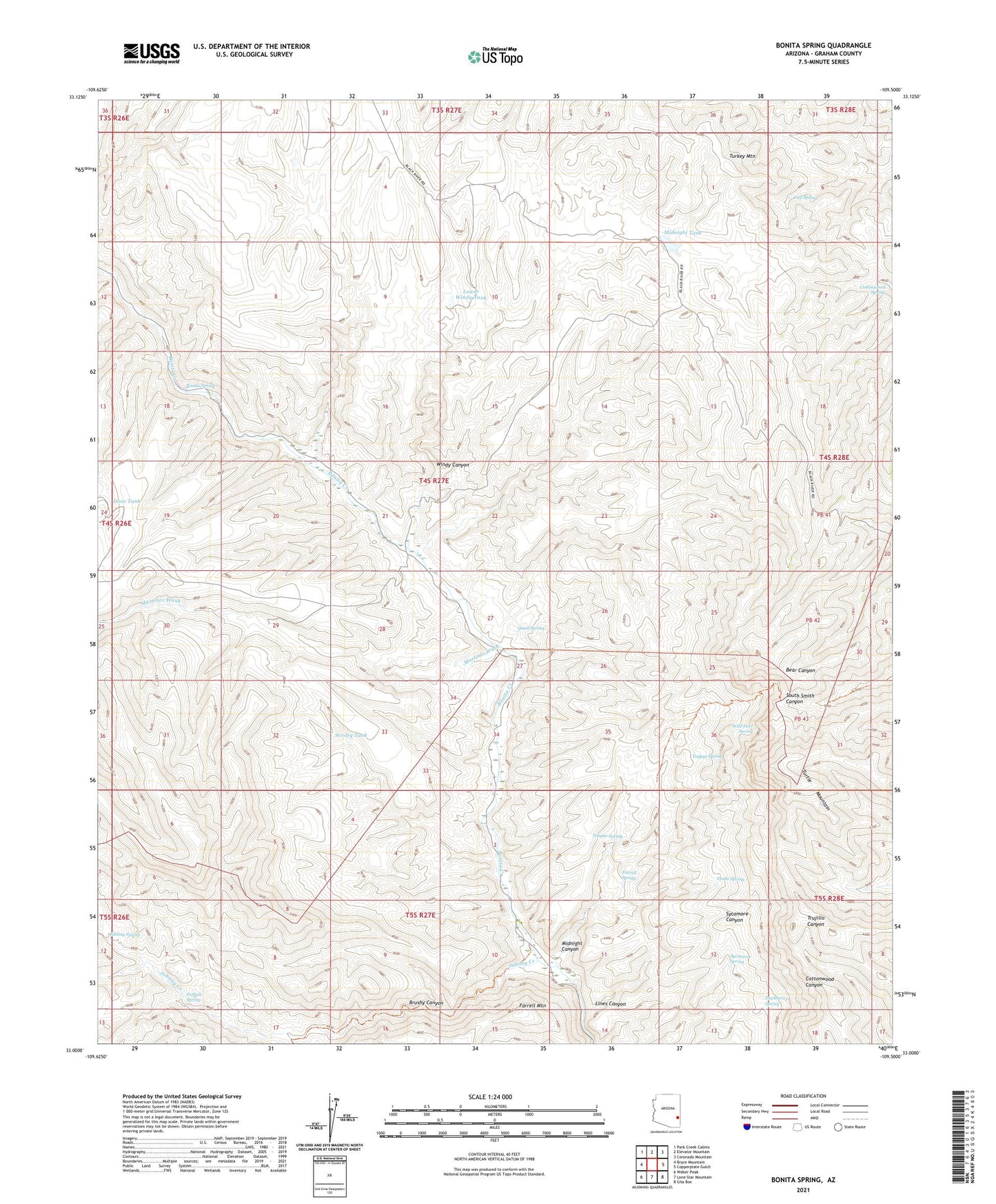
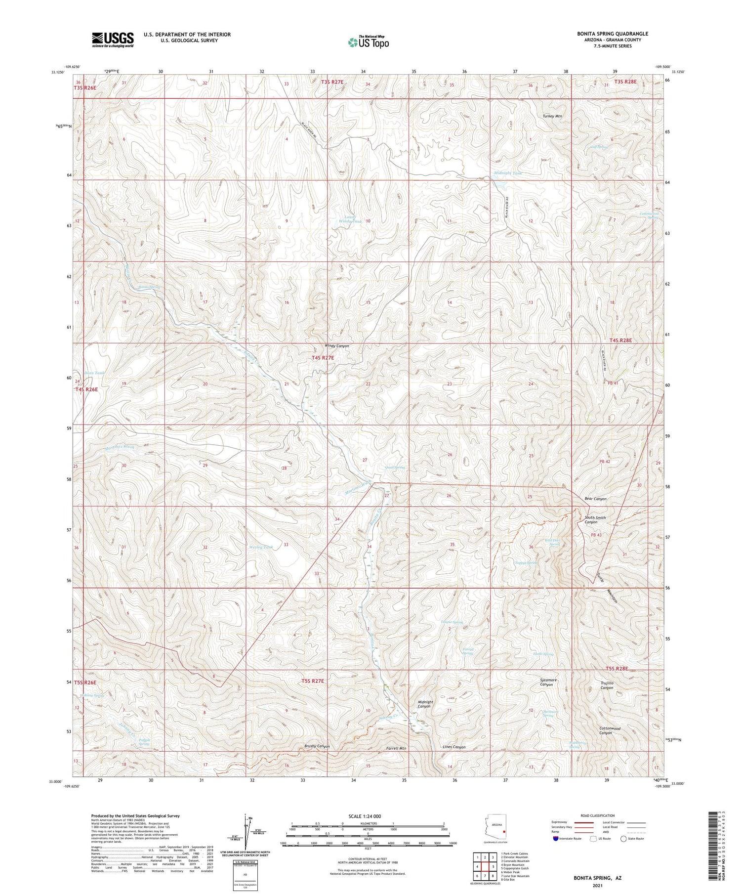
2021 topographic map quadrangle Bonita Spring in the state of Arizona. Scale: 1:24000. Based on the newly updated USGS 7.5' US Topo map series, this map is in the following counties: Graham. The map contains contour data, water features, and other items you are used to seeing on USGS maps, but also has updated roads and other features. This is the next generation of topographic maps. Printed on high-quality waterproof paper with UV fade-resistant inks.
Quads adjacent to this one:
West: Bryce Mountain
Northwest: Park Creek Cabins
North: Elevator Mountain
Northeast: Coronado Mountain
East: Copperplate Gulch
Southeast: Gila Box
South: Lone Star Mountain
Southwest: Weber Peak
This map covers the same area as the classic USGS quad with code o33109a5.
Contains the following named places: Bonita Camp, Bonita Spring, Brushy Canyon, Calf Spring, Cottonwood Spring, Dons Tank, Farrell Spring, Hackberry Spring, Johnny Creek, Johnny Spring, Lines Canyon, Lower Windy Tank, Martinez Wash, Midnight Canyon, Midnight Creek, Midnight Dam, Midnight Tank, Oak Creek, Pothole Spring, Quail Spring, Rubble Dam, Rubble Dam Three, Sycamore Spring, Teague Spring, Toppys Spring, Turkey Mountain, Turtle Mountain, Turtle Spring, Wesley Tank, Wild Deer Spring, Windy Canyon