MyTopo
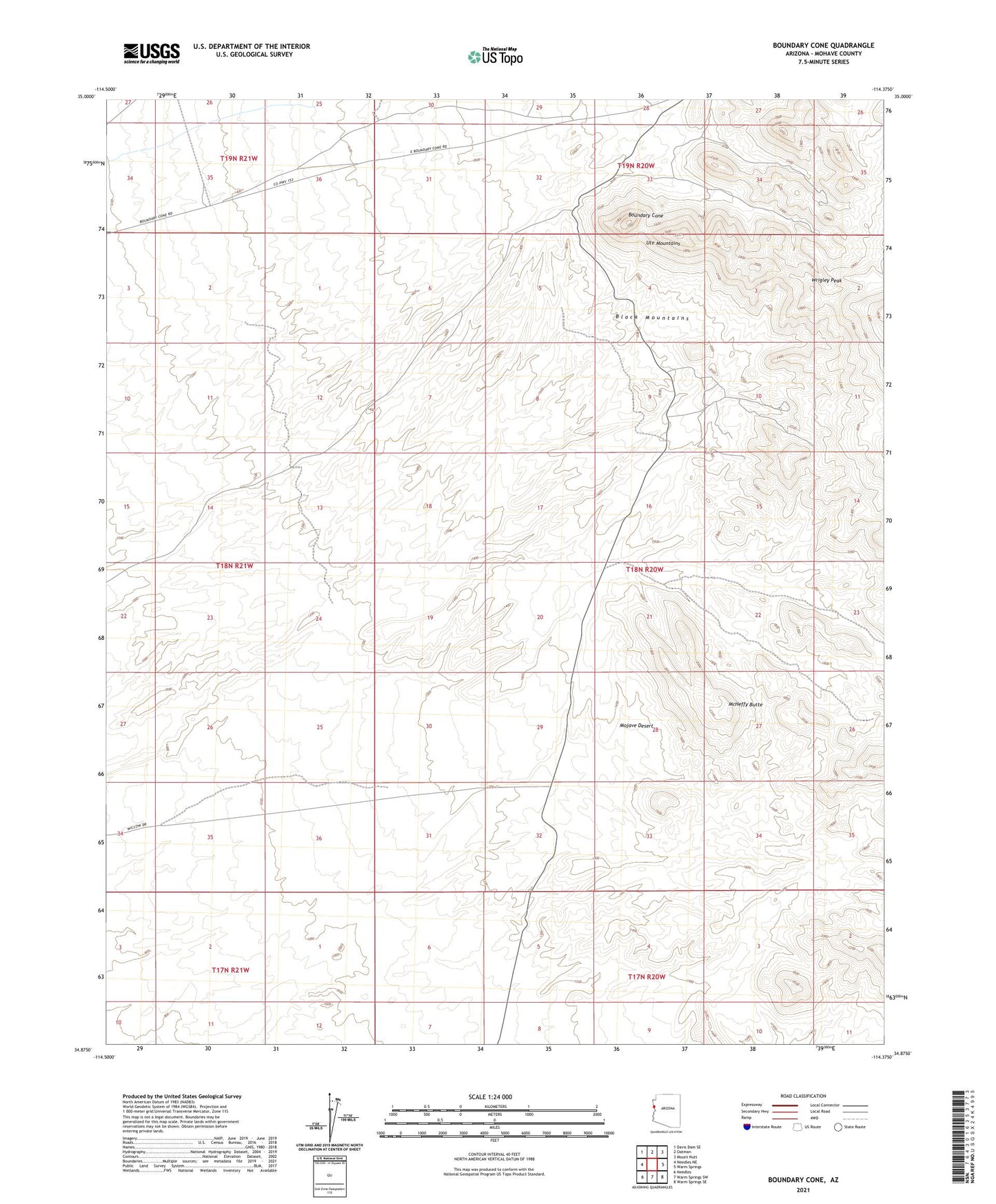
Boundary Cone Arizona US Topo Map
Couldn't load pickup availability
2021 topographic map quadrangle Boundary Cone in the state of Arizona. Scale: 1:24000. Based on the newly updated USGS 7.5' US Topo map series, this map is in the following counties: Mohave. The map contains contour data, water features, and other items you are used to seeing on USGS maps, but also has updated roads and other features. This is the next generation of topographic maps. Printed on high-quality waterproof paper with UV fade-resistant inks.
Quads adjacent to this one:
West: Needles NE
Northwest: Davis Dam SE
North: Oatman
Northeast: Mount Nutt
East: Warm Springs
Southeast: Warm Springs SE
South: Warm Springs SW
Southwest: Needles
This map covers the same area as the classic USGS quad with code o34114h4.
Contains the following named places: Adams Mine, Alcyone Mine, Black Range Mine, Boundary Cone, Cone Mine, Cook Mine, Green Quartz Mine, Lazy Boy Mine, McHeffy Butte, Nellie Mine, Oatman Southern Mine, Oatman Syndicate Mine, Paragon Mine, Peerless Mine, United Oatman Mine, Ute Mountains, Wrigley Mine, Wrigley Peak