MyTopo
Cape Solitude Arizona US Topo Map
Couldn't load pickup availability
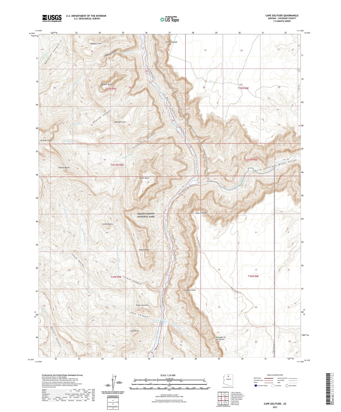
2021 topographic map quadrangle Cape Solitude in the state of Arizona. Scale: 1:24000. Based on the newly updated USGS 7.5' US Topo map series, this map is in the following counties: Coconino. The map contains contour data, water features, and other items you are used to seeing on USGS maps, but also has updated roads and other features. This is the next generation of topographic maps. Printed on high-quality waterproof paper with UV fade-resistant inks.
Quads adjacent to this one:
West: Walhalla Plateau
Northwest: Point Imperial
North: Nankoweap Mesa
Northeast: Blue Moon Reservoir
East: Salt Trail Canyon
Southeast: Blue Spring
South: Desert View
Southwest: Cape Royal
This map covers the same area as the classic USGS quad with code o36111b7.
Contains the following named places: Awatubi Canyon, Awatubi Creek, Awatubi Crest, Cape Solitude, Carbon Butte, Carbon Canyon, Carbon Creek, Chuar Butte, Chuar Creek, Chuar Lava Hill, Chuar Valley, Desert Facade, East Fork Carbon Creek, Galeros Butte, Gunther Castle, Kwagunt Butte, Lava Butte, Lava Canyon, Lava Canyon Rapids, Lava Creek, Little Colorado River, Little Colorado River Gorge, Malgosa Canyon, Malgosa Creek, Malgosa Crest, Marble Canyon, Palisades Creek, Peshlakai Point, Sixtymile Canyon, Sixtymile Creek, Sixtymile Rapids, Temple Butte, West Fork Carbon Creek