MyTopo
Castle Rock Arizona US Topo Map
Couldn't load pickup availability
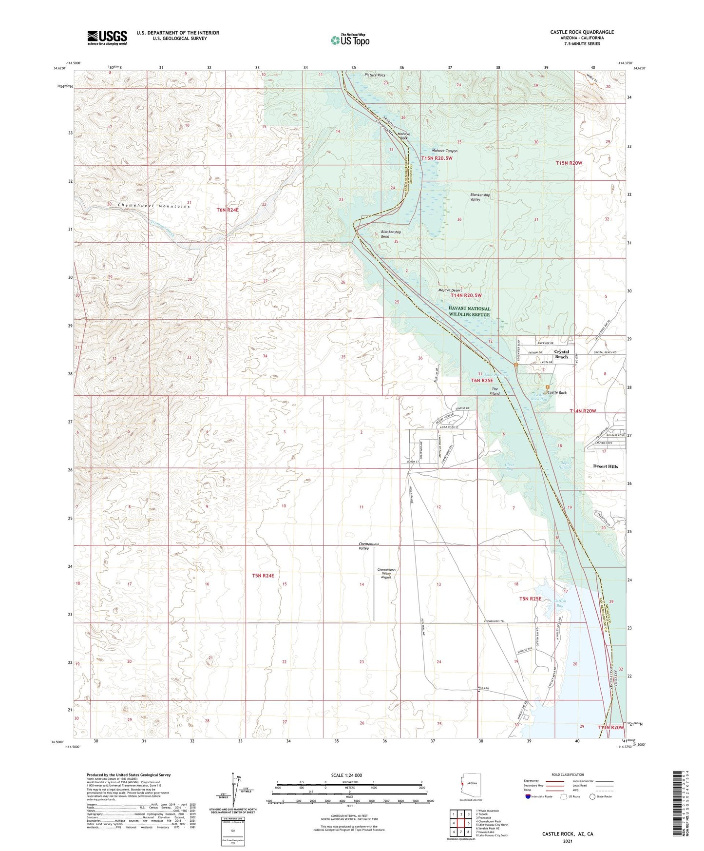
2021 topographic map quadrangle Castle Rock in the state of Arizona. Scale: 1:24000. Based on the newly updated USGS 7.5' US Topo map series, this map is in the following counties: Mohave, San Bernardino. The map contains contour data, water features, and other items you are used to seeing on USGS maps, but also has updated roads and other features. This is the next generation of topographic maps. Printed on high-quality waterproof paper with UV fade-resistant inks.
Quads adjacent to this one:
West: Chemehuevi Peak
Northwest: Whale Mountain
North: Topock
Northeast: Franconia
East: Lake Havasu City North
Southeast: Lake Havasu City South
South: Havasu Lake
Southwest: Savahia Peak NE
Contains the following named places: Blankenship Bend, Blankenship Valley, Castle Rock, Castle Rock Bay, Crystal Beach Census Designated Place, Desert Hills Census Designated Place, Desert Hills Estates Mobile Home Park, Desert Hills Estates Recreational Vehicle Park, Jops Harbor, Mohave Canyon, Mohave Rock, Picture Rock