MyTopo
Topock Arizona US Topo Map
Couldn't load pickup availability
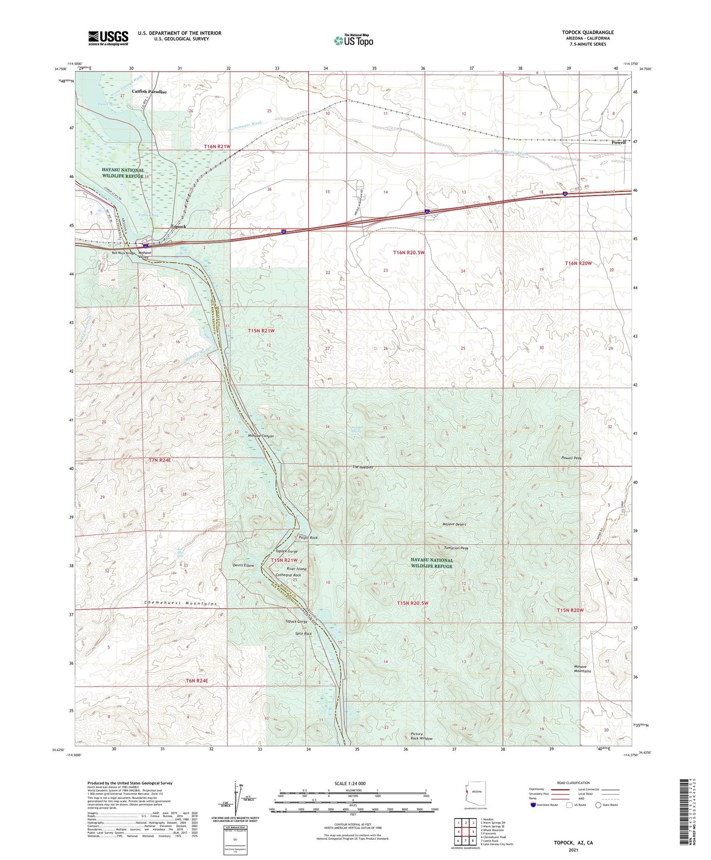
2021 topographic map quadrangle Topock in the states of Arizona, California. Scale: 1:24000. Based on the newly updated USGS 7.5' US Topo map series, this map is in the following counties: Mohave, San Bernardino. The map contains contour data, water features, and other items you are used to seeing on USGS maps, but also has updated roads and other features. This is the next generation of topographic maps. Printed on high-quality waterproof paper with UV fade-resistant inks.
Quads adjacent to this one:
West: Whale Mountain
Northwest: Needles
North: Warm Springs SW
Northeast: Warm Springs SE
East: Franconia
Southeast: Lake Havasu City North
South: Castle Rock
Southwest: Chemehuevi Peak
Contains the following named places: Bat Cave Wash, Catfish Paradise, Cathedral Rock, Devils Elbow, Gold Dome Mine, Havasu National Wildlife Refuge, Havasu Wilderness, Jackpot Mine, Jackpot Spring, Mohave Mountains, Mohave Wash, Picture Rock Window, Powell, Powell Peak, Powell Railroad Station, Pulpit Rock, Red Rock Bridge, Red Rock Falls, River Island, Sacramento Wash, Split Rock, The Needles, Topock, Topock Bay, Topock Census Designated Place, Topock Gorge, Tumarion Peak, Yucca Mine