
MyTopo
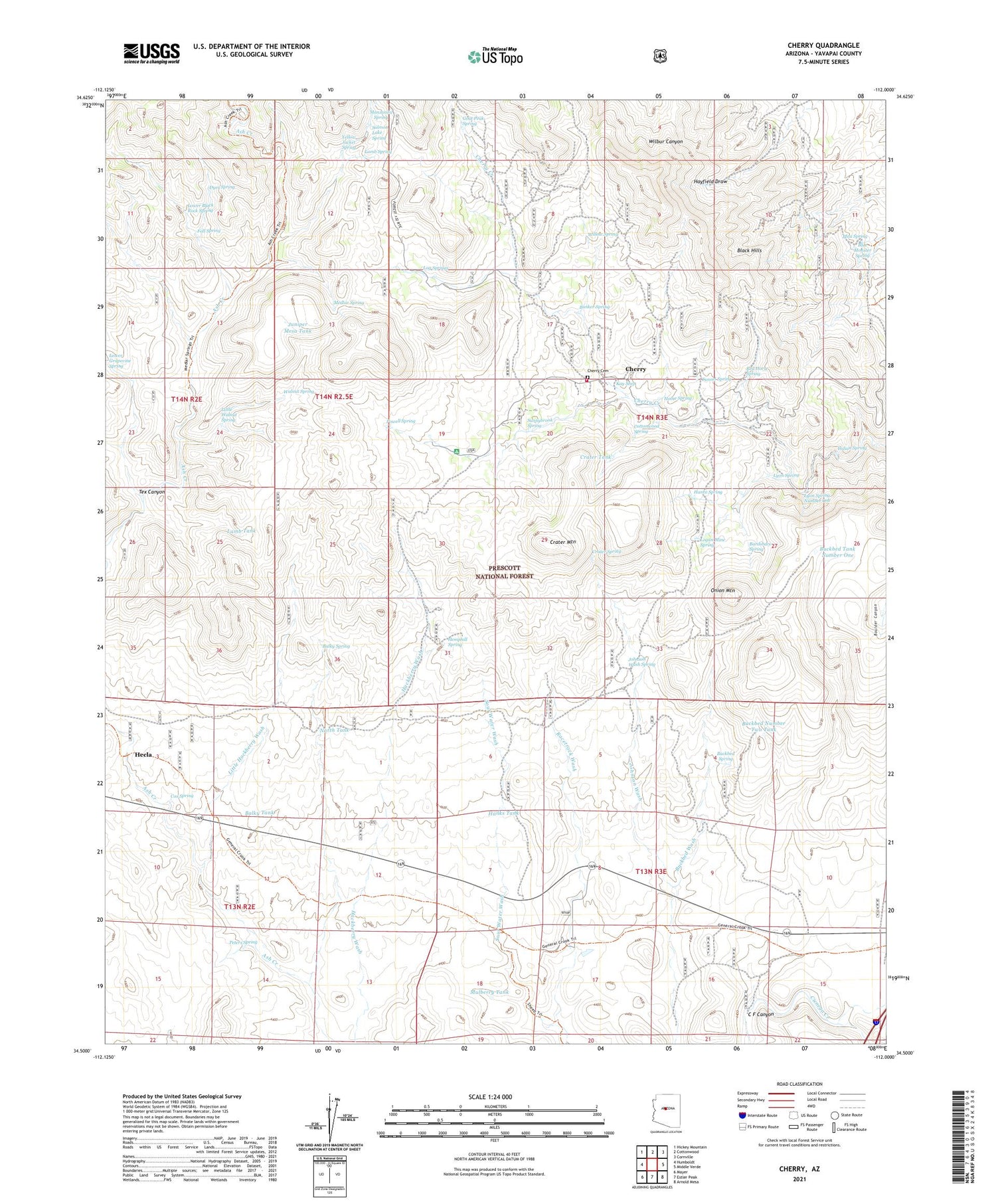
Cherry Arizona US Topo Map
Couldn't load pickup availability
Also explore the Cherry Forest Service Topo of this same quad for updated USFS data
2021 topographic map quadrangle Cherry in the state of Arizona. Scale: 1:24000. Based on the newly updated USGS 7.5' US Topo map series, this map is in the following counties: Yavapai. The map contains contour data, water features, and other items you are used to seeing on USGS maps, but also has updated roads and other features. This is the next generation of topographic maps. Printed on high-quality waterproof paper with UV fade-resistant inks.
Quads adjacent to this one:
West: Humboldt
Northwest: Hickey Mountain
North: Cottonwood
Northeast: Cornville
East: Middle Verde
Southeast: Arnold Mesa
South: Estler Peak
Southwest: Mayer
This map covers the same area as the classic USGS quad with code o34112e1.
Contains the following named places: Aband Well, Ash Creek Well, Balky Spring, Balky Tank, Bardshare Spring, Black Hawk Mine, Black Hills, Blue Monster Spring, Boulder Canyon Tank Number One, Boulder Canyon Tank Number Two, Buckbed Number Two Tank, Buckbed Spring, Buckbed Tank Number One, Buckbed Wash, Bunker Mine, Bunker Spring, Bushy Well, C F Canyon, Cherry, Cherry Cemetery, Cherry King Mine, Conger Mine, Cottonwood Spring, Cox Spring, Crater Mountain, Crater Spring, Crater Tank, D-Nine Tank, Dyer Spring, Fall Spring, Federal Mine, Goat Peak Spring, Gold Bullion Mine, Gold Coin Mine, Gold Eagle Mine, Golden Idol Mine, Hance Spring, Hanks Tank, Hecla, Hemphill Spring, Heola Mine, Home Spring, Indian Spring, Johnson Wash Ranger Station, Johnson Wash Spring, Johnson Wash Well, Juniper Mesa Tank, Kay Seep, Lamb Spring, Lamb Tank, Leghorn Mine, Little Hackberry Wash, Little Hackberry Well, Little Walnut Spring, Log Springs, Logan Mine, Logan Mine Spring, Lower Black Rock Spring, Lyon Spring, Lyon Spring Number One, Manzanita Spring, Medlar Spring, Monarch Mine, Mulberry Tank, North Tank, Onion Mountain, Peters Spring, Pfau Spring, Powell Spring, Powell Springs Campground, Racetrack Well, Racetrack Windmill, Red Horse Spring, Ridge Tank, Salmon Lake Spring, Sitting Bull Mine, Sour Water Wash, Spring Tank, Sunnybrook Mine, Sunnybrook Spring, Tex Canyon, Tunnel Spring, Uncle Sam Mine, Walnut Spring, Wambacker Mine, Willow Spring, Yellow Jacket Spring, ZIP Code: 86327


