MyTopo
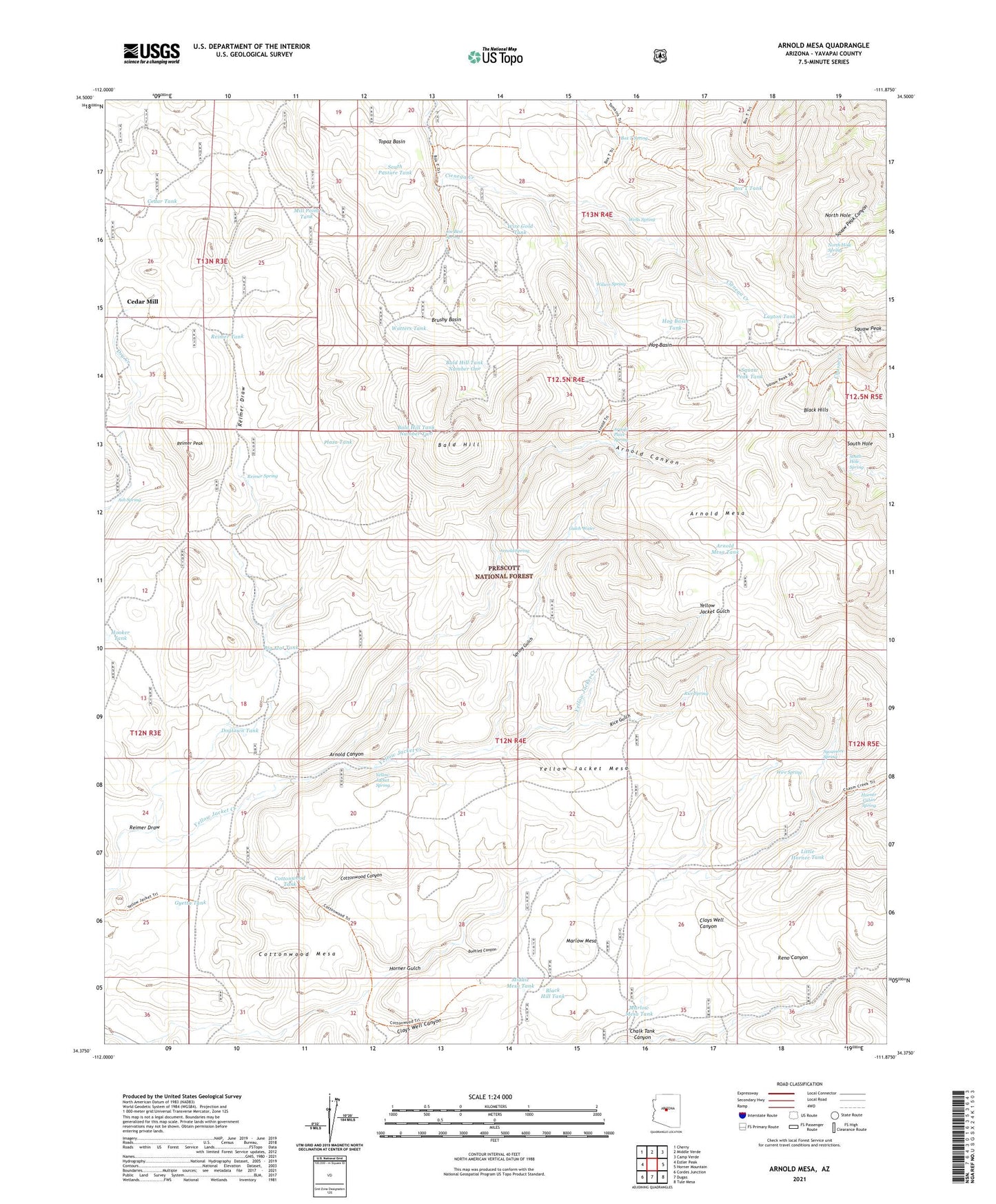
Arnold Mesa Arizona US Topo Map
Couldn't load pickup availability
Also explore the Arnold Mesa Forest Service Topo of this same quad for updated USFS data
2023 topographic map quadrangle Arnold Mesa in the state of Arizona. Scale: 1:24000. Based on the newly updated USGS 7.5' US Topo map series, this map is in the following counties: Yavapai. The map contains contour data, water features, and other items you are used to seeing on USGS maps, but also has updated roads and other features. This is the next generation of topographic maps. Printed on high-quality waterproof paper with UV fade-resistant inks.
Quads adjacent to this one:
West: Estler Peak
Northwest: Cherry
North: Middle Verde
Northeast: Camp Verde
East: Horner Mountain
Southeast: Tule Mesa
South: Dugas
Southwest: Cordes Junction
This map covers the same area as the classic USGS quad with code o34111d8.
Contains the following named places: Arnold Canyon, Arnold Mesa, Arnold Mesa Tank, Arnold Place, Arnold Place Spring, Arnold Spring, Ash Spring, Bald Hill, Bald Hill Tank Number One, Bald Hill Tank Number Two, Bald Hill Well, Beehouse Tank, Big Flat Tank, Black Butte Corral, Black Hill Tank, Bootleg Cabin, Bootleg Canyon, Box T Spring, Box T Tank, Brushy Basin, Cedar Mill, Cedar Mill Windmill, Cedar Tank, Cottonwood Canyon, Cottonwood Mesa, Cottonwood Tank, Dogtown Tank, Gulch Water, Gyetta Tank, Hells Hole Tank, Hog Basin, Hog Basin Tank, Hooker Well, Horner Cabin Spring, Joe Best Spring, Layton Tank, Little Horner Tank, Marlow Mesa, Marlow Mesa Tank, Middle Mesa Tank, Mill Point Tank, Moebes Tank, North Hole, North Hole Spring, Phoebes Tank, Plaza Tank, Reimer Corral, Reimer Draw, Reimer Peak, Reimer Spring, Reimer Tank, Rice Gulch, Rice Spring, South Hole, South Hole Spring, South Pasture Tank, Spring Gulch, Squaw Peak, Squaw Peak Tank, Sycamore Spring, Topaz Basin, Watters Tank, Wells Spring, Wids Tank, Wilson Spring, Wire Gold Tank, Wire Spring, Yellow Jacket Mesa, Yellow Jacket Spring