MyTopo
Desert Well Arizona US Topo Map
Couldn't load pickup availability
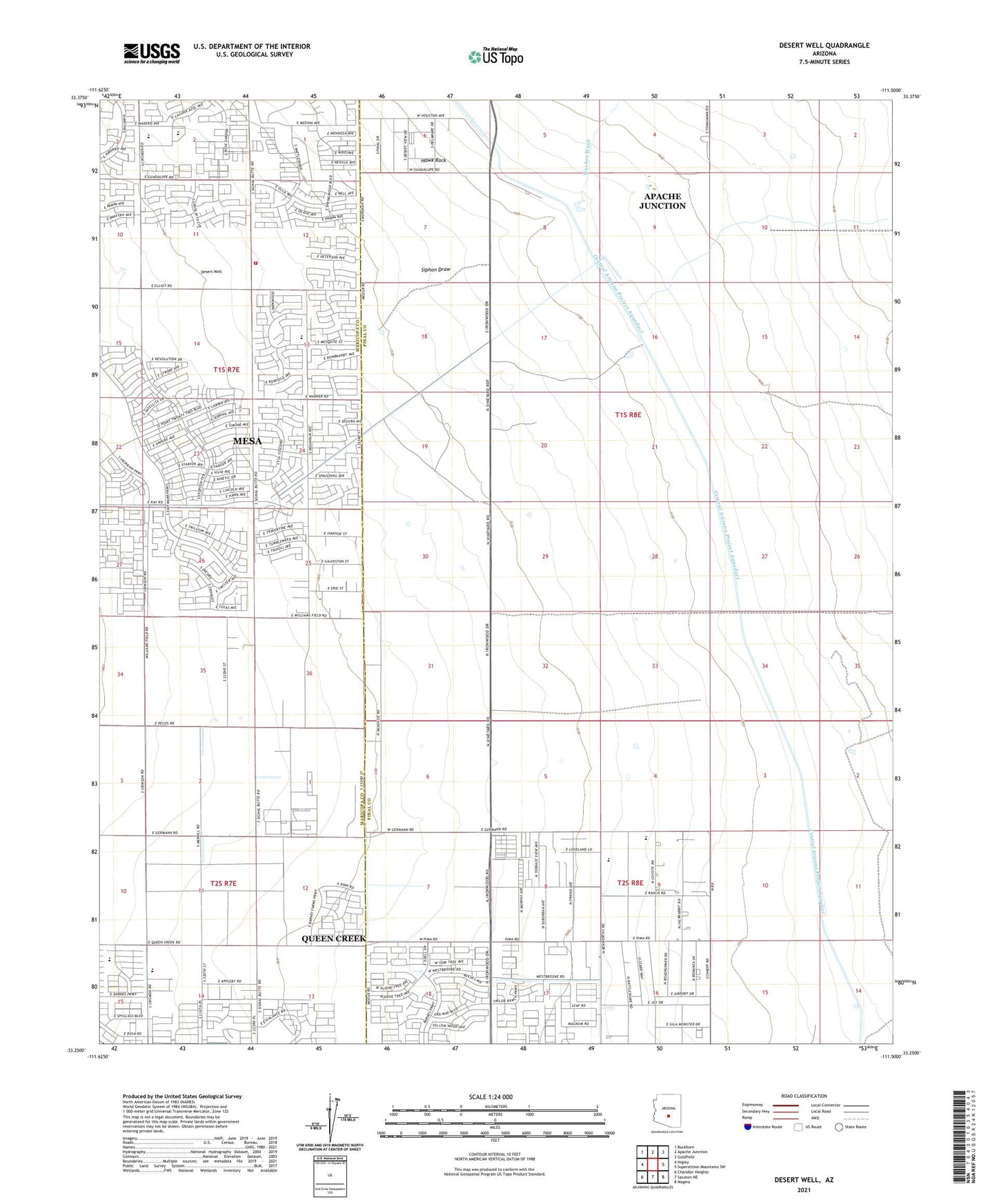
2021 topographic map quadrangle Desert Well in the state of Arizona. Scale: 1:24000. Based on the newly updated USGS 7.5' US Topo map series, this map is in the following counties: Pinal, Maricopa. The map contains contour data, water features, and other items you are used to seeing on USGS maps, but also has updated roads and other features. This is the next generation of topographic maps. Printed on high-quality waterproof paper with UV fade-resistant inks.
Quads adjacent to this one:
West: Higley
Northwest: Buckhorn
North: Apache Junction
Northeast: Goldfield
East: Superstition Mountains SW
Southeast: Magma
South: Sacaton NE
Southwest: Chandler Heights
This map covers the same area as the classic USGS quad with code o33111c5.
Contains the following named places: Anderson Ranch, Apache Junction Landfill, Apache Junction Wastewater Treatment Plant, Apache Sun Golf Club, Benjamin Franklin Charter School - Queen Creek, Cimmaron Trails Mobile Home Park, Combs High School, Desert Proving Grounds, Desert Ridge High School, Desert Ridge Junior High School, Desert Well, Hawk Rock, Jack Barnes Elementary School, Los Hermanos Mobile Home Park, Meridian Elementary School, Mesa Fire Department Station 219, Pleasant Valley Mobile Home Park, Powerline Dam, Ranch Elementary School, Rittenhouse Dam, Siphon Draw, The Church of Jesus Christ of Latter Day Saints, Vineyard Road Dam, Weekes Wash, Womack Airport, Womack Airstrip