
MyTopo
Chandler Heights Arizona US Topo Map
Couldn't load pickup availability
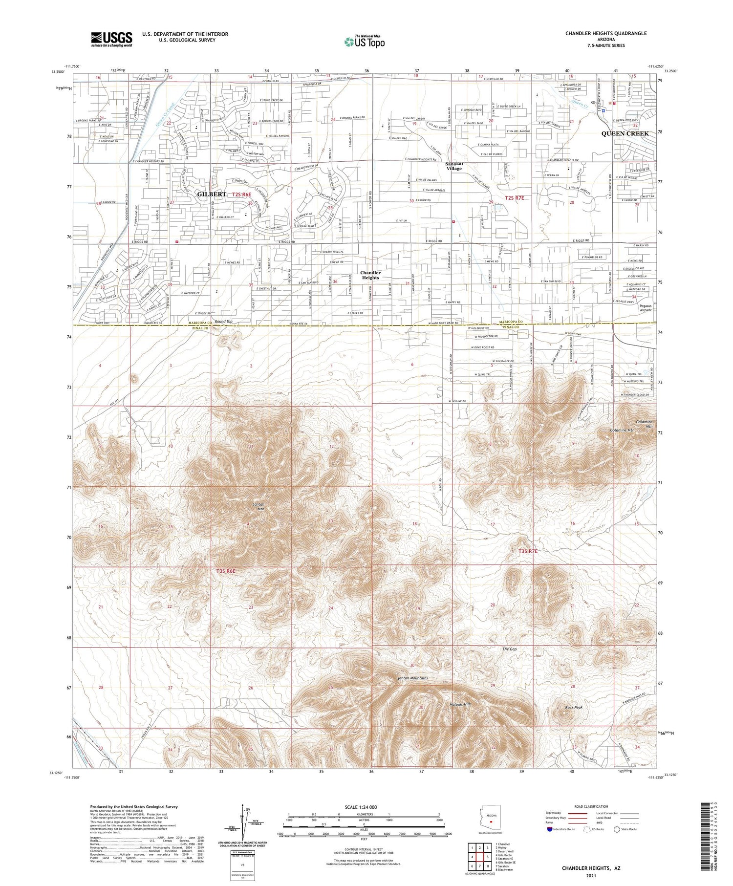
2021 topographic map quadrangle Chandler Heights in the state of Arizona. Scale: 1:24000. Based on the newly updated USGS 7.5' US Topo map series, this map is in the following counties: Pinal, Maricopa. The map contains contour data, water features, and other items you are used to seeing on USGS maps, but also has updated roads and other features. This is the next generation of topographic maps. Printed on high-quality waterproof paper with UV fade-resistant inks.
Quads adjacent to this one:
West: Gila Butte
Northwest: Chandler
North: Higley
Northeast: Desert Well
East: Sacaton NE
Southeast: Blackwater
South: Sacaton
Southwest: Gila Butte SE
This map covers the same area as the classic USGS quad with code o33111b6.
Contains the following named places: Calvary Chapel of Queen Creek, Chandler Heights, Chandler Heights School, Chandler Traditional Academy - Freedom Campus, Charlotte Upham Patterson Elementary School, Desert Mountain Bible Fellowship, Desert Mountain Elementary School, Dock, Dock Railroad Station, Family of Faith Fellowship, Gilbert Fire Department Station 11, Goldmine Mountain, Malpais Hills, Maricopa County Sheriff's Office District 6, Newell Barney Junior High School, Our Lady of Guadalupe Catholic Church, Patriot Academy, Payne Junior High School, Queen Creek, Queen Creek Community Center, Queen Creek Elementary School, Queen Creek Fire Department Station 411, Queen Creek Fire Department Station 412, Queen Creek Post Office, Queen Creek Town Hall, Riggs Elementary School, Rittenhouse Substation, Rock Peak, Round Top, San Tan Mountain Regional Park, Sanokai Village, Santan Canal, Santan Mountain, Santan Mountains, Seville Golf and Country Club, The Church of Jesus Christ of Latter Day Saints, The Gap, ZIP Codes: 85142, 85147, 85298


