MyTopo
Diamond Joe Peak Arizona US Topo Map
Couldn't load pickup availability
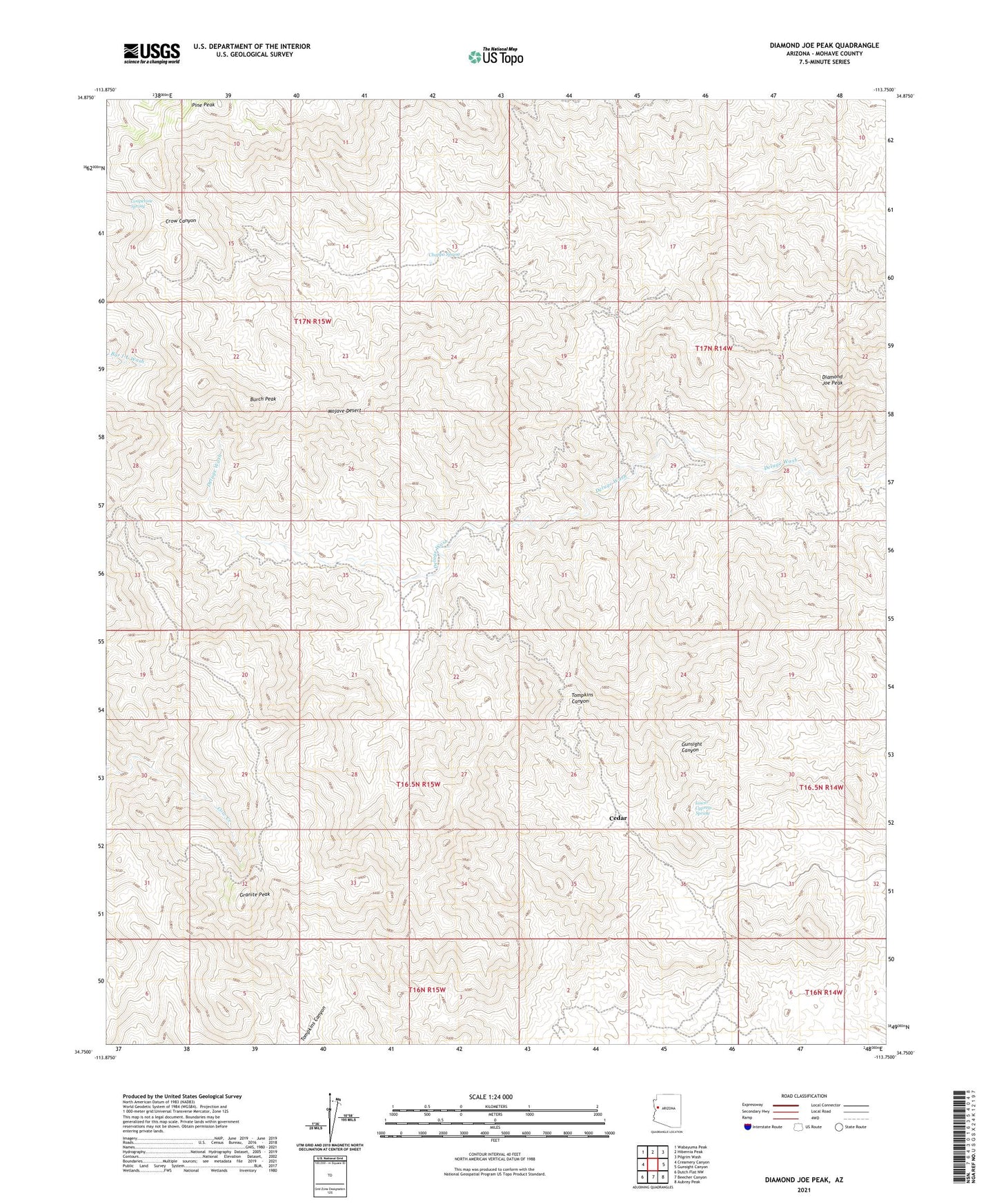
2021 topographic map quadrangle Diamond Joe Peak in the state of Arizona. Scale: 1:24000. Based on the newly updated USGS 7.5' US Topo map series, this map is in the following counties: Mohave. The map contains contour data, water features, and other items you are used to seeing on USGS maps, but also has updated roads and other features. This is the next generation of topographic maps. Printed on high-quality waterproof paper with UV fade-resistant inks.
Quads adjacent to this one:
West: Creamery Canyon
Northwest: Wabayuma Peak
North: Hibernia Peak
Northeast: Pilgrim Wash
East: Gunsight Canyon
Southeast: Aubrey Peak
South: Beecher Canyon
Southwest: Dutch Flat NW
This map covers the same area as the classic USGS quad with code o34113g7.
Contains the following named places: Burch Peak, Cedar, Chappo Spring, Diamond Joe Peak, Granite Peak, Grapevine Spring, Leviathan Mine, Lower Cypress Spring, Pine Peak