MyTopo
Dos Cabezas Arizona US Topo Map
Couldn't load pickup availability
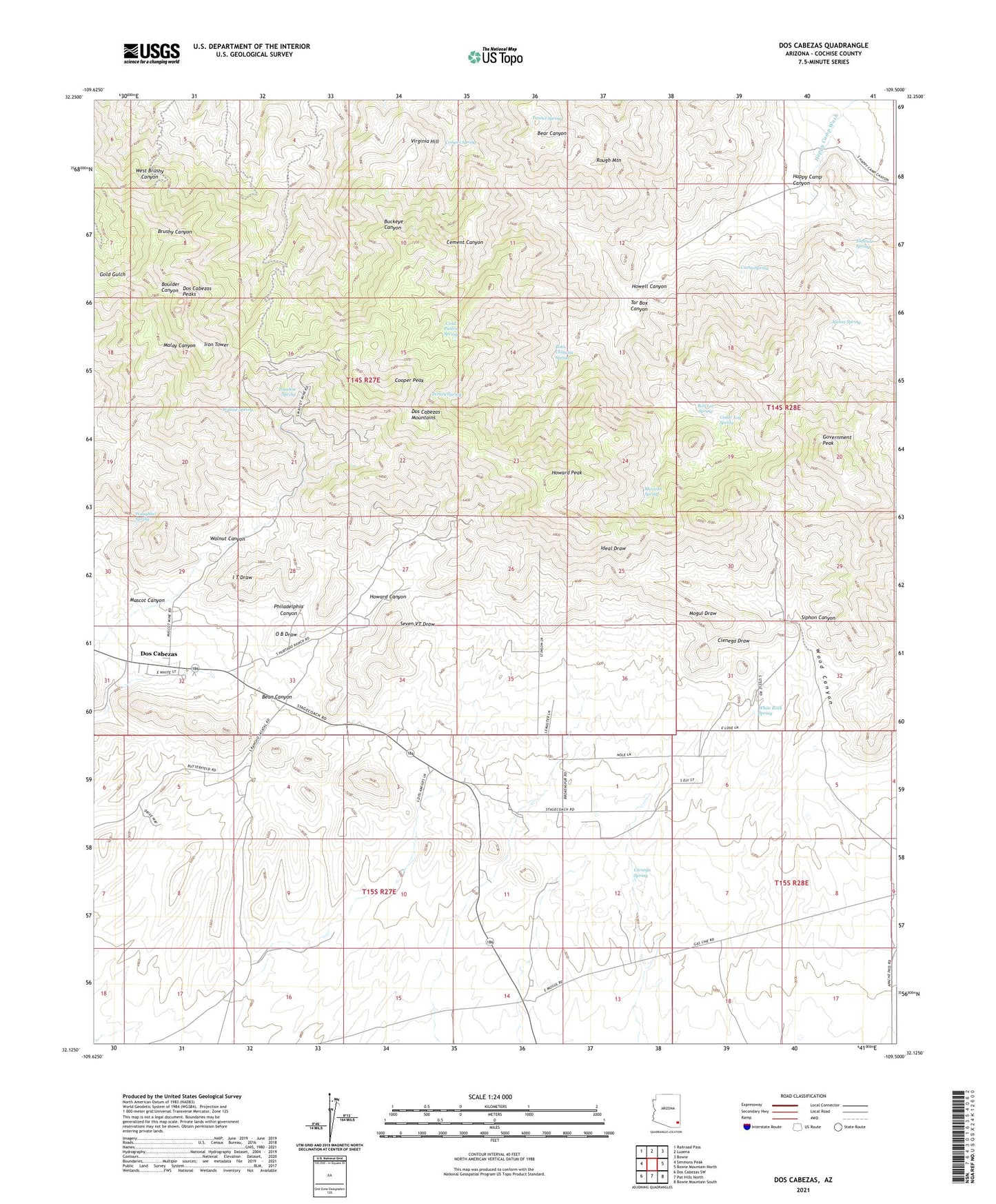
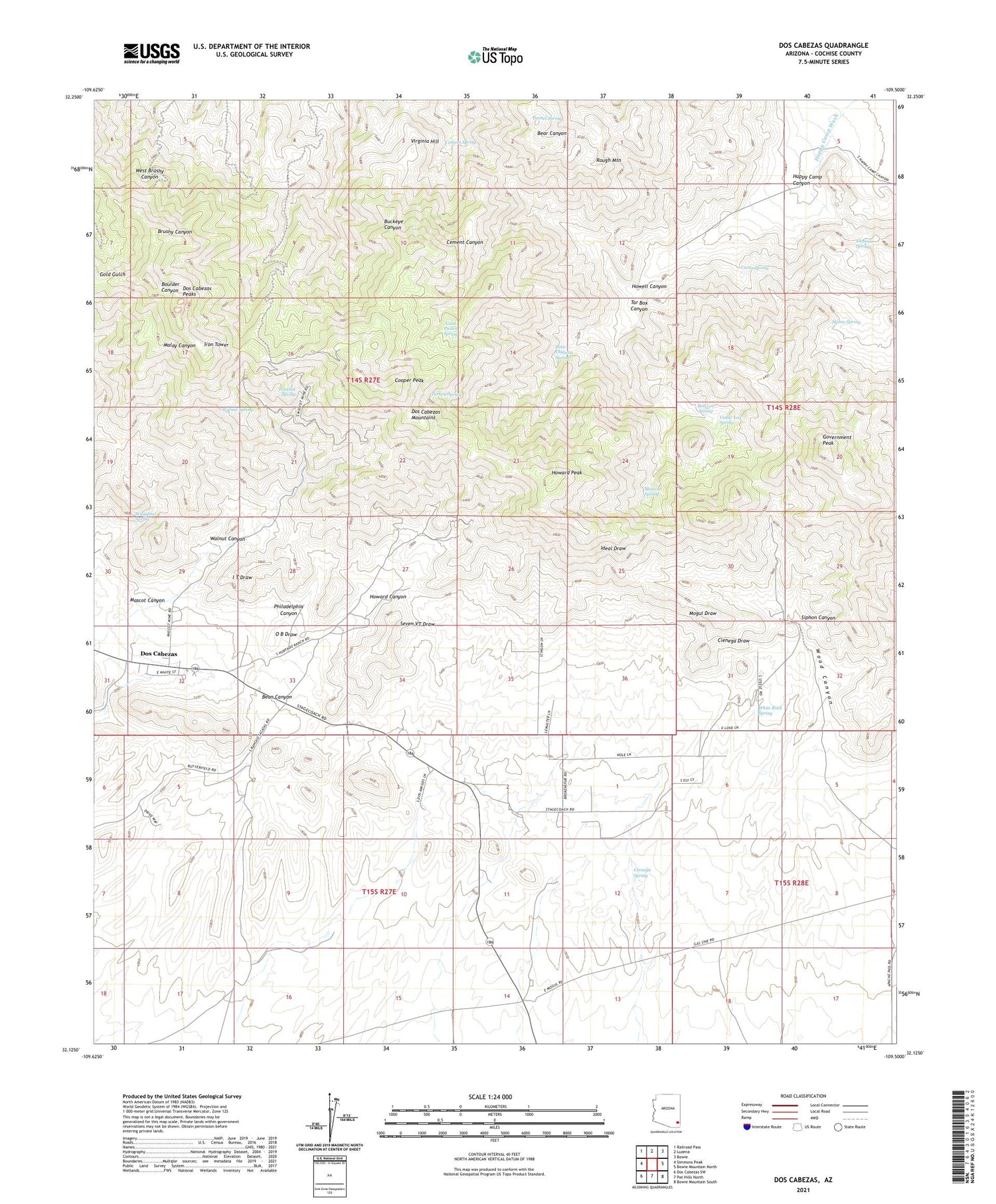
2021 topographic map quadrangle Dos Cabezas in the state of Arizona. Scale: 1:24000. Based on the newly updated USGS 7.5' US Topo map series, this map is in the following counties: Cochise. The map contains contour data, water features, and other items you are used to seeing on USGS maps, but also has updated roads and other features. This is the next generation of topographic maps. Printed on high-quality waterproof paper with UV fade-resistant inks.
Quads adjacent to this one:
West: Simmons Peak
Northwest: Railroad Pass
North: Luzena
Northeast: Bowie
East: Bowie Mountain North
Southeast: Bowie Mountain South
South: Pat Hills North
Southwest: Dos Cabezas SW
This map covers the same area as the classic USGS quad with code o32109b5.
Contains the following named places: Alamo Spring, Bean Canyon, Bob Lee Spring, Bota Chiquita Spring, Buckeye Mine, Casa Piedra Spring, Cedar Log Spring, Cement Spring, Cienega Spring, Cooper Peak, Curtis Spring, Dos Cabezas, Dos Cabezas Catchment, Dos Cabezas Mountains, Dos Cabezas Mountains Wilderness, Dos Cabezas Peaks, Elefante Spring, Elma Mine, Gold Prince Mine, Government Peak, Happy Camp Canyon, Howard Canyon, Howard Peak, Howell Canyon, Iron Tower, Ivanhoe Spring, Leroy Mine, Mascot Canyon, Mascot Mine, Mexican Spring, Mineral Park, Philadelphia Canyon, Rancho Sacatal, Rough Mountain, Siphon Canyon, Tar Box Canyon, Tunnel Spring, Turkey Spring, Virginia Hill, Walnut Canyon, Walnut Spring, Waughtal Spring, White Rock Spring