MyTopo
Railroad Pass Arizona US Topo Map
Couldn't load pickup availability
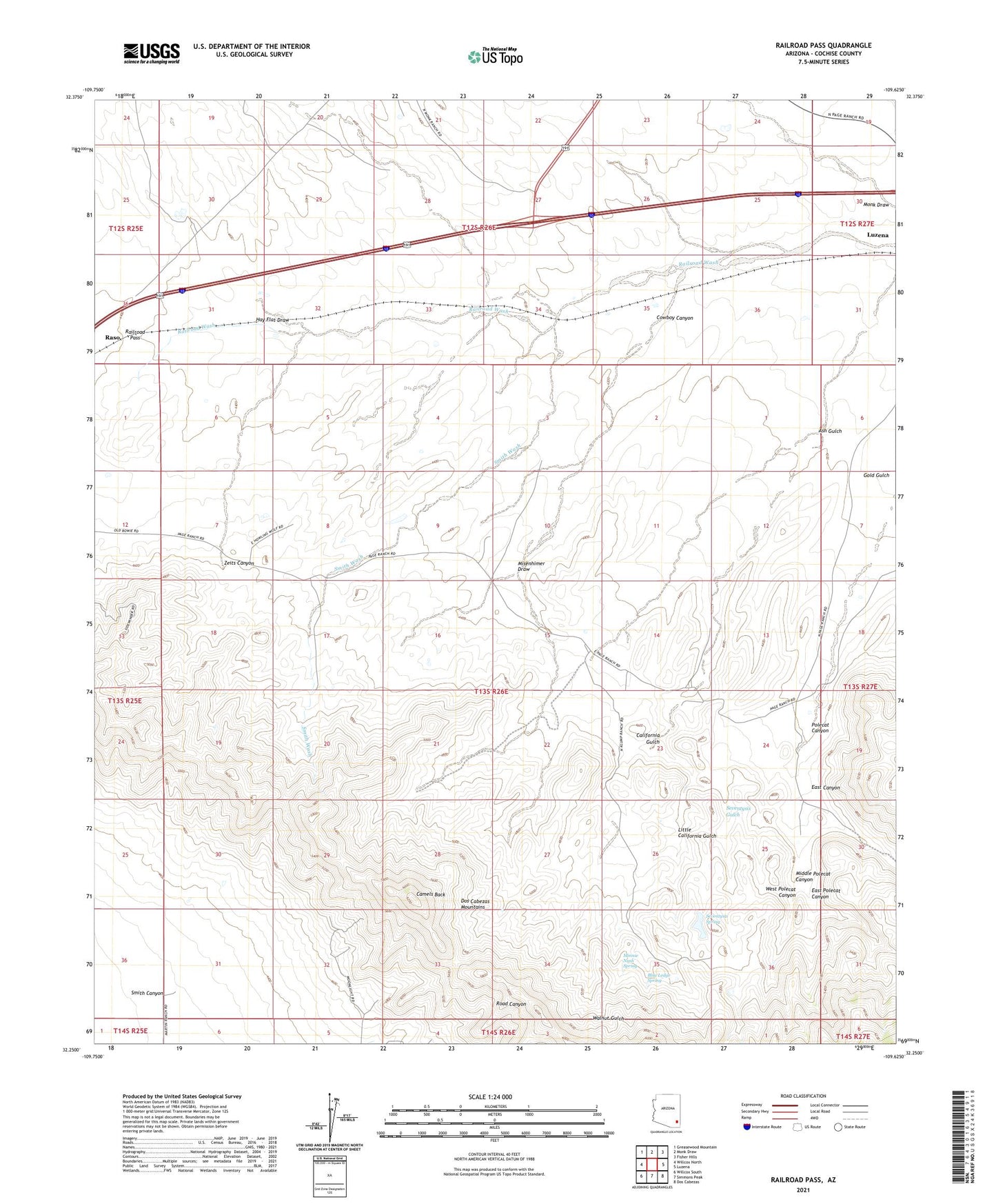
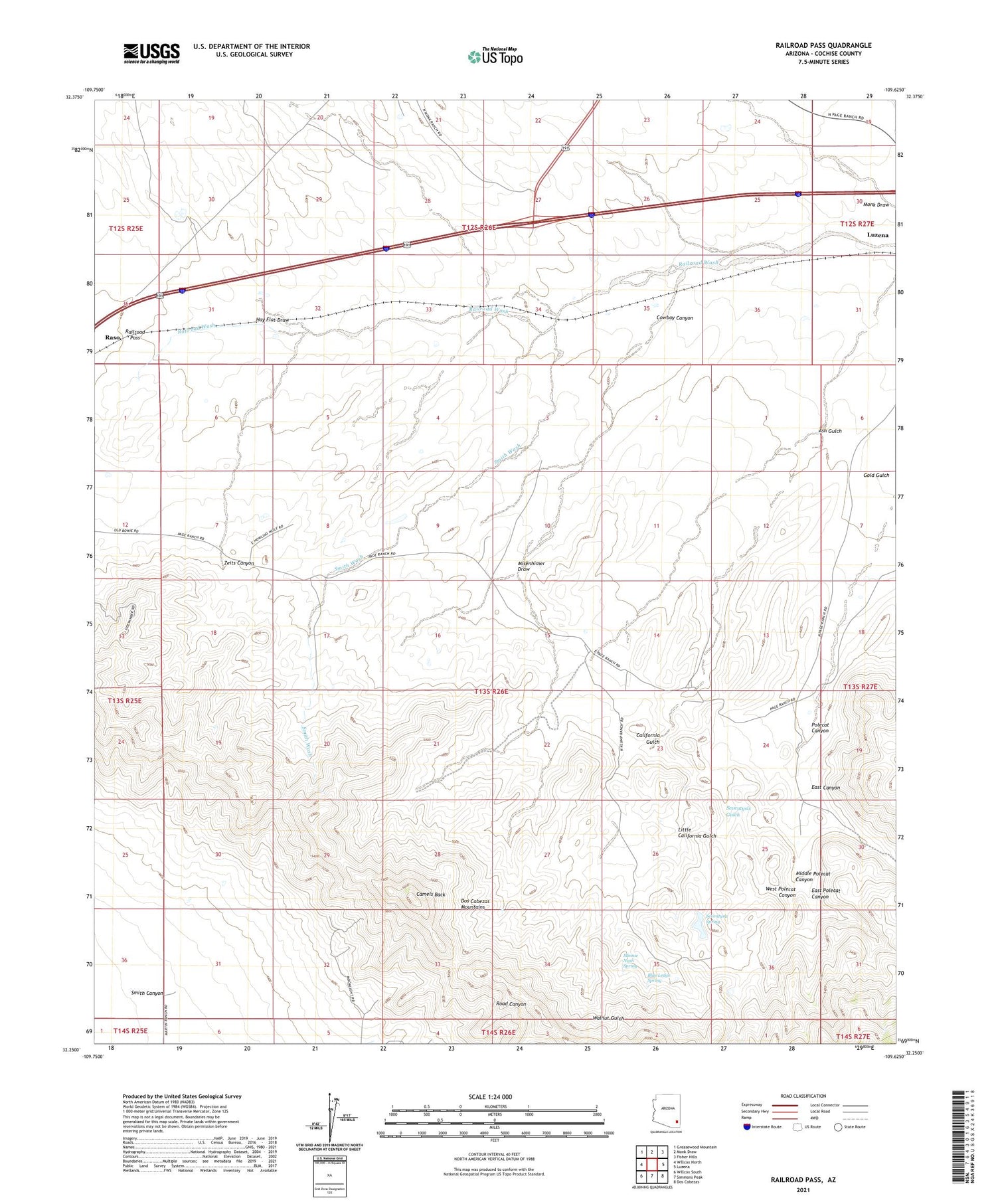
2021 topographic map quadrangle Railroad Pass in the state of Arizona. Scale: 1:24000. Based on the newly updated USGS 7.5' US Topo map series, this map is in the following counties: Cochise. The map contains contour data, water features, and other items you are used to seeing on USGS maps, but also has updated roads and other features. This is the next generation of topographic maps. Printed on high-quality waterproof paper with UV fade-resistant inks.
Quads adjacent to this one:
West: Willcox North
Northwest: Greasewood Mountain
North: Monk Draw
Northeast: Fisher Hills
East: Luzena
Southeast: Dos Cabezas
South: Simmons Peak
Southwest: Willcox South
This map covers the same area as the classic USGS quad with code o32109c6.
Contains the following named places: Ash Gulch, Blue Ledge Spring, Bowie Junction, Bowie Turbine Station, California Gulch, Camels Back, Cowboy Canyon, East Canyon, East Polecat Canyon, Flying W Ranch, Hay Flat Draw, Little California Gulch, Luzena, Middle Polecat Canyon, Minnie Nash Spring, Misenhimer Draw, Polecat Canyon, Railroad Pass, Seventysix Gulch, Seventysix Spring, Smith Canyon, Smith Wash, West Polecat Canyon, Zeits Canyon