MyTopo
Dudleyville Arizona US Topo Map
Couldn't load pickup availability
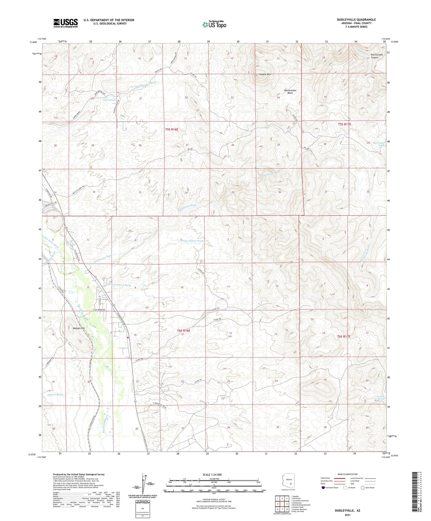
2021 topographic map quadrangle Dudleyville in the state of Arizona. Scale: 1:24000. Based on the newly updated USGS 7.5' US Topo map series, this map is in the following counties: Pinal. The map contains contour data, water features, and other items you are used to seeing on USGS maps, but also has updated roads and other features. This is the next generation of topographic maps. Printed on high-quality waterproof paper with UV fade-resistant inks.
Quads adjacent to this one:
West: Winkelman
Northwest: Hayden
North: Christmas
Northeast: Jerusalem Mountain
East: Brandenburg Mountain
Southeast: Holy Joe Peak
South: Lookout Mountain
Southwest: Putnam Wash
This map covers the same area as the classic USGS quad with code o32110h6.
Contains the following named places: Carrico Spring, Dodson Wash, Dudleyville, Dudleyville Landfill, Dudleyville Volunteer Fire Department, Eskimazene Ranch, Eskiminzin Wash, Green Lantern Wash, Indian Hills Mobile Home Park, Kelleys Camp, Malpais Hill, Piper Springs, Rattlesnake Basin, Rattlesnake Canyon, Saddle Mountain, Swingle Wash, Whittaker Ranch, ZIP Code: 85192