
MyTopo
Christmas Arizona US Topo Map
Couldn't load pickup availability
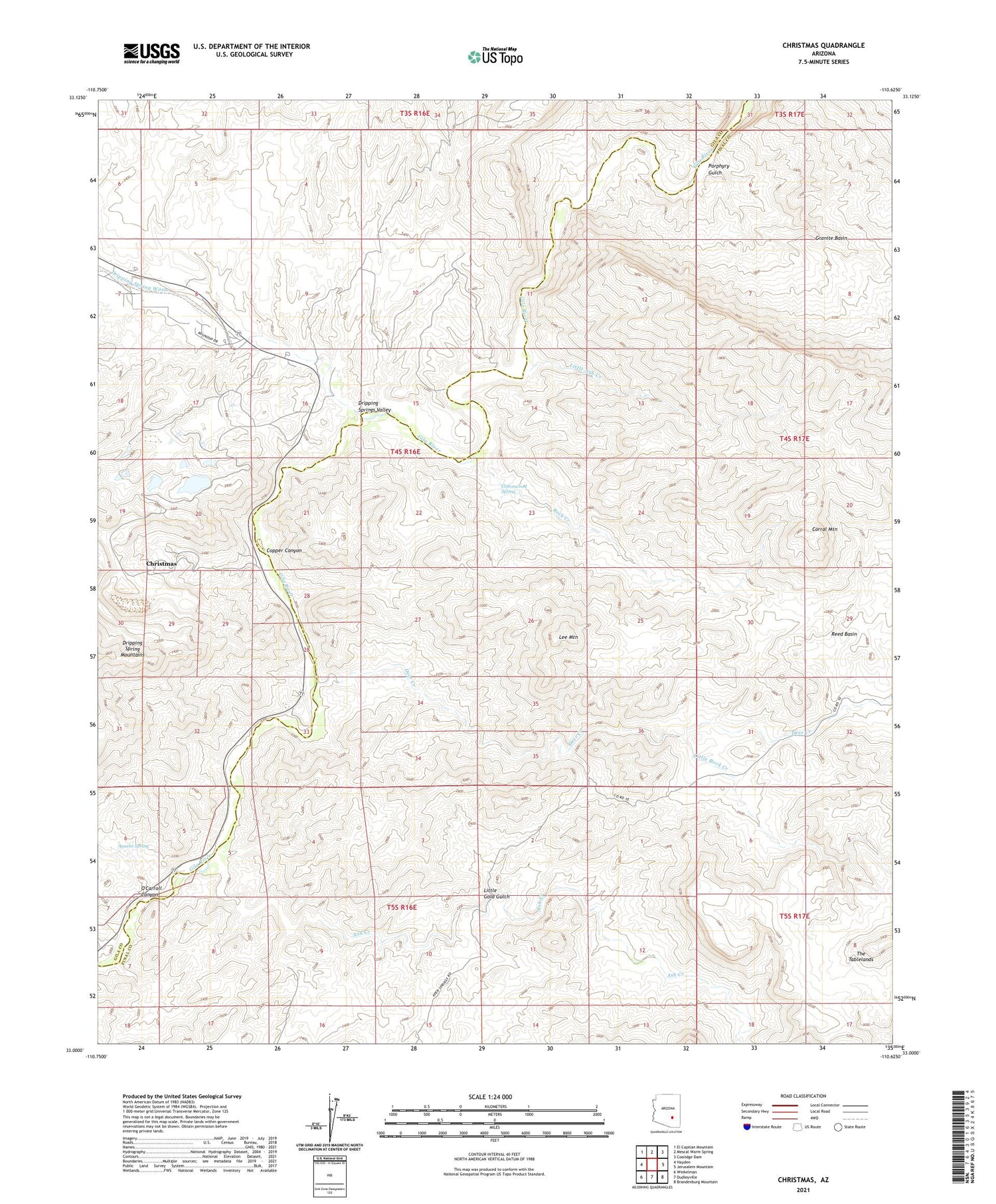
2021 topographic map quadrangle Christmas in the state of Arizona. Scale: 1:24000. Based on the newly updated USGS 7.5' US Topo map series, this map is in the following counties: Pinal, Gila. The map contains contour data, water features, and other items you are used to seeing on USGS maps, but also has updated roads and other features. This is the next generation of topographic maps. Printed on high-quality waterproof paper with UV fade-resistant inks.
Quads adjacent to this one:
West: Hayden
Northwest: El Capitan Mountain
North: Mescal Warm Spring
Northeast: Coolidge Dam
East: Jerusalem Mountain
Southeast: Brandenburg Mountain
South: Dudleyville
Southwest: Winkelman
This map covers the same area as the classic USGS quad with code o33110a6.
Contains the following named places: Apache Spring, Ash Creek, Christmas, Christmas Mill and Mine, Christmas Tailings Dam Number Five, Christmas Tailings Dam Number One, Christmas Tailings Dam Number Seven, Christmas Tailings Dam Number Six, Christmas Tailings Dam Number Three, Christmas Tailings Dam Number Two, Copper Canyon, Corral Mountain, Cottonwood Spring, Deer Creek, Dripping Spring Wash, Dripping Springs Valley, Granite Basin, Lee Mountain, Lees Mine, Little Ash Creek, Little Gold Gulch, Little Rock Creek, O'Carroll Canyon, Old Mill, Pooles Mine, Porphyry Gulch, Reese Ranch, Rock Creek, The Tablelands, Two Queens Mine, Young Ranch


