
MyTopo
Fern Glen Canyon Arizona US Topo Map
Couldn't load pickup availability
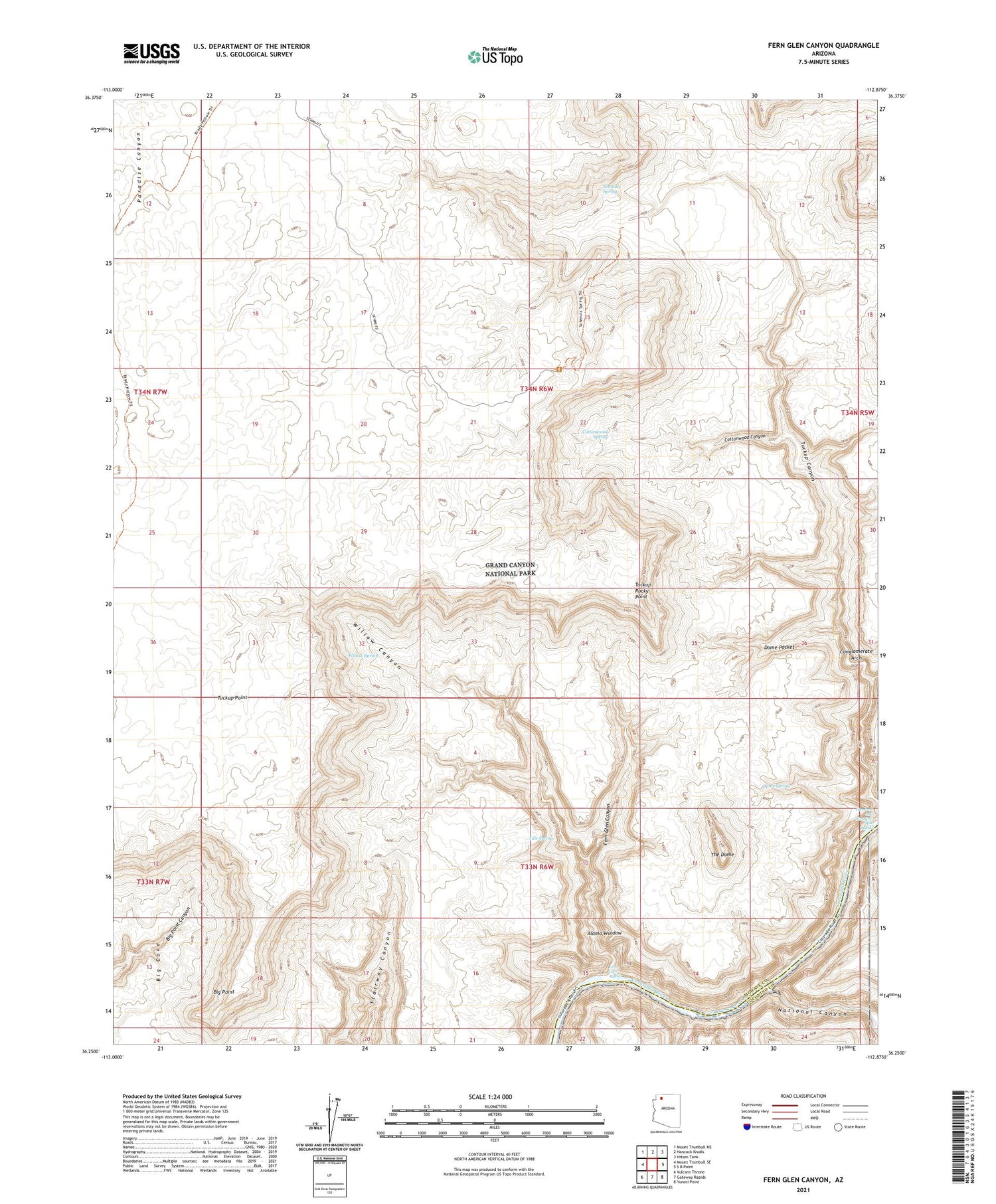
2021 topographic map quadrangle Fern Glen Canyon in the state of Arizona. Scale: 1:24000. Based on the newly updated USGS 7.5' US Topo map series, this map is in the following counties: Mohave, Coconino. The map contains contour data, water features, and other items you are used to seeing on USGS maps, but also has updated roads and other features. This is the next generation of topographic maps. Printed on high-quality waterproof paper with UV fade-resistant inks.
Quads adjacent to this one:
West: Mount Trumbull SE
Northwest: Mount Trumbull NE
North: Hancock Knolls
Northeast: Hitson Tank
East: S B Point
Southeast: Yunosi Point
South: Gateway Rapids
Southwest: Vulcans Throne
This map covers the same area as the classic USGS quad with code o36112c8.
Contains the following named places: Alamo Window, Big Point, Conglomerate Arch, Cottonwood Canyon, Cottonwood Spring, Dome Pocket, Dome Spring, Dome Trail, Fern Glen Canyon, Fern Glen Rapids, Hundred and Sixtyfour Mile Rapids, National Canyon, Schmutz Spring, The Dome, Tuckup Rocky Point, Tuckup Trail, Tule Spring, Willow Canyon, Willow Spring


