
MyTopo
Mount Trumbull SE Arizona US Topo Map
Couldn't load pickup availability
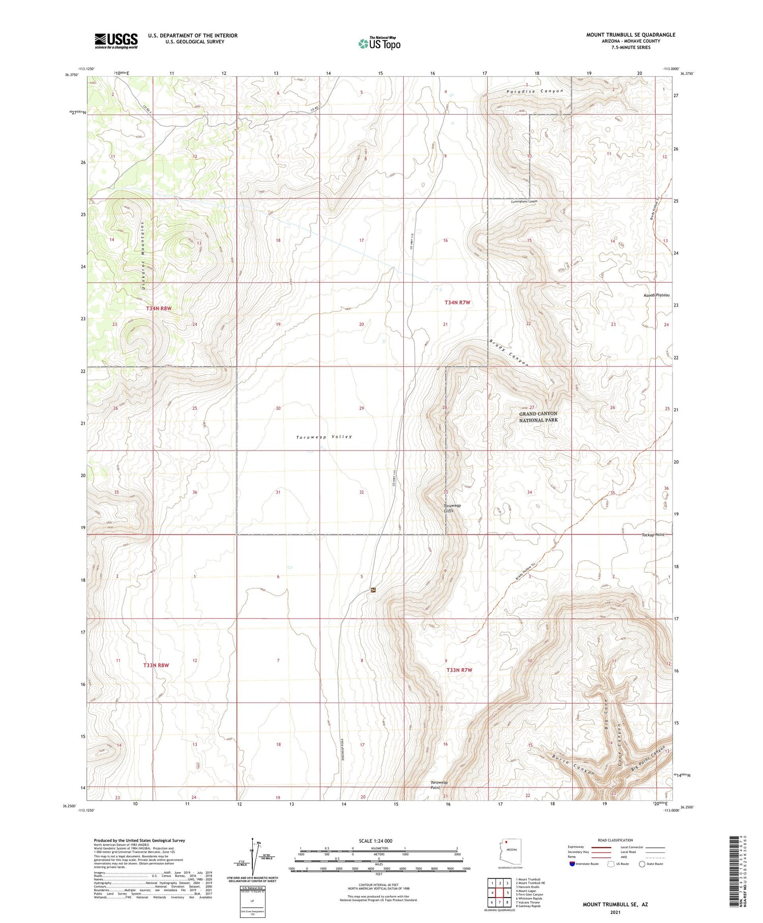
2021 topographic map quadrangle Mount Trumbull SE in the state of Arizona. Scale: 1:24000. Based on the newly updated USGS 7.5' US Topo map series, this map is in the following counties: Mohave. The map contains contour data, water features, and other items you are used to seeing on USGS maps, but also has updated roads and other features. This is the next generation of topographic maps. Printed on high-quality waterproof paper with UV fade-resistant inks.
Quads adjacent to this one:
West: Mount Logan
Northwest: Mount Trumbull
North: Mount Trumbull NE
Northeast: Hancock Knolls
East: Fern Glen Canyon
Southeast: Gateway Rapids
South: Vulcans Throne
Southwest: Whitmore Rapids
This map covers the same area as the classic USGS quad with code o36113c1.
Contains the following named places: Big Cove, Big Point Canyon, Brady Canyon, Burro Canyon, Cunninghams Canyon, Kent Ranch, Paradise Canyon, Schmutz Ranch, Toroweap Cliffs, Toroweap Landing Strip, Toroweap Ranger Station, Tuckup Point, Tuweep Airport


