
MyTopo
Granite Park Arizona US Topo Map
Couldn't load pickup availability
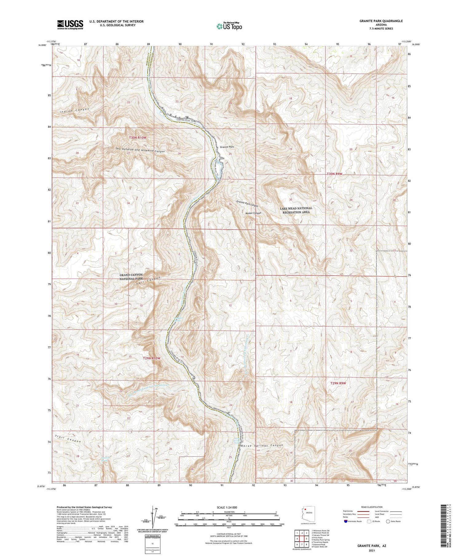
2021 topographic map quadrangle Granite Park in the state of Arizona. Scale: 1:24000. Based on the newly updated USGS 7.5' US Topo map series, this map is in the following counties: Coconino, Mohave. The map contains contour data, water features, and other items you are used to seeing on USGS maps, but also has updated roads and other features. This is the next generation of topographic maps. Printed on high-quality waterproof paper with UV fade-resistant inks.
Quads adjacent to this one:
West: Price Point
Northwest: Whitmore Point SW
North: Whitmore Point SE
Northeast: Vulcans Throne SW
East: Hockey Puck Spring
Southeast: Frazier Wells SW
South: Diamond Peak
Southwest: Travertine Rapids
This map covers the same area as the classic USGS quad with code o35113h3.
Contains the following named places: Fall Canyon, Granite Park, Granite Park Canyon, Indian Canyon, Natural Arch, Old Bonnie Tunnel, Pumpkin Spring, Shanley Spring, Snyder Mine, Three Springs Canyon, Three Springs Rapid, Two Hundred and Fifteenmile Creek, Two Hundred and Fourteenmile Creek, Two Hundred and Ninemile Canyon


