MyTopo
Grasshopper Junction NW Arizona US Topo Map
Couldn't load pickup availability
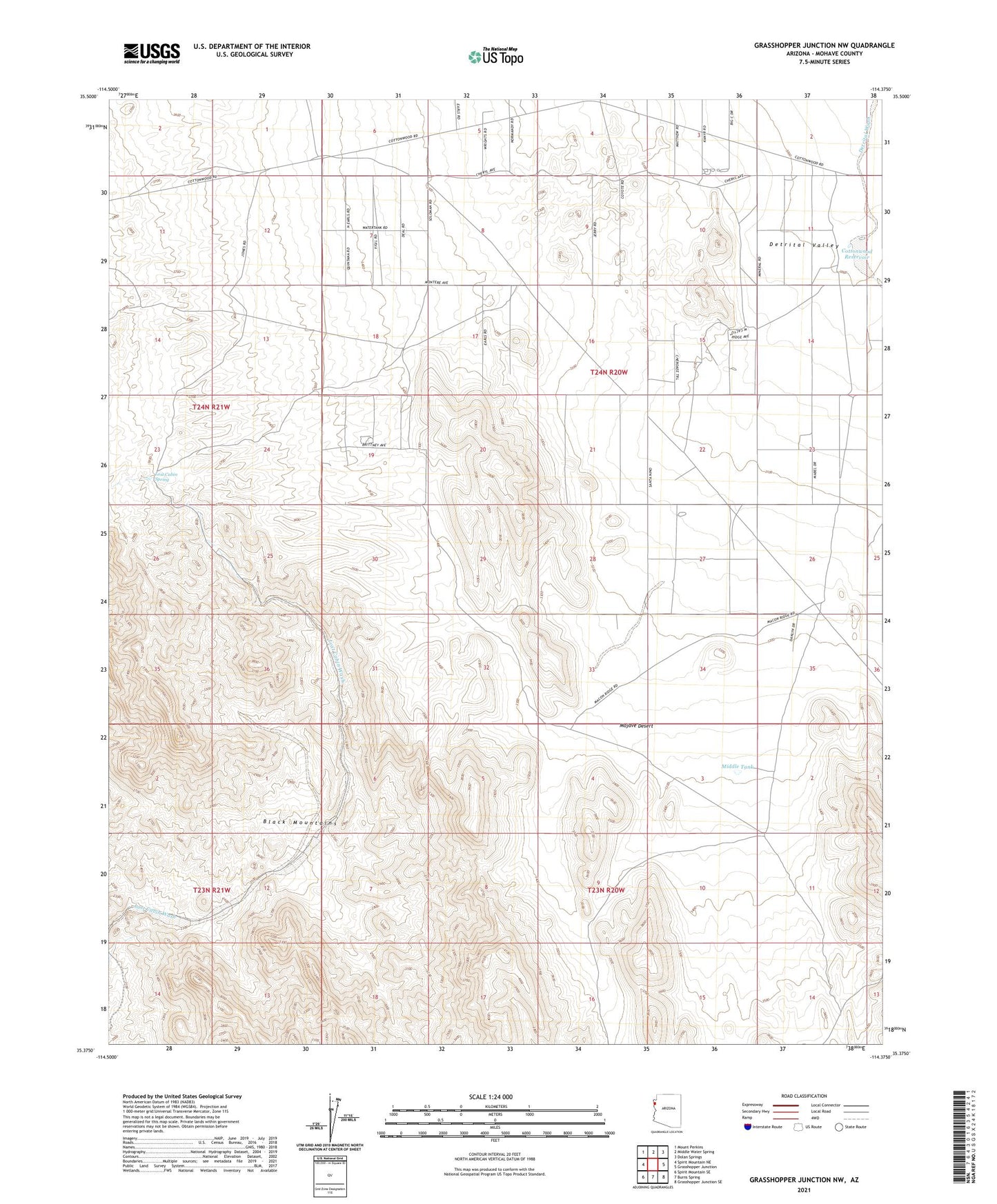
2023 topographic map quadrangle Grasshopper Junction NW in the state of Arizona. Scale: 1:24000. Based on the newly updated USGS 7.5' US Topo map series, this map is in the following counties: Mohave. The map contains contour data, water features, and other items you are used to seeing on USGS maps, but also has updated roads and other features. This is the next generation of topographic maps. Printed on high-quality waterproof paper with UV fade-resistant inks.
Quads adjacent to this one:
West: Spirit Mountain NE
Northwest: Mount Perkins
North: Middle Water Spring
Northeast: Dolan Springs
East: Grasshopper Junction
Southeast: Grasshopper Junction SE
South: Burns Spring
Southwest: Spirit Mountain SE
This map covers the same area as the classic USGS quad with code o35114d4.
Contains the following named places: Cottonwood Reservoir, Junction Tank, Lost Cabin Spring, Middle Tank, Squaw Pocket Well