MyTopo
Spirit Mountain NE Arizona US Topo Map
Couldn't load pickup availability
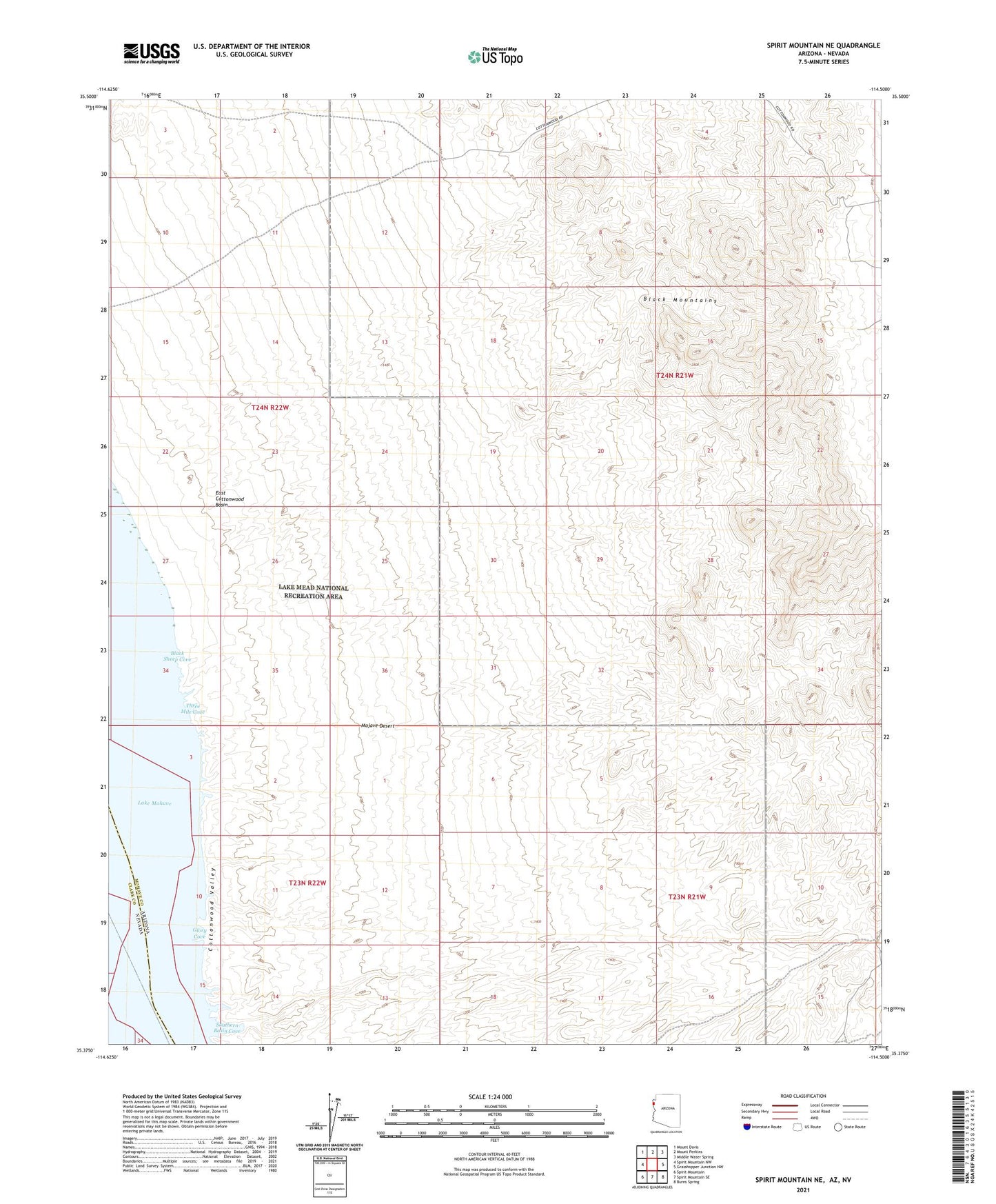
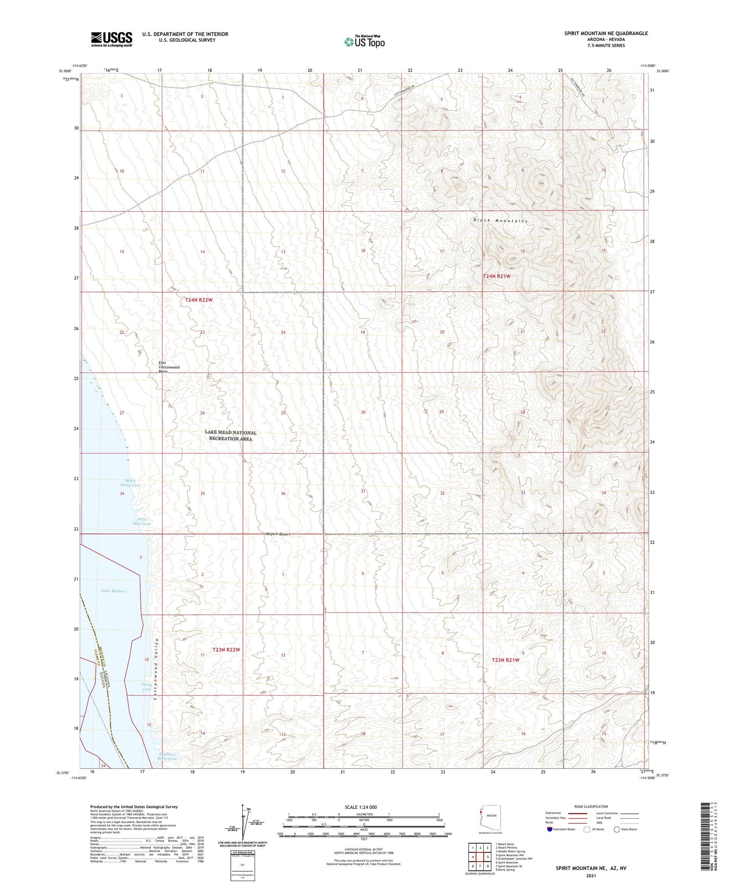
2021 topographic map quadrangle Spirit Mountain NE in the state of Arizona. Scale: 1:24000. Based on the newly updated USGS 7.5' US Topo map series, this map is in the following counties: Mohave, Clark. The map contains contour data, water features, and other items you are used to seeing on USGS maps, but also has updated roads and other features. This is the next generation of topographic maps. Printed on high-quality waterproof paper with UV fade-resistant inks.
Quads adjacent to this one:
West: Spirit Mountain NW
Northwest: Mount Davis
North: Mount Perkins
Northeast: Middle Water Spring
East: Grasshopper Junction NW
Southeast: Burns Spring
South: Spirit Mountain SE
Southwest: Spirit Mountain
Contains the following named places: Black Sheep Cove, East Cottonwood Basin, Glory Cove, Glory Hole Area, Portland Mine, Southern Basin Cove, Southern Basin Light, Three Mile Cove, Three Mile Flat Area