MyTopo
Harcuvar Arizona US Topo Map
Couldn't load pickup availability
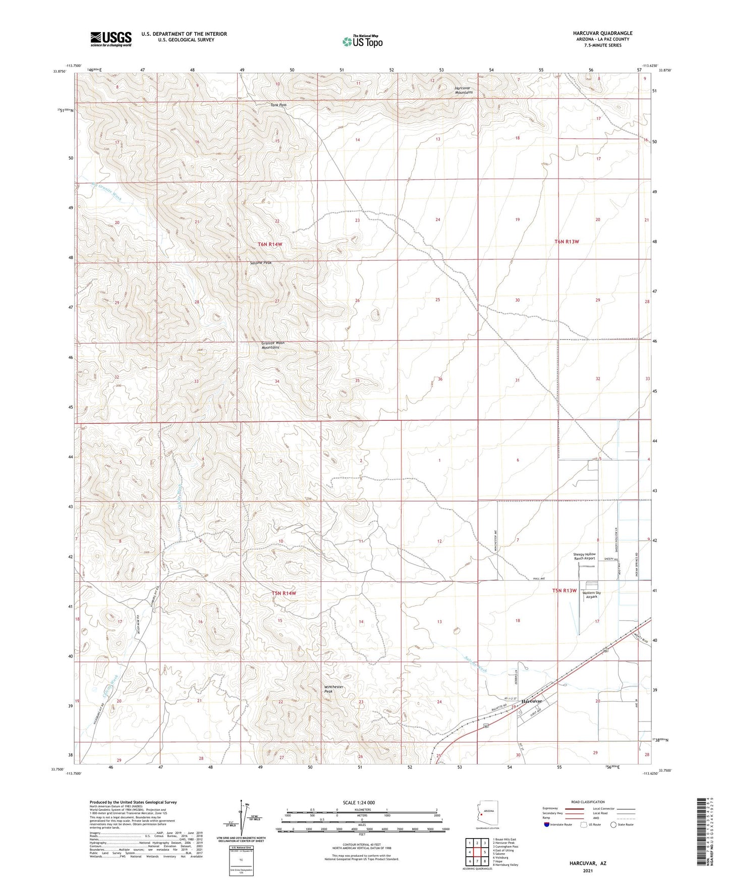
2021 topographic map quadrangle Harcuvar in the state of Arizona. Scale: 1:24000. Based on the newly updated USGS 7.5' US Topo map series, this map is in the following counties: La Paz. The map contains contour data, water features, and other items you are used to seeing on USGS maps, but also has updated roads and other features. This is the next generation of topographic maps. Printed on high-quality waterproof paper with UV fade-resistant inks.
Quads adjacent to this one:
West: East of Utting
Northwest: Bouse Hills East
North: Harcuvar Peak
Northeast: Cunningham Pass
East: Salome
Southeast: Harrisburg Valley
South: Hope
Southwest: Vicksburg
This map covers the same area as the classic USGS quad with code o33113g6.
Contains the following named places: Ballit Mine, Calcite Mine, Desert Gem Recreational Vehicle Park, Desert Mine, Desert Queen Mine, Glory Hole Mine, Granite Wash Mountains, Harcuvar, Harcuvar Railroad Station, Salome Peak, Sheepy Hollow Ranch Airport, Tank Pass, True Blue Mine, Western Sky Airpark, Winchester Peak, Yuma Mine