MyTopo
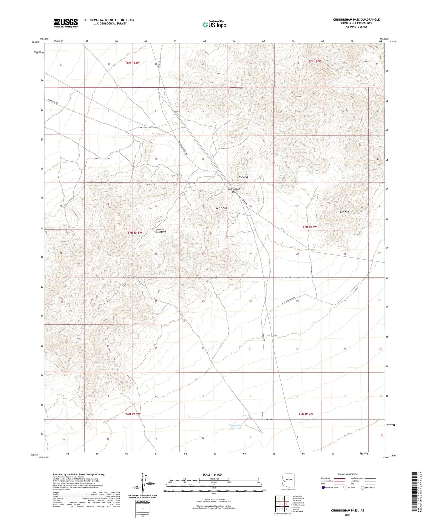
Cunningham Pass Arizona US Topo Map
Couldn't load pickup availability
2021 topographic map quadrangle Cunningham Pass in the state of Arizona. Scale: 1:24000. Based on the newly updated USGS 7.5' US Topo map series, this map is in the following counties: La Paz. The map contains contour data, water features, and other items you are used to seeing on USGS maps, but also has updated roads and other features. This is the next generation of topographic maps. Printed on high-quality waterproof paper with UV fade-resistant inks.
Quads adjacent to this one:
West: Harcuvar Peak
Northwest: Butler Well
North: Alamo Dam SE
Northeast: E C P Peak
East: Webber Canyon
Southeast: Socorro Peak
South: Salome
Southwest: Harcuvar
This map covers the same area as the classic USGS quad with code o33113h5.
Contains the following named places: Bonanza Mine, Centroid Mine, Critic Mine, Cunningham Pass, Cuprite Mine, ECC Peak, Harcuvar Mountains, Little Giant Mine, Low Mountain, W C P Peak, Winchester Reservoir