MyTopo
John Daw Mesa Arizona US Topo Map
Couldn't load pickup availability
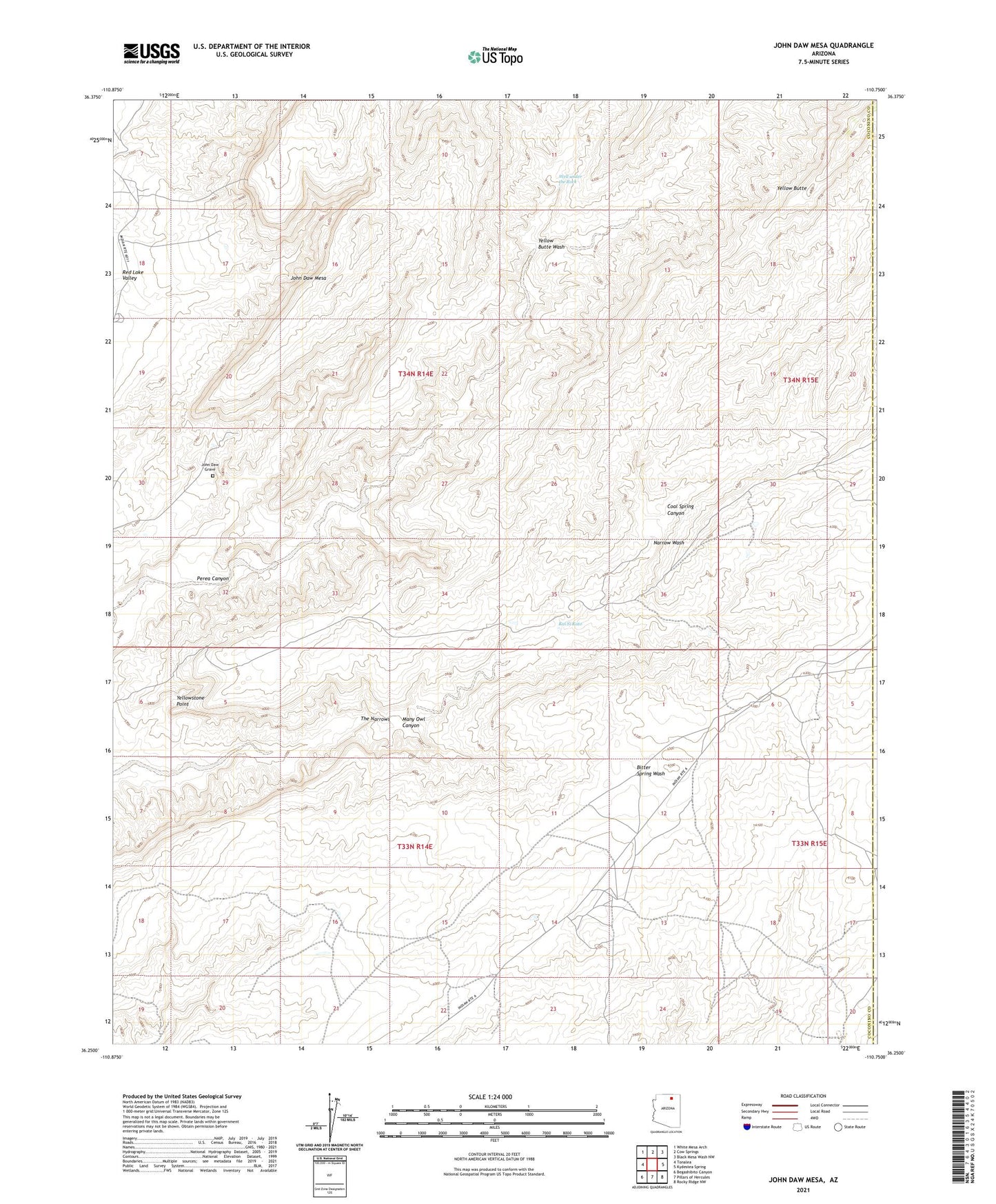
2021 topographic map quadrangle John Daw Mesa in the state of Arizona. Scale: 1:24000. Based on the newly updated USGS 7.5' US Topo map series, this map is in the following counties: Coconino, Navajo. The map contains contour data, water features, and other items you are used to seeing on USGS maps, but also has updated roads and other features. This is the next generation of topographic maps. Printed on high-quality waterproof paper with UV fade-resistant inks.
Quads adjacent to this one:
West: Tonalea
Northwest: White Mesa Arch
North: Cow Springs
Northeast: Black Mesa Wash NW
East: Kydestea Spring
Southeast: Rocky Ridge NW
South: Pillars of Hercules
Southwest: Begashibito Canyon
This map covers the same area as the classic USGS quad with code o36110c7.
Contains the following named places: Coal Spring Canyon, John Daw Grave, John Daw Mesa, John Daw Well, Kai Si Kato, Many Owl Canyon, Perea Canyon, RU252, Smoke Hole Tank, The Narrows, Well under the Rock, Yellow Butte, Yellow Butte Wash, Yellowstone Point