MyTopo
Tonalea Arizona US Topo Map
Couldn't load pickup availability
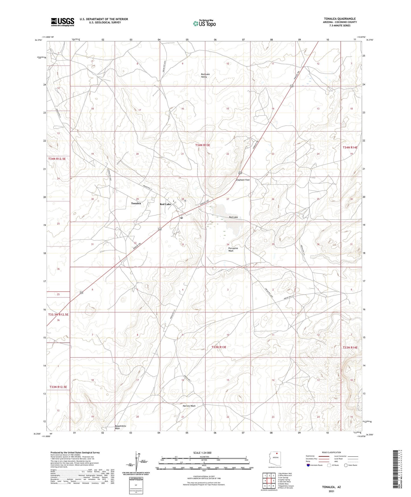
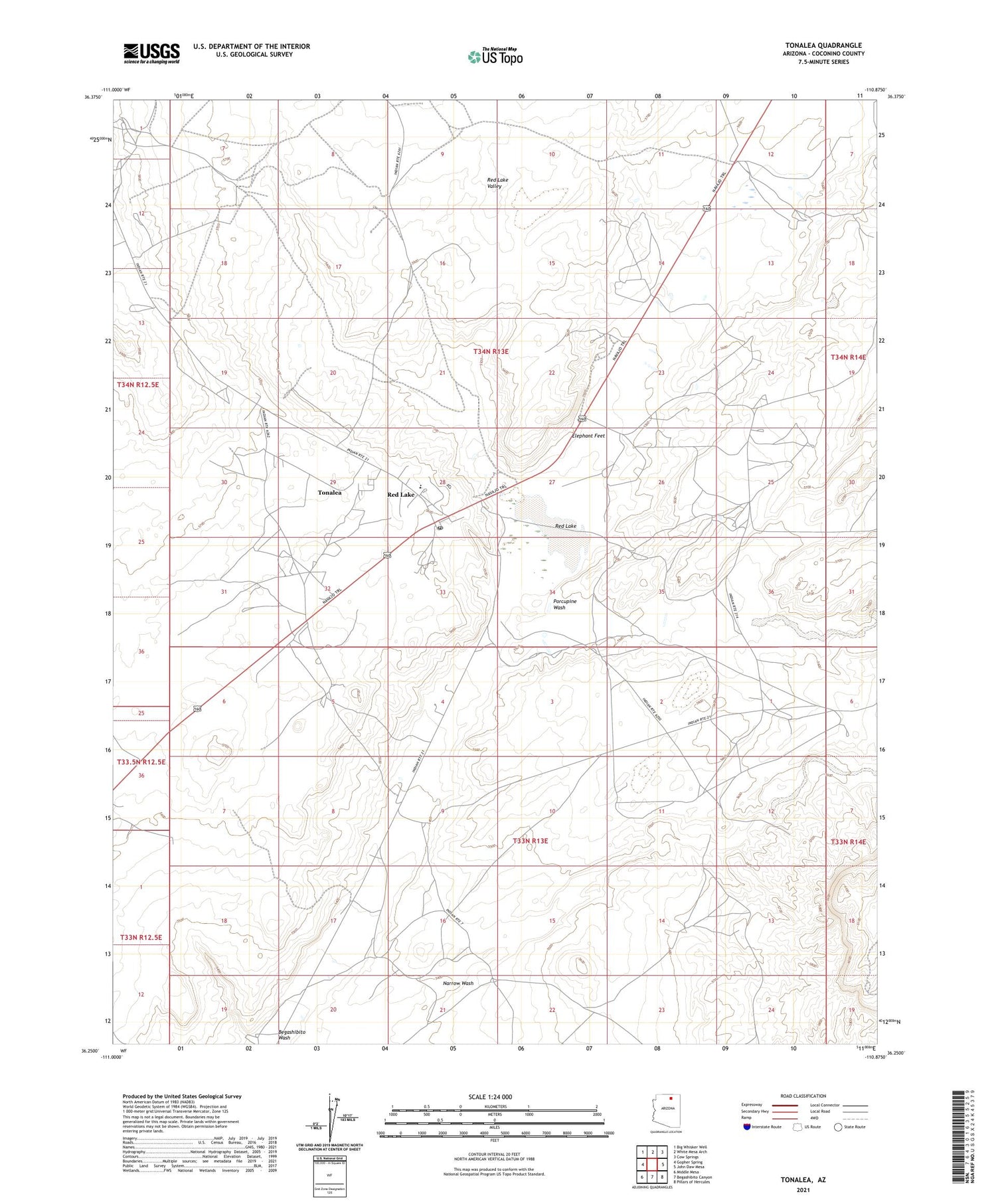
2021 topographic map quadrangle Tonalea in the state of Arizona. Scale: 1:24000. Based on the newly updated USGS 7.5' US Topo map series, this map is in the following counties: Coconino. The map contains contour data, water features, and other items you are used to seeing on USGS maps, but also has updated roads and other features. This is the next generation of topographic maps. Printed on high-quality waterproof paper with UV fade-resistant inks.
Quads adjacent to this one:
West: Gopher Spring
Northwest: Big Whisker Well
North: White Mesa Arch
Northeast: Cow Springs
East: John Daw Mesa
Southeast: Pillars of Hercules
South: Begashibito Canyon
Southwest: Middle Mesa
This map covers the same area as the classic USGS quad with code o36110c8.
Contains the following named places: Bitter Well, Elephant Feet, Elephants Feet Rest Area, George Smith Historical Monument, Mormon Well, Narrow Wash, Navajo Mountain High School, Porcupine Wash, Red Lake, Side Rock Well, Tonalea, Tonalea Census Designated Place, Tonalea Post Office